 Old Cumbria Gazetteer
 |
 |
|
| Winderwath, Brougham | ||
| Winderwath | ||
| civil parish:- | Brougham (formerly Westmorland) | |
| county:- | Cumbria | |
| locality type:- | buildings | |
| locality type:- | garden | |
| coordinates:- | NY59802937 | |
| 1Km square:- | NY5929 | |
| 10Km square:- | NY52 | |
|
|
||
| evidence:- | old map:- OS County Series (Wmd 4 11) placename:- Winderwath |
|
| source data:- | Maps, County Series maps of Great Britain, scales 6 and 25
inches to 1 mile, published by the Ordnance Survey, Southampton,
Hampshire, from about 1863 to 1948. |
|
|
|
||
| evidence:- | old map:- Saxton 1579 placename:- Winderworth |
|
| source data:- | Map, hand coloured engraving, Westmorlandiae et Cumberlandiae Comitatus ie Westmorland
and Cumberland, scale about 5 miles to 1 inch, by Christopher Saxton, London, engraved
by Augustinus Ryther, 1576, published 1579-1645. Sax9NY53.jpg Tower, symbol for a house, hall, tower, etc. "Winderworth" item:- private collection : 2 Image © see bottom of page |
|
|
|
||
| evidence:- | old map:- Jansson 1646 placename:- Winderworth |
|
| source data:- | Map, hand coloured engraving, Cumbria and Westmoria, ie
Cumberland and Westmorland, scale about 3.5 miles to 1 inch, by
John Jansson, Amsterdam, Netherlands, 1646. JAN3NY53.jpg "Winderworth" Buildings and tower. item:- JandMN : 88 Image © see bottom of page |
|
|
|
||
| evidence:- | hearth tax returns:- Hearth Tax 1675 placename:- Winderwath |
|
| source data:- | Records, hearth tax survey returns, Westmorland, 1674/75. "Winderwath" in "Cliburne" |
|
|
|
||
| evidence:- | old map:- Morden 1695 (Cmd) placename:- Winderworth |
|
| source data:- | Map, uncoloured engraving, Cumberland, scale about 4 miles to 1
inch, by Robert Morden, 1695, published by Abel Swale, the
Unicorn, St Paul's Churchyard, Awnsham, and John Churchill, the
Black Swan, Paternoster Row, London, 1695-1715.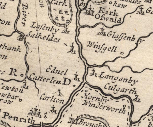 MD12NY53.jpg "Winderworth" Circle. item:- JandMN : 90 Image © see bottom of page |
|
|
|
||
| evidence:- | old map:- Morden 1695 (Wmd) placename:- Winderwath |
|
| source data:- | Map, hand coloured engraving, Westmorland, scale about 2.5 miles to 1 inch, by Robert
Morden, published by Abel Swale, the Unicorn, St Paul's Churchyard, Awnsham, and John
Churchill, the Black Swan, Paternoster Row, London, 1695.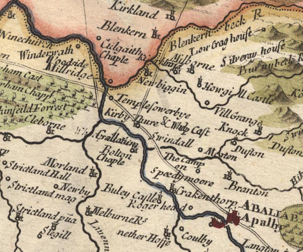 MD10NY62.jpg "Winderwath" Circle. item:- JandMN : 24 Image © see bottom of page |
|
|
|
||
| evidence:- | old map:- Bowen and Kitchin 1760 placename:- Winderworth |
|
| source data:- | Map, hand coloured engraving, A New Map of the Counties of
Cumberland and Westmoreland Divided into their Respective Wards,
scale about 4 miles to 1 inch, by Emanuel Bowen and Thomas
Kitchin et al, published by T Bowles, Robert Sayer, and John
Bowles, London, 1760.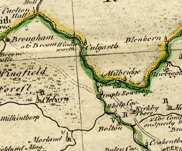 BO18NY52.jpg "Winderworth" circle, tower item:- Armitt Library : 2008.14.10 Image © see bottom of page |
|
|
|
||
| evidence:- | database:- Listed Buildings 2010 placename:- Winderwath |
|
| source data:- | courtesy of English Heritage "WINDERWATH / / / BROUGHAM / EDEN / CUMBRIA / II / 74219 / NY5980829376" |
|
|
|
||
| Longville, Tim &Corbett, Val (photr): 2007: Gardens of the Lake District: Lincoln,
Frances (London) |
||
|
|
||
| notes:- |
site of 15th century hall |
|
| Perriam, D R &Robinson, J: 1998: Medieval Fortified Buildings of Cumbria: CWAAS::
ISBN 1 873124 23 6; plan and illustration |
||
|
|
||
 Lakes Guides menu.