 Old Cumbria Gazetteer
 |
 |
|
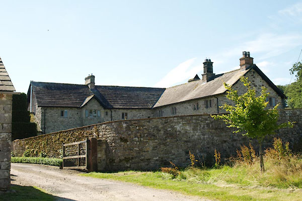
| Winder Hall Farm, Barton | ||
| Winder Hall | ||
| Winder Hall Farm | ||
| locality:- | Low Winder | |
| civil parish:- | Barton (formerly Westmorland) | |
| county:- | Cumbria | |
| locality type:- | buildings | |
| coordinates:- | NY49172454 | |
| 1Km square:- | NY4924 | |
| 10Km square:- | NY42 | |
|
|
||
 BXA90.jpg (taken 10.8.2012) 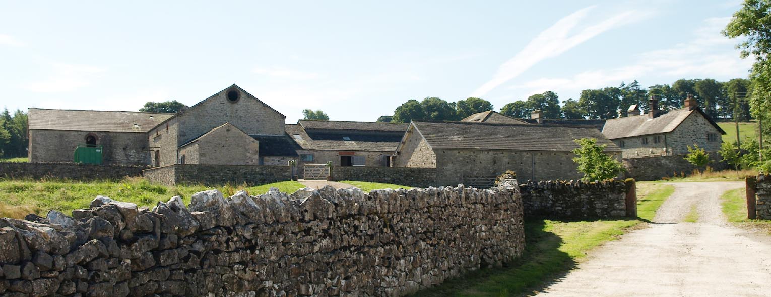 Click to enlarge BXA89.jpg (taken 10.8.2012) |
||
|
|
||
| evidence:- | old map:- OS County Series (Wmd 7) placename:- Winder Hall |
|
| source data:- | Maps, County Series maps of Great Britain, scales 6 and 25
inches to 1 mile, published by the Ordnance Survey, Southampton,
Hampshire, from about 1863 to 1948. "Winder Hall" |
|
|
|
||
| evidence:- | hearth tax returns:- Hearth Tax 1675 placename:- Hall |
|
| source data:- | Records, hearth tax survey returns, Westmorland, 1674/75. "Hall" in "Low winder" |
|
|
|
||
| evidence:- | old photograph:- Bell 1880s-1940s placename:- Winder Hall |
|
| source data:- | Photograph, Winder Hall, Barton, Westmorland, by Herbert Bell, photographer, Ambleside,
Westmorland, 1896.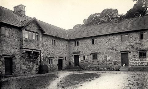 click to enlarge click to enlargeHB0070.jpg Vol.1 no.70 in an album, Examples of Early Domestic and Military Architecture in Westmorland, assembled 1910. ms at bottom:- "70. Winder Hall. Barton. W." item:- Armitt Library : 1958.3165.70 Image © see bottom of page |
|
|
|
||
| evidence:- | database:- Listed Buildings 2010 placename:- Winder Hall item:- date stone (1612) |
|
| source data:- | courtesy of English Heritage "WINDER HALL / / / BARTON / EDEN / CUMBRIA / II / 74528 / NY4916724521" |
|
|
|
||
 Lakes Guides menu.