 Old Cumbria Gazetteer
 |
 |
|
| Whittle Hole, Lancashire | ||
| Whittle Hole | ||
| county:- | Lancashire | |
| locality type:- | cave | |
| coordinates:- | SD65957995 (?) | |
| 1Km square:- | SD6579 | |
| 10Km square:- | SD67 | |
| altitude:- | 670 feet | |
| altitude:- | 204m | |
| SummaryText:- | Grade I; permsission from Council of Northern Caving Clubs. | |
| references:- | Brook, D & Davies, G & Long, M H &Sutcliffe, J R: 1975: Northern Caves, vol.4 Whernside
and Gragareth: Dalesman Books:: ISBN 0 85206 259 1 |
|
|
|
||
| evidence:- | old map:- OS County Series (Wmd 48 6) placename:- Whittle Hole |
|
| source data:- | Maps, County Series maps of Great Britain, scales 6 and 25
inches to 1 mile, published by the Ordnance Survey, Southampton,
Hampshire, from about 1863 to 1948. |
|
|
|
||
| evidence:- | old map:- Jefferys 1770 (Wmd) placename:- Whittle Hole |
|
| source data:- | Map, 4 sheets, The County of Westmoreland, scale 1 inch to 1
mile, surveyed 1768, and engraved and published by Thomas
Jefferys, London, 1770.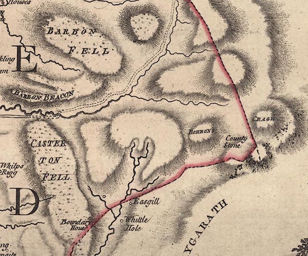 J5SD68SE.jpg "Whittle Hole" circle, labelled in italic lowercase text; settlement, farm, house, or hamlet? item:- National Library of Scotland : EME.s.47 Image © National Library of Scotland |
|
|
|
||
 Lakes Guides menu.