 Old Cumbria Gazetteer
 |
 |
|
| Whitefield House, Ireby | ||
| Whitefield House | ||
| civil parish:- | Ireby (formerly Cumberland) | |
| county:- | Cumbria | |
| locality type:- | buildings | |
| 1Km square:- | NY2434 | |
| 10Km square:- | NY23 | |
|
|
||
| evidence:- | old map:- Garnett 1850s-60s H placename:- Whitefield Hall |
|
| source data:- | Map of the English Lakes, in Cumberland, Westmorland and
Lancashire, scale about 3.5 miles to 1 inch, published by John
Garnett, Windermere, Westmorland, 1850s-60s.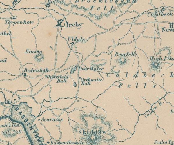 GAR2NY23.jpg "Whitefield Hall" block, building item:- JandMN : 82.1 Image © see bottom of page |
|
|
|
||
| evidence:- | presumably old map:- Post Office 1850s-1900s placename:- Whitefield House |
|
| source data:- | Post road maps, General Post Office Circulation Map for England
and Wales, for the General Post Office, London, 1850s-1900s. click to enlarge click to enlargePOF7Cm.jpg "Whitefield Ho." map date 1909 |
|
|
|
||
| :- |
images courtesy of the British Postal Museum and Hampshire CC Museums |
|
|
|
||
 Lakes Guides menu.