 Old Cumbria Gazetteer
 |
 |
|
| White Pike, St John's Castlerigg etc | ||
| White Pike | ||
| civil parish:- | St John's Castlerigg and Wythburn (formerly Cumberland) | |
| county:- | Cumbria | |
| locality type:- | hill | |
| coordinates:- | NY33912294 (etc) | |
| 1Km square:- | NY3322 | |
| 10Km square:- | NY32 | |
|
|
||
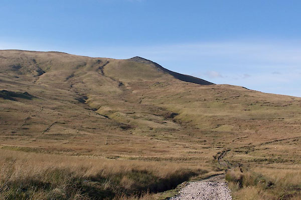 BXP17.jpg (taken 27.10.2012) |
||
|
|
||
| evidence:- | old map:- Donald 1774 (Cmd) placename:- White Pike |
|
| source data:- | Map, hand coloured engraving, 3x2 sheets, The County of Cumberland, scale about 1
inch to 1 mile, by Thomas Donald, engraved and published by Joseph Hodskinson, 29
Arundel Street, Strand, London, 1774.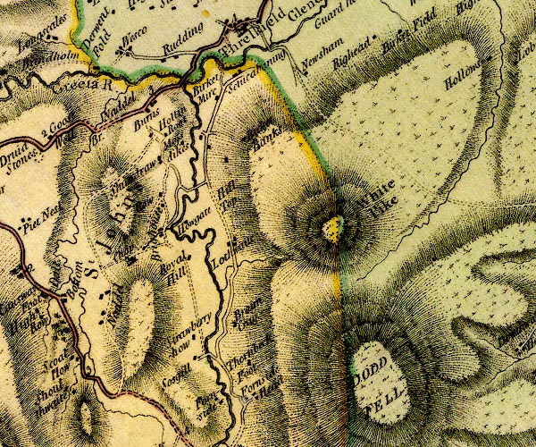 D4NY32SW.jpg "White Pike" hill hachuring; a hill or mountain item:- Carlisle Library : Map 2 Image © Carlisle Library |
|
|
|
||
| evidence:- | old map:- Ford 1839 map placename:- White Pike |
|
| source data:- | Map, uncoloured engraving, Map of the Lake District of
Cumberland, Westmoreland and Lancashire, scale about 3.5 miles
to 1 inch, published by Charles Thurnam, Carlisle, and by R
Groombridge, 5 Paternoster Row, London, 3rd edn 1843.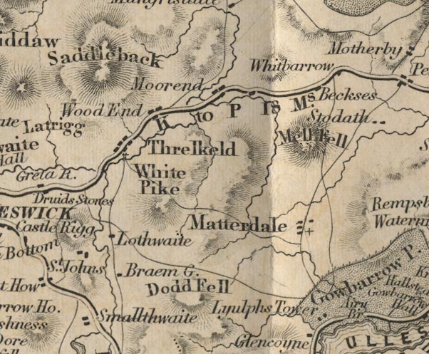 FD02NY32.jpg "White Pike" Hill hachuring. item:- JandMN : 100.1 Image © see bottom of page |
|
|
|
||
| evidence:- | outline view:- Matthew 1866 placename:- White Pike |
|
| source data:- | Print, engraving, outline view, Helvellyn from above Harrop Tarn, Poney Road from
Wythburn to Whatendlath and Borrowdale, Cumberland, published by J Richardson, Highgate,
Kendal, Westmorland, 1866.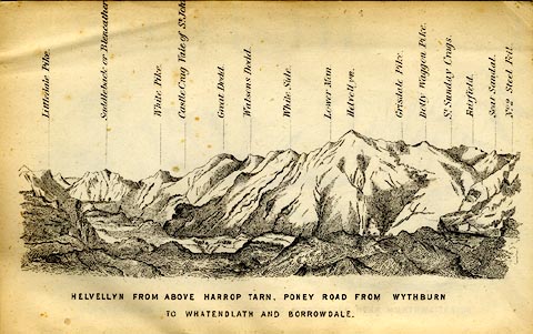 click to enlarge click to enlargeMW1E02.jpg Tipped in before p.1 of The English Lakes, Peaks and Passes, from Kendal to Keswick, by George King Matthew. printed at bottom:- "HELVELLYN FROM ABOVE HARROP TARN, PONEY ROAD FROM WYTHBURN TO WHATENDLATH AND BORROWDALE." printed at caption to mountains:- "... White Pike. ..." item:- Armitt Library : A1168.2 Image © see bottom of page |
|
|
|
||
| evidence:- | outline view:- Tattersall 1836 placename:- White Pike |
|
| source data:- | Print, engraving, Vale of St John, from the South, Cumberland, drawn by George Tattersall,
engraved by W F Topham, published by Sherwood and Co, Paternoster Row, London, about
1836.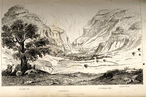 click to enlarge click to enlargeTAT119.jpg The print is captioned with mountain names and acts as an outline view. Tipped in opposite p.56 of The Lakes of England, by George Tattersall. printed at bottom:- "VALE OF ST. JOHN. / from the South." printed at bottom left to right:- "Middle Fell. / Saddleback. / Pt.of White Pike. / Castle Rock." item:- Armitt Library : A1204.20 Image © see bottom of page |
|
|
|
||
| evidence:- | outline view:- placename:- White Pike |
|
| source data:- | Print, hand coloured engraving, Vale of St John from the South, Cumberland, published
by Sherwood and Co, London, 1836?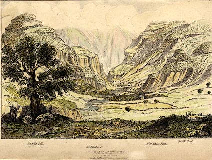 click to enlarge click to enlargePR0372.jpg Objects in the view are identified by a caption at the bottom - Naddle Fell, Saddleback, Pt. of White Pike, Castle Rock. printed at bottom:- "VALE of ST. JOHN, / from the South. / London, Pubd. April 15th 1836 by Sherwood &Co." item:- Dove Cottage : 2008.107.372 Image © see bottom of page |
|
|
|
||
 Lakes Guides menu.