 Old Cumbria Gazetteer
 |
 |
|
| Whitbarrow Scar, Crosthwaite and Lyth | ||
| Whitbarrow Scar | ||
| site name:- | Whitbarrow | |
| civil parish:- | Crosthwaite and Lyth (formerly Westmorland) | |
| civil parish:- | Witherslack (formerly Westmorland) | |
| county:- | Cumbria | |
| locality type:- | hill | |
| locality type:- | rocks | |
| coordinates:- | SD44658589 (etc) | |
| 1Km square:- | SD4485 | |
| 10Km square:- | SD48 | |
|
|
||
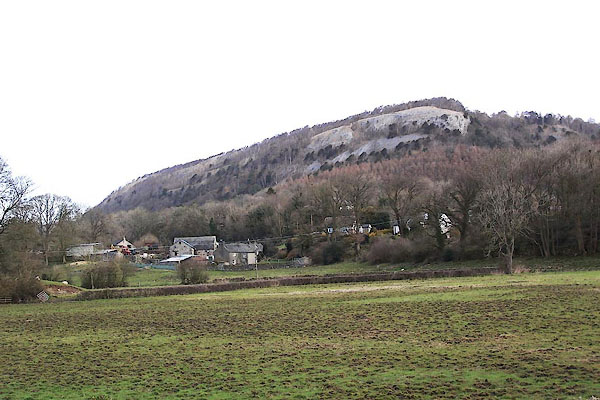
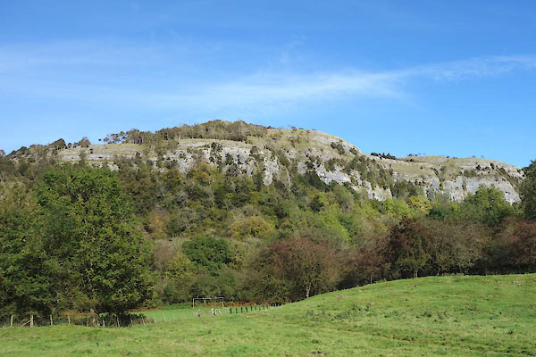 CGQ49.jpg (taken 28.9.2017) 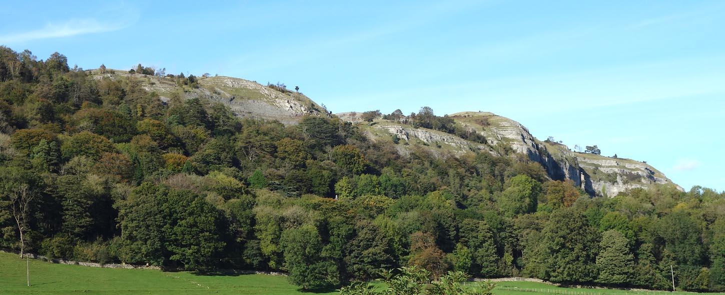 Click to enlarge CGQ53.jpg South face, looking toward White Scar. (taken 28.9.2017) |
||
|
|
||
| evidence:- | old map:- OS County Series (Wmd 38 13) placename:- Whitbarrow Scar |
|
| source data:- | Maps, County Series maps of Great Britain, scales 6 and 25
inches to 1 mile, published by the Ordnance Survey, Southampton,
Hampshire, from about 1863 to 1948. OS County Series (Wmd 42 1) OS County Series (Wmd 42 5) |
|
|
|
||
| evidence:- | old map:- Jefferys 1770 (Wmd) placename:- Witherslack Scar placename:- Whitbarrow Scar |
|
| source data:- | Map, 4 sheets, The County of Westmoreland, scale 1 inch to 1
mile, surveyed 1768, and engraved and published by Thomas
Jefferys, London, 1770.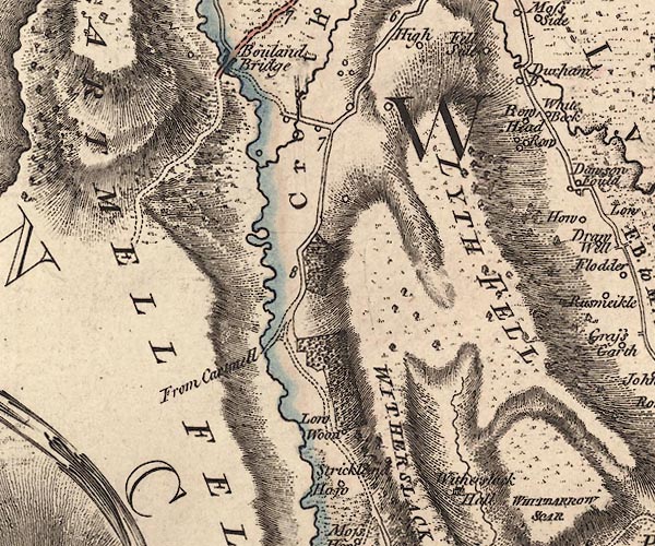 J5SD48NW.jpg 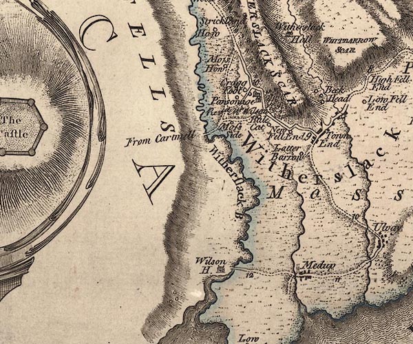 J5SD48SW.jpg "WITHERSLACK SCAR / WHITBARROW SCAR" hill hachuring; hill or mountain item:- National Library of Scotland : EME.s.47 Images © National Library of Scotland |
|
|
|
||
| evidence:- | descriptive text:- West 1778 (11th edn 1821) |
|
| source data:- | Guide book, A Guide to the Lakes, by Thomas West, published by
William Pennington, Kendal, Cumbria once Westmorland, and in
London, 1778 to 1821. goto source goto sourcePage 26, footnote:- "... to the Black Bull at Witherslack 3 miles (which takes you to the foot of Whitbarrow-scar, a remarkable precipice of limestone rock, formed in several places like a fortress). ..." "..." goto sourcePage 29:- "... To the north of Whitbarrow-scar, a huge arched and bended cliff, of an immense height, shows its stern beaten front. ..." |
|
|
|
||
| evidence:- | old map:- West 1784 map placename:- Witherslack Scar |
|
| source data:- | Map, hand coloured engraving, A Map of the Lakes in Cumberland,
Westmorland and Lancashire, scale about 3.5 miles to 1 inch,
engraved by Paas, 53 Holborn, London, about 1784.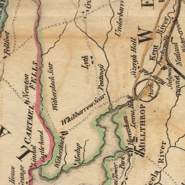 Ws02SD48.jpg item:- Armitt Library : A1221.1 Image © see bottom of page |
|
|
|
||
| evidence:- | old map:- Cary 1789 (edn 1805) placename:- Witherslack Scar |
|
| source data:- | Map, uncoloured engraving, Westmoreland, scale about 2.5 miles
to 1 inch, by John Cary, London, 1789; edition 1805.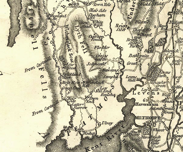 CY24SD48.jpg "Witherslack Scar" hill hachuring item:- JandMN : 129 Image © see bottom of page |
|
|
|
||
| evidence:- | old print:- placename:- Whitbarrow Scar item:- seagull; fishing boat; boat |
|
| source data:- | Print, uncoloured aquatint, Distant View of Whitbarrow Scar, Westmoreland, drawn and
engraved by William Daniell, published by Longman and Co, Paternoster Row, and W Daniell,
9 Cleveland Street, Fitzroy Square, London, 1816.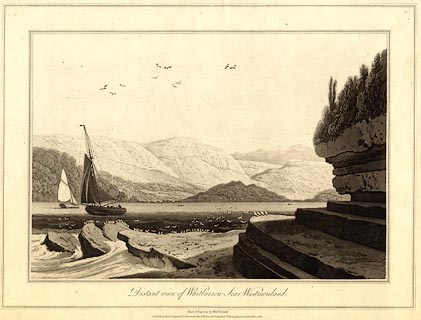 click to enlarge click to enlargePR0517.jpg printed at bottom:- "Distant view of Whitbarrow Scar, Westmoreland. / Drawn & Engraved by Willm. Daniell. / Published by Messrs.Longman & Co, Paternoster Row, &W. Daniell, 9 Cleveland St. Fitzroy Square, London, Feby. 1,1816." item:- Dove Cottage : 2008.107.466 Image © see bottom of page |
|
|
|
||
| evidence:- | old print:- Ayton and Daniell 1814-25 placename:- Whitbarrow Scar item:- seagull; fishing boat; boat |
|
| source data:- | Print, hand coloured aquatint, Distant View of Whitbarrow Scar, Westmoreland, drawn
and engraved by William Daniell, probably published by Longman and Co, Paternoster
Row, and W Daniell, 9 Cleveland Street, Fitzroy Square, London, 1816.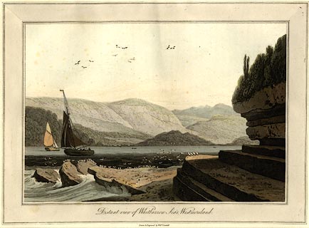 click to enlarge click to enlargePR0780.jpg printed at bottom:- "Distant view of Whitbarrow Scar, Westmoreland. / Drawn & Engraved by Willm. Daniell. / Published by Messrs.Longman & Co, Paternoster Row, &W. Daniell, 9 Cleveland St. Fitzroy Square, London, Feby. 1,1816." item:- private collection : 209 Image © see bottom of page |
|
|
|
||
 BLU06.jpg (taken 7.4.2006) |
||
|
|
||
Lakes Guides menu.