 Old Cumbria Gazetteer
 |
 |
|
| Wellfoot, Longsleddale | ||
| Wellfoot | ||
| Well Foot | ||
| civil parish:- | Longsleddale (formerly Westmorland) | |
| county:- | Cumbria | |
| locality type:- | buildings | |
| coordinates:- | NY49200384 | |
| 1Km square:- | NY4903 | |
| 10Km square:- | NY40 | |
|
|
||
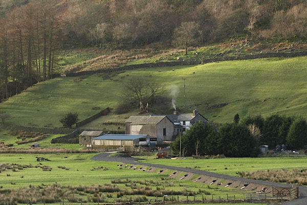 BVT75.jpg (taken 6.1.2012) 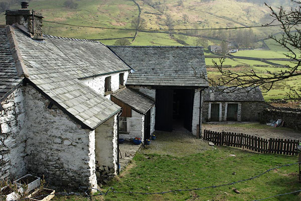 BSN77.jpg (taken 16.4.2010) |
||
|
|
||
| evidence:- | old map:- OS County Series (Wmd 27 11) placename:- Wellfoot |
|
| source data:- | Maps, County Series maps of Great Britain, scales 6 and 25
inches to 1 mile, published by the Ordnance Survey, Southampton,
Hampshire, from about 1863 to 1948.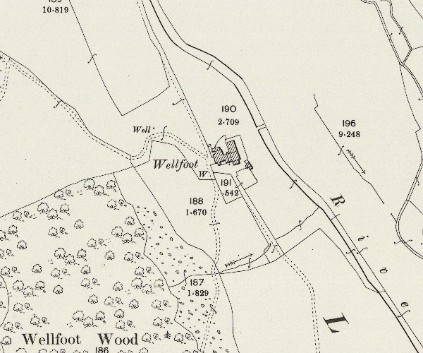 C5E011.jpg "Wellfoot" |
|
|
|
||
| evidence:- | census returns:- placename:- Wellfoot placename:- Well Foot |
|
|
|
||
 old parish registers (formerly ) old parish registers (formerly ) |
||
|
|
||
| evidence:- | old map:- Hodgson 1828 placename:- Well Foot |
|
| source data:- | Map, hand coloured engraving, 4 sheets mounted together on linen and rolled, Plan
of the County of Westmorland, scale about 1.25 inches to 1 mile, by Thomas Hodgson,
engraved by W R Gardner, Harpur Street, London, published by Thomas Hodgson, Lancaster,
and perhaps by C Smith, 172 Strand, London,1828.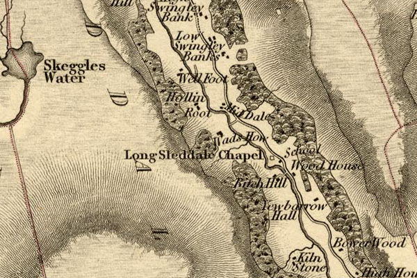 HDG6lsl2.jpg map courtesy of Mark Cropper "Well Foot" item:- private collection : 371 Image © see bottom of page |
|
|
|
||
| evidence:- | old map:- Kendal Corn Rent Act 1836 placename:- Well Foot |
|
| source data:- | Tithe map, Plan of part of the Township of Longsleddale, Westmorland, made regarding
the Kendal Corn Rent Act, ie a tithe award map, scale about 20 inches to 1 mile, Kendal,
Westmorland, 1836.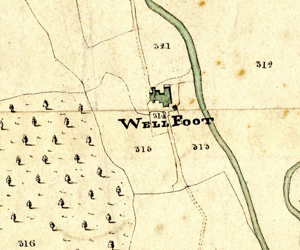 KCR211.jpg courtesy of Mark Cropper Plan of part of the Township of Longsleddale, Westmorland, made regarding the Kendal Corn Rent Act, ie a tithe award map, scale about 20 inches to 1 mile, Kendal, Westmorland, 1836. "WELL FOOT" item:- private collection : 370 Image © see bottom of page |
|
|
|
||
| Kendal Corn Rent Act 1836 |
||
|
|
||
| evidence:- | old map:- OS 1881-82 New Series (outline edition) placename:- Wellfoot |
|
| source data:- | Map, engraving, area north of Kendal, Westmorland, New Series
one inch map, outline edition, sheet 39, scale 1 inch to 1 mile,
published by the Ordnance Survey, Southampton, Hampshire,
1881-82.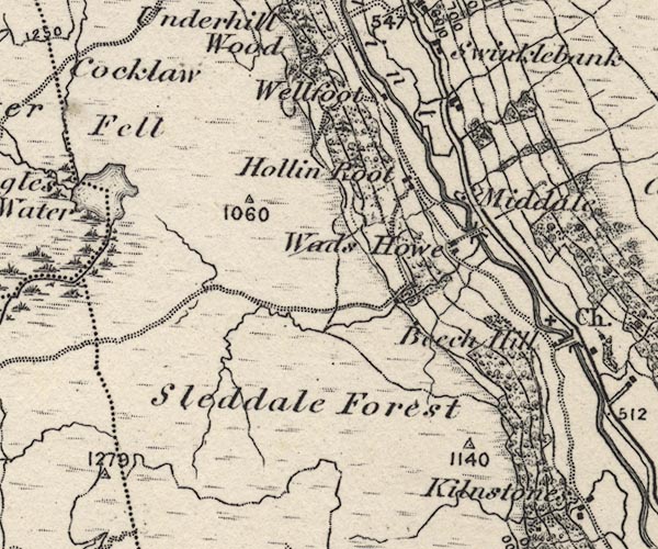 O21NY40W.jpg "Wellfoot" item:- JandMN : 61 Image © see bottom of page |
|
|
|
||
| evidence:- | descriptive text:- |
|
| source data:- | Royal Commission on Historical Monuments in England: 1936: Inventory of the Historical
Monuments in Westmorland: HMSO "[17th century, 2 storey, rubble walls, slate roofs] ..." |
|
|
|
||
| census records |
||
|
|
||
| directory entries |
||
|
|
||
| evidence:- | map:- OS Six Inch (1956) placename:- Wellfoot |
|
| source data:- | Map series, various editions with the national grid, scale about
6 inches to 1 mile, published by the Ordnance Survey,
Southampton, Hampshire, scale 1 to 10560 from 1950s to 1960s,
then 1 to 10000 from 1960s to 2000s, superseded by print on
demand from digital data.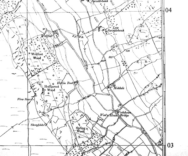 SINY4903.jpg "Wellfoot" |
|
|
|
||
| evidence:- | shepherds guide:- Wilson 1913 placename:- Well Foot |
|
| source data:- | Book, New Shepherd's Guide for Cumberland, Westmorland, and
Lancashire, by Thomas Wilson, 1913.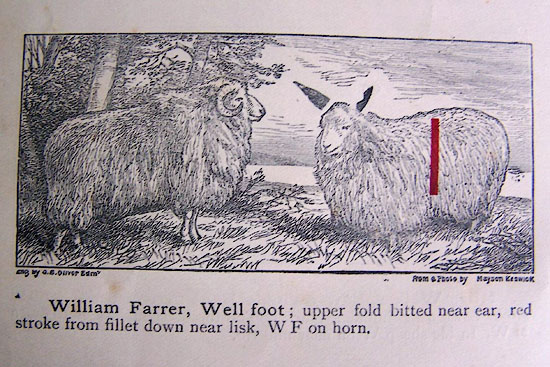 WL1p370b.jpg "William Farrer, Well foot; upper fold bitted near ear, red stroke from fillet down near lisk, W F on horn." item:- private collection : 329 Image © see bottom of page |
|
|
|
||
| evidence:- | shepherds guide:- Gate 1879 placename:- Well Foot |
|
| source data:- | Book, New Shepherd's Guide for Cumberland, Westmoreland, and
Lancashire, published by Daniel Gate, Keswick, Cumberland, 1879.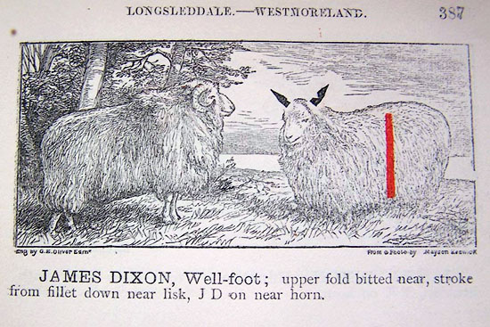 GT1p387a.jpg "JAMES DIXON, Well-foot; upper fold bitted near, stroke from fillet down near lisk, JD on near horn." item:- Kendal Library : 38 Image © see bottom of page |
|
|
|
||
| evidence:- | shepherds guide:- Lamb 1937 placename:- Well Foot |
|
| source data:- | Book, Lamb's Shepherds' Guide for Cumberland, Westmorland and
Lancashire, by R H Lamb, published by the Herald Printing Co,
Penrith, Cumberland, 1937.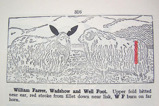 LM1p316a.jpg "William Farrer, Wadshow and Well Foot. Upper fold bitted near ear, red stroke from fillet down near lisk, W F burn on far horn." item:- Kendal Library : 40 Image © see bottom of page |
|
|
|
||
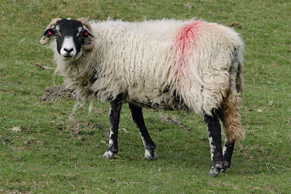 BSN81.jpg Wellfoot flock; red stroke down near lisk. Matching red ear tags. (taken 16.4.2010) 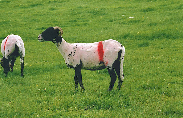 BIX20.jpg Swaledale sheep, newly shorn, newly marked, Wellfoot; Wellfoot mark, red stroke down nearside hook. (taken 6.2004) 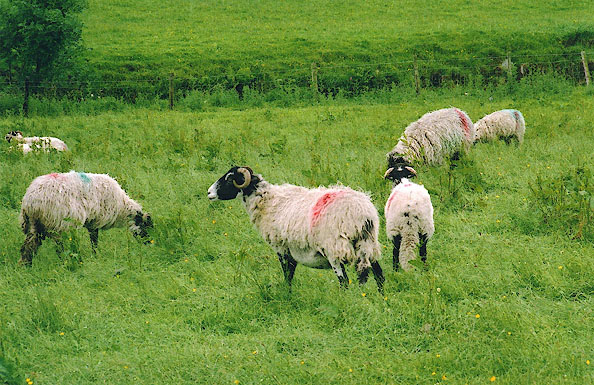 BIX18.jpg Wellfoot flock; red stroke down near lisk. |
||
|
|
||
 Lakes Guides menu.