 Old Cumbria Gazetteer
 |
 |
|
| Wanthwaite, St John's Castlerigg etc | ||
| Wanthwaite | ||
| locality:- | St John's in the Vale | |
| civil parish:- | St John's Castlerigg and Wythburn (formerly Cumberland) | |
| county:- | Cumbria | |
| locality type:- | buildings | |
| locality type:- | locality | |
| coordinates:- | NY31832297 | |
| 1Km square:- | NY3122 | |
| 10Km square:- | NY32 | |
|
|
||
| evidence:- | old map:- OS County Series (Cmd 64 8) placename:- Wanthwaite |
|
| source data:- | Maps, County Series maps of Great Britain, scales 6 and 25
inches to 1 mile, published by the Ordnance Survey, Southampton,
Hampshire, from about 1863 to 1948. |
|
|
|
||
| evidence:- | old text:- Clarke 1787 |
|
| source data:- | Guide book, A Survey of the Lakes of Cumberland, Westmorland,
and Lancashire, written and published by James Clarke, Penrith,
Cumberland, and in London etc, 1787; published 1787-93. goto source goto sourcePage 61:- "... [at] Riddings, from a small declivity in the road, stop and take a view of the beautiful vale of Wanthwaite, erroneously called by all authors St John's Vale: this error hath I suppose arisen from its being within the chapelry of St John's; whereas these two vales are distinct, and are separated by the mountain called Naddle-Fell. ..." |
|
|
|
||
| evidence:- | old map:- Otley 1818 placename:- Wanthwaite |
|
| source data:- | Map, uncoloured engraving, The District of the Lakes,
Cumberland, Westmorland, and Lancashire, scale about 4 miles to
1 inch, by Jonathan Otley, 1818, engraved by J and G Menzies,
Edinburgh, Scotland, published by Jonathan Otley, Keswick,
Cumberland, et al, 1833.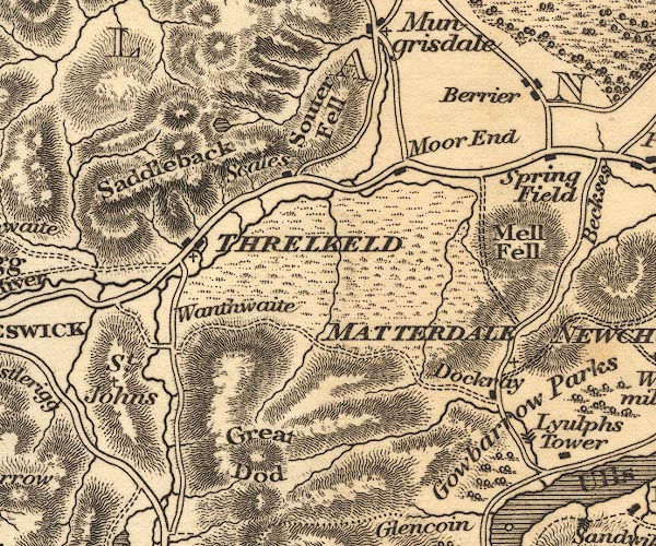 OT02NY32.jpg item:- JandMN : 48.1 Image © see bottom of page |
|
|
|
||
| evidence:- | old map:- Garnett 1850s-60s H placename:- Wanthwaite |
|
| source data:- | Map of the English Lakes, in Cumberland, Westmorland and
Lancashire, scale about 3.5 miles to 1 inch, published by John
Garnett, Windermere, Westmorland, 1850s-60s.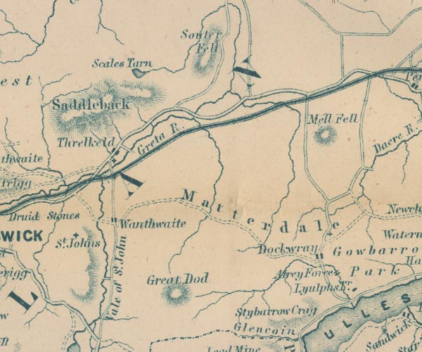 GAR2NY32.jpg "Wanthwaite" blocks, settlement item:- JandMN : 82.1 Image © see bottom of page |
|
|
|
||
Lakes Guides menu.