 Old Cumbria Gazetteer
 |
 |
|
| Wadshowe Bridge, Longsleddale | ||
| Wadshowe Bridge | ||
| site name:- | Sprint, River | |
| civil parish:- | Longsleddale (formerly Westmorland) | |
| county:- | Cumbria | |
| locality type:- | bridge | |
| locality type:- | flood | |
| coordinates:- | NY49660327 | |
| 1Km square:- | NY4903 | |
| 10Km square:- | NY40 | |
|
|
||
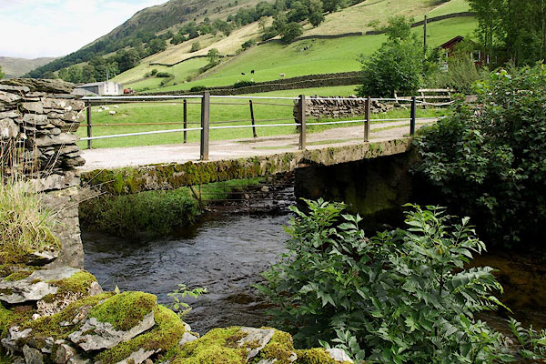 BRH96.jpg (taken 27.8.2009) |
||
|
|
||
| evidence:- | old map:- OS County Series (Wmd 27 11) placename:- Wadshowe Bridge |
|
| source data:- | Maps, County Series maps of Great Britain, scales 6 and 25
inches to 1 mile, published by the Ordnance Survey, Southampton,
Hampshire, from about 1863 to 1948.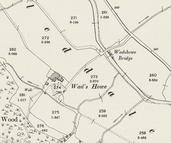 C5E014.jpg "Wadshowe Bridge" |
|
|
|
||
| evidence:- | old map:- Jefferys 1770 (Wmd) |
|
| source data:- | Map, 4 sheets, The County of Westmoreland, scale 1 inch to 1
mile, surveyed 1768, and engraved and published by Thomas
Jefferys, London, 1770.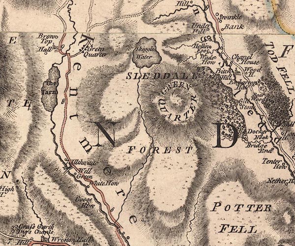 J5NY40SE.jpg double line, road, across a stream; bridge item:- National Library of Scotland : EME.s.47 Image © National Library of Scotland |
|
|
|
||
| evidence:- | old map:- Hodgson 1828 |
|
| source data:- | Map, hand coloured engraving, 4 sheets mounted together on linen and rolled, Plan
of the County of Westmorland, scale about 1.25 inches to 1 mile, by Thomas Hodgson,
engraved by W R Gardner, Harpur Street, London, published by Thomas Hodgson, Lancaster,
and perhaps by C Smith, 172 Strand, London,1828.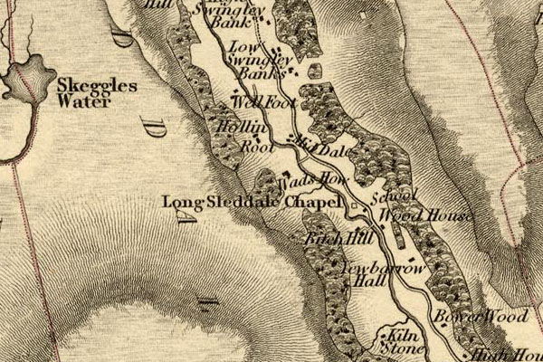 HDG6lsl2.jpg map courtesy of Mark Cropper item:- private collection : 371 Image © see bottom of page |
|
|
|
||
| evidence:- | records:- Curwen 1926 placename:- Waddshow Bridge placename:- Wadshaw Bridge |
|
| source data:- | Records Relating to the Barony of Kendale, supplementary vol.3,
edited by John F Curwen, published by Titus Wilson and Son,
Kendal, Westmorland, 1926. CURWEN01.txt "1721/22 January 12 : Waddshow Bridge in Long Sleddale presented to to be very ruinous and in decay to the danger of passengers. K. Indictment Book, 1692-1724." "..." "1750/51 January 18 : Whereas by petition it is set forth that by a violent flood which happened in 1749 Wadshaw Bridge in the high road from Ambleside to Appleby was entirely destroyed and that the inhabitants had to a great expense to themselves rebuilt the said bridge, and that by the said flood also sustained a great loss to the amount of £600, this court having taken the matter of the petition into consideration and compassionating the hardship and great expense hath ordered that the High Constable of Kendale do pay the sum of £8 to the petitioners as a gratuity, but not to be taken as a precedent for any future claims, towards the rebuilding of the said bridge. K. Order Book, 1750-60." |
|
|
|
||
| evidence:- | records:- KendalRO : QS AR/2/13/3 213/18 placename:- item:- floods |
|
| source data:- | Summary from Quarter Session Rolls; Kendal Christmas Sessions Roll 1749 Petition, Robert Wilson, Mathew Munkhouse, Thomas Hall, Thomas Hudson, Robert Walker and Jonathan Newton of Longsleddale, "in August 1749 a large and serviceable Stone Bridge within Longsleddale afd. was drove down by violent Floods which your Petre are liable to rebuild" the said bridge is necessary to make the highway from Ambleside to Kirkby Stephen passable, petitioners were at great expense 24 years ago in erecting said bridge and have received considerable damage by the said floods. Desire bridge to be rebuilt by county or gratuity. |
|
|
|
||
| evidence:- | records:- KendalRO : QS AR/2/13/3 220/11 placename:- Wadshaw Bridge item:- floods; road, Ambleside to Appleby |
|
| source data:- | Summary from Quarter Session Rolls; Kendal Christmas Sessions Roll 1750-51 Petition, Jonathan Newton, Matthew Monkhouse, Robert Wilson, Robert Walker, Thomas Hudson, Thomas Hall, had rebuilt Wadshaw bridge (destroyed by flood in 1749) in the highroad from Ambleside to Appleby, desire gratuity. Ordered that the High Constable of Kendal ward pay the petitioners L8. Endorsed. account for repair of bridge with brief details of construction. |
|
|
|
||
| evidence:- | map:- OS Six Inch (1956) placename:- Wadshowe Bridge |
|
| source data:- | Map series, various editions with the national grid, scale about
6 inches to 1 mile, published by the Ordnance Survey,
Southampton, Hampshire, scale 1 to 10560 from 1950s to 1960s,
then 1 to 10000 from 1960s to 2000s, superseded by print on
demand from digital data.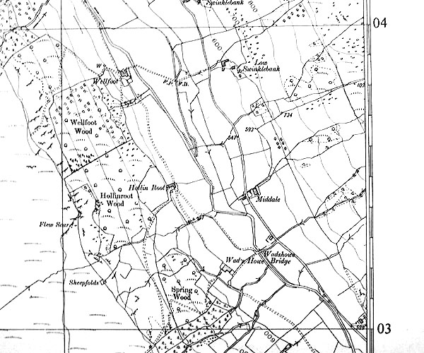 SINY4903.jpg "Wadshowe Bridge" |
|
|
|
||
| hearsay:- |
This is said to be the site of a bridge of a post medieval date (whatever that means) |
|
|
|
||
 Lakes Guides menu.