 Old Cumbria Gazetteer
 |
 |
|
| Ulgraves, Strickland Roger | ||
| Ulgraves | ||
| civil parish:- | Strickland Roger (formerly Westmorland) | |
| county:- | Cumbria | |
| locality type:- | hill | |
| coordinates:- | SD51119962 | |
| 1Km square:- | SD5199 | |
| 10Km square:- | SD59 | |
| altitude:- | 1089 feet | |
| altitude:- | 332m | |
|
|
||
| evidence:- | old map:- OS County Series (Wmd 33 4) placename:- Ulgraves |
|
| source data:- | Maps, County Series maps of Great Britain, scales 6 and 25
inches to 1 mile, published by the Ordnance Survey, Southampton,
Hampshire, from about 1863 to 1948. County Series 25 inch map, Westmorland sheet XXXIII 4, surveyed 1858-59, revised 1896, 2nd edition published by Ordnance Survey, 1898. "Ulgraves" Mostly outwith the parish. |
|
|
|
||
| evidence:- | map:- OS Six Inch (1956) placename:- Ulgraves |
|
| source data:- | Map series, various editions with the national grid, scale about
6 inches to 1 mile, published by the Ordnance Survey,
Southampton, Hampshire, scale 1 to 10560 from 1950s to 1960s,
then 1 to 10000 from 1960s to 2000s, superseded by print on
demand from digital data.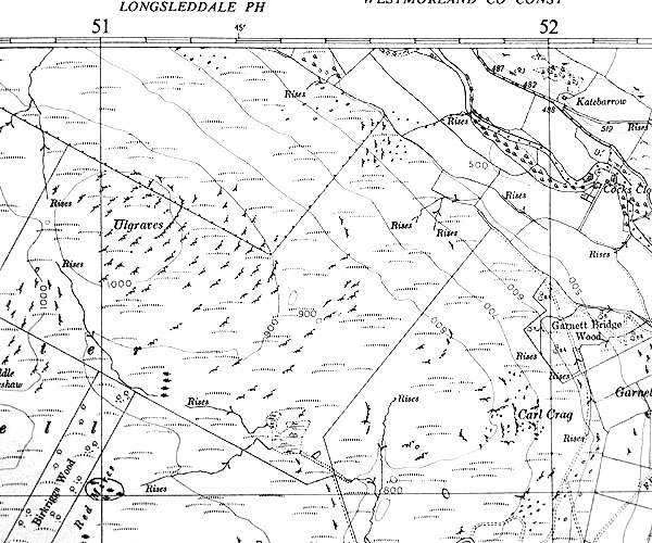 SISD5199.jpg "Ulgraves" |
|
|
|
||
 Lakes Guides menu.