 Old Cumbria Gazetteer
 |
 |
|
| Uldale House, Sedbergh | ||
| Uldale House | ||
| locality:- | Uldale | |
| civil parish:- | Sedbergh (formerly Yorkshire) | |
| county:- | Cumbria | |
| locality type:- | buildings | |
| coordinates:- | SD73089660 | |
| 1Km square:- | SD7396 | |
| 10Km square:- | SD79 | |
|
|
||
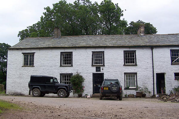 BWY31.jpg (taken 22.7.2012) 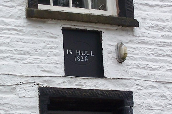 BWY32.jpg Date stone:- "I S HULL / 1828" (taken 22.7.2012) |
||
|
|
||
| evidence:- | old map:- Jefferys 1770 (Wmd) placename:- Uldale |
|
| source data:- | Map, 4 sheets, The County of Westmoreland, scale 1 inch to 1
mile, surveyed 1768, and engraved and published by Thomas
Jefferys, London, 1770.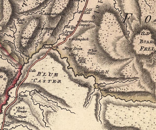 J5SD79NW.jpg "Uldale" circle, labelled in italic lowercase text; settlement, farm, house, or hamlet? item:- National Library of Scotland : EME.s.47 Image © National Library of Scotland |
|
|
|
||
| evidence:- | old map:- Cary 1789 (edn 1805) placename:- Oldale |
|
| source data:- | Map, uncoloured engraving, Westmoreland, scale about 2.5 miles
to 1 inch, by John Cary, London, 1789; edition 1805.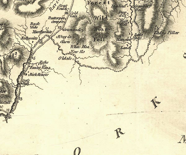 CY24SD79.jpg "Oldale" block/s, labelled in italic lowercase; house, or hamlet item:- JandMN : 129 Image © see bottom of page |
|
|
|
||
| evidence:- | database:- Listed Buildings 2010 placename:- Uldale House |
|
| source data:- | courtesy of English Heritage "ULDALE HOUSE / / CAUTLEY ROAD / SEDBERGH / SOUTH LAKELAND / CUMBRIA / II / 484551 / SD7308896604" |
|
|
|
||
| evidence:- | database:- Listed Buildings 2010 |
|
| source data:- | courtesy of English Heritage "BARN ATTACHED TO WEST END OF ULDALE HOUSE / / CAUTLEY ROAD / SEDBERGH / SOUTH LAKELAND / CUMBRIA / II / 484552 / SD7307196603" |
|
|
|
||
 Lakes Guides menu.