 Old Cumbria Gazetteer
 |
 |
|
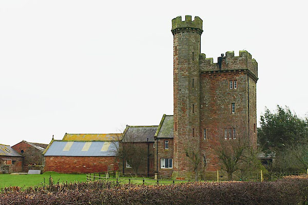
| Toppin Castle, Hayton | ||
| Toppin Castle | ||
| civil parish:- | Hayton (formerly Cumberland) | |
| county:- | Cumbria | |
| locality type:- | buildings | |
| locality type:- | folly | |
| locality type:- | castle | |
| coordinates:- | NY49665705 | |
| 1Km square:- | NY4957 | |
| 10Km square:- | NY45 | |
|
|
||
 BQF66.jpg (taken 11.3.2009) 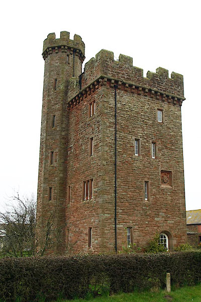 BQF67.jpg (taken 11.3.2009) |
||
|
|
||
| evidence:- | old map:- OS County Series (Cmd 24 3) placename:- Toppin Castle |
|
| source data:- | Maps, County Series maps of Great Britain, scales 6 and 25
inches to 1 mile, published by the Ordnance Survey, Southampton,
Hampshire, from about 1863 to 1948. |
|
|
|
||
| evidence:- | database:- Listed Buildings 2010 placename:- Toppin Castle |
|
| source data:- | courtesy of English Heritage "TOPPIN CASTLE / / / HAYTON / CARLISLE / CUMBRIA / II / 78057 / NY4961957047" |
|
|
|
||
| evidence:- | database:- Listed Buildings 2010 |
|
| source data:- | courtesy of English Heritage "BARNS EAST OF TOPPIN CASTLE / / / HAYTON / CARLISLE / CUMBRIA / II / 78058 / NY4966057053" |
|
|
|
||
| evidence:- | database:- Listed Buildings 2010 |
|
| source data:- | courtesy of English Heritage "GATE PIERS SOUTH EAST OF TOPPIN CASTLE / / / HAYTON / CARLISLE / CUMBRIA / II / 78059 / NY4963857032" |
|
|
|
||
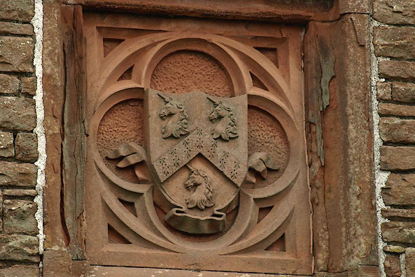 BQF70.jpg Coat of arms, George Head Head (taken 11.3.2009) |
||
|
|
||
| hearsay:- |
Farm converted to a tower house by George Head Head. |
|
|
|
||
 Lakes Guides menu.