 Old Cumbria Gazetteer
 |
 |
|
| Toll Bar Cottage, Underbarrow and Bradleyfield | ||
| Toll Bar Cottage | ||
| civil parish:- | Underbarrow and Bradleyfield (formerly Westmorland) | |
| county:- | Cumbria | |
| locality type:- | toll gate (site) | |
| locality type:- | toll house (ex) | |
| locality type:- | buildings | |
| coordinates:- | SD48209223 | |
| 1Km square:- | SD4892 | |
| 10Km square:- | SD49 | |
|
|
||
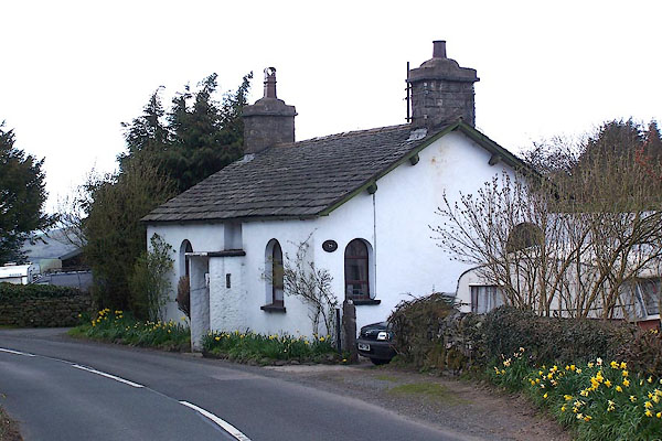 BLW17.jpg (taken 16.4.2006) |
||
|
|
||
| evidence:- | old map:- OS County Series (Wmd 38 7) placename:- Underbarrow TP |
|
| source data:- | Maps, County Series maps of Great Britain, scales 6 and 25
inches to 1 mile, published by the Ordnance Survey, Southampton,
Hampshire, from about 1863 to 1948. "Underbarrow T.P." gate across road and a building |
|
|
|
||
| evidence:- | old map:- Jefferys 1770 (Wmd) |
|
| source data:- | Map, 4 sheets, The County of Westmoreland, scale 1 inch to 1
mile, surveyed 1768, and engraved and published by Thomas
Jefferys, London, 1770.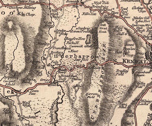 J5SD49SE.jpg "Toll Gate" circle, labelled in italic lowercase text; settlement, farm, house, or hamlet? item:- National Library of Scotland : EME.s.47 Image © National Library of Scotland |
|
|
|
||
| evidence:- | old map:- Cary 1789 (edn 1805) |
|
| source data:- | Map, uncoloured engraving, Westmoreland, scale about 2.5 miles
to 1 inch, by John Cary, London, 1789; edition 1805.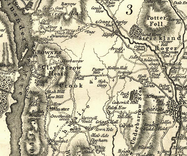 CY24SD49.jpg "Toll Gate" block/s, labelled in italic lowercase; house, or hamlet item:- JandMN : 129 Image © see bottom of page |
|
|
|
||
| evidence:- | database:- Listed Buildings 2010 placename:- Toll Bar Cottage |
|
| source data:- | courtesy of English Heritage "TOLL BAR COTTAGE / / / UNDERBARROW AND BRADLEYFIELD / SOUTH LAKELAND / CUMBRIA / II / 75315 / SD4820792226" |
|
| source data:- | courtesy of English Heritage "Toll house, C18. Stone, rendered walls, slate roof, stone ridge. End chimney stacks. Central doorway with stone slab porch (probably later addition). Round headed window to either side of door with C20 glazing. C20 extension to right hand side not included in listing." |
|
|
|
||
 Lakes Guides menu.