 Old Cumbria Gazetteer
 |
 |
|
||
| Todhills, Rockcliffe | ||||
| Todhills | ||||
| civil parish:- | Rockcliffe (formerly Cumberland) | |||
| county:- | Cumbria | |||
| locality type:- | locality | |||
| locality type:- | buildings | |||
| coordinates:- | NY36816311 (etc) | |||
| 1Km square:- | NY3663 | |||
| 10Km square:- | NY36 | |||
|
|
||||
| evidence:- | old map:- Burrow 1920s |
|||
| source data:- | Road book, On the Road, Dunlop Pictorial Road Plans, volume V,
strip maps with parts in Westmorland, Cumberland etc, irregular
scale about 1.5 miles to 1 inch, by E J Burrow and Co,
Cheltenham, Gloucestershire, 1920s.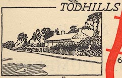 EJB3Vg62.jpg item:- private collection : 17 Image © see bottom of page |
|||
|
|
||||
| places:- |
|
|||
 Lakes Guides menu.