 Old Cumbria Gazetteer
 |
 |
|
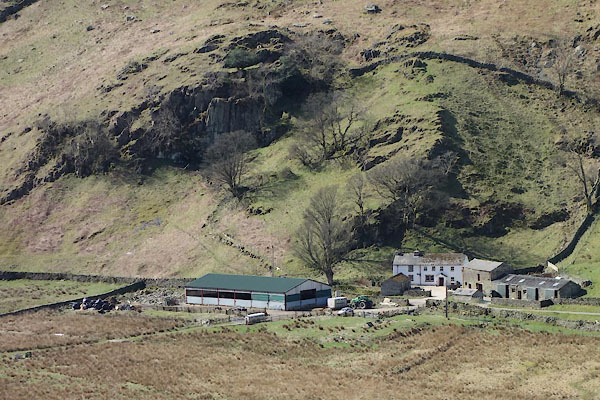
| Thrangcrag, Martindale | ||
| Thrangcrag | ||
| Thrang Crag | ||
| locality:- | Martindale Common | |
| civil parish:- | Martindale (formerly Westmorland) | |
| county:- | Cumbria | |
| locality type:- | buildings | |
| coordinates:- | NY43431757 | |
| 1Km square:- | NY4317 | |
| 10Km square:- | NY41 | |
|
|
||
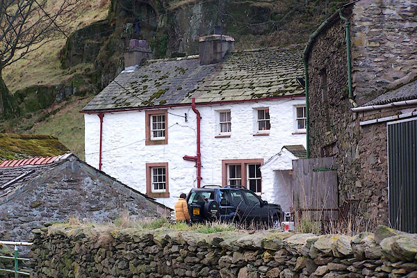 BLP04.jpg (taken 25.1.2006) 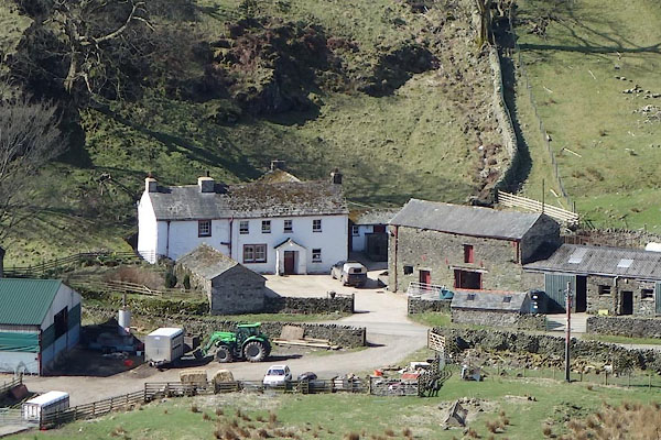 CCU84.jpg (taken 8.4.2015) |
||
|
|
||
| evidence:- | old map:- OS County Series (Wmd 12 8) placename:- Throngcrag |
|
| source data:- | Maps, County Series maps of Great Britain, scales 6 and 25
inches to 1 mile, published by the Ordnance Survey, Southampton,
Hampshire, from about 1863 to 1948. |
|
|
|
||
| evidence:- | old map:- Jefferys 1770 (Wmd) placename:- Thrang Crag |
|
| source data:- | Map, 4 sheets, The County of Westmoreland, scale 1 inch to 1
mile, surveyed 1768, and engraved and published by Thomas
Jefferys, London, 1770.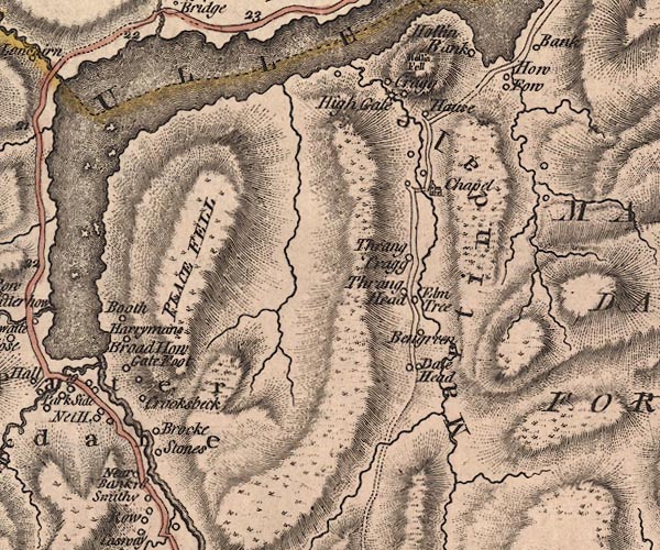 J5NY41NW.jpg "Thrang Crag" circle, labelled in italic lowercase text; settlement, farm, house, or hamlet? item:- National Library of Scotland : EME.s.47 Image © National Library of Scotland |
|
|
|
||
| evidence:- | database:- Listed Buildings 2010 placename:- Thrang Crag |
|
| source data:- | courtesy of English Heritage "THRANG CRAG / / / MARTINDALE / EDEN / CUMBRIA / II / 74537 / NY4342817530" |
|
|
|
||
 CCU85.jpg (taken 8.4.2015) |
||
|
|
||
 Lakes Guides menu.