 Old Cumbria Gazetteer
 |
 |
|
| Thorphinsty Hall, Cartmel Fell | ||
| Thorphinsty Hall | ||
| civil parish:- | Cartmel Fell (formerly Lancashire) | |
| county:- | Cumbria | |
| locality type:- | buildings | |
| coordinates:- | SD41458622 | |
| 1Km square:- | SD4186 | |
| 10Km square:- | SD48 | |
|
|
||
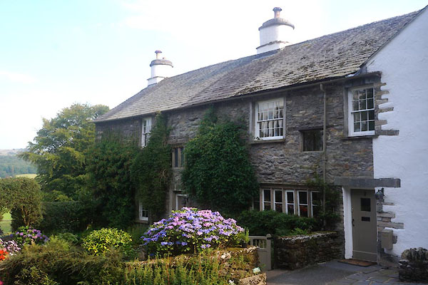 CDX65.jpg (taken 11.9.2015) |
||
|
|
||
| evidence:- | old map:- OS County Series (Lan 8 16) placename:- Thorphinsty Hall |
|
| source data:- | Maps, County Series maps of Great Britain, scales 6 and 25
inches to 1 mile, published by the Ordnance Survey, Southampton,
Hampshire, from about 1863 to 1948. |
|
|
|
||
| evidence:- | database:- Listed Buildings 2010 placename:- Thorphinsty Hall |
|
| source data:- | courtesy of English Heritage "THORPHINSTY HALL / / / CARTMEL FELL / SOUTH LAKELAND / CUMBRIA / II / 421166 / SD4145886224" |
|
|
|
||
| evidence:- | database:- Listed Buildings 2010 |
|
| source data:- | courtesy of English Heritage "BARN APPROXIMATELY 80 METRES TO NORTH OF THORPHINSTY HALL / / / CARTMEL FELL / SOUTH LAKELAND / CUMBRIA / II / 421167 / SD4148586315" |
|
|
|
||
 Lakes Guides menu.