 Old Cumbria Gazetteer
 |
 |
|
| Thistlewood, Highbridge | ||
| Thistlewood | ||
| locality:- | Highbridge | |
| civil parish:- | Castle Sowerby (formerly Cumberland) | |
| county:- | Cumbria | |
| locality type:- | buildings | |
| locality type:- | castle | |
| coordinates:- | NY39654363 | |
| 1Km square:- | NY3943 | |
| 10Km square:- | NY34 | |
|
|
||
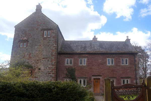 CEX40.jpg (taken 22.4.2016) 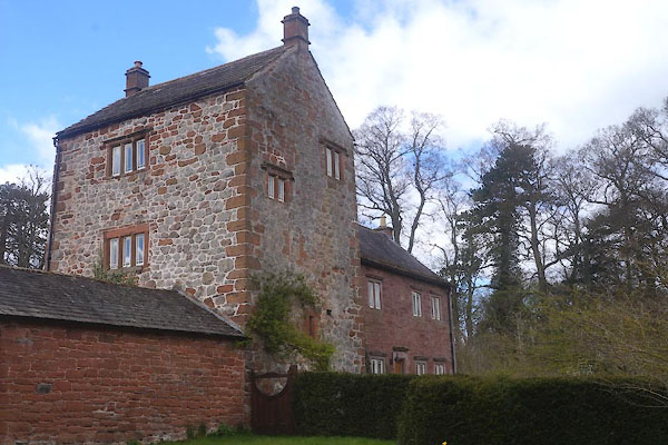 CEX41.jpg (taken 22.4.2016) |
||
|
|
||
| evidence:- | old map:- Ford 1839 map placename:- Thistlewood |
|
| source data:- | Map, uncoloured engraving, Map of the Lake District of
Cumberland, Westmoreland and Lancashire, scale about 3.5 miles
to 1 inch, published by Charles Thurnam, Carlisle, and by R
Groombridge, 5 Paternoster Row, London, 3rd edn 1843.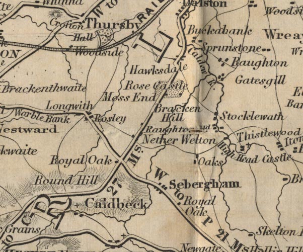 FD02NY34.jpg "Thistlewood" item:- JandMN : 100.1 Image © see bottom of page |
|
|
|
||
| evidence:- | database:- Listed Buildings 2010 placename:- Thistlewood Farm |
|
| source data:- | courtesy of English Heritage "THISTLEWOOD FARMHOUSE / / / CASTLE SOWERBY / EDEN / CUMBRIA / I / 73730 / NY3961343612" |
|
|
|
||
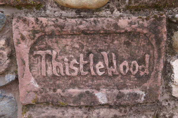 CEX42.jpg Sign. (taken 22.4.2016) |
||
|
|
||
| hearsay:- |
15th century pele with 16th century additions. Closed to visits. |
|
|
|
||
| notes:- |
14th centuy tower and 17th century hall |
|
| Perriam, D R &Robinson, J: 1998: Medieval Fortified Buildings of Cumbria: CWAAS::
ISBN 1 873124 23 6; plan and illustration |
||
|
|
||
 Lakes Guides menu.