 Old Cumbria Gazetteer
 |
 |
|
| Thirlspot Copper Mine, St John's Castlerigg etc | ||
| Thirlspot Copper Mine | ||
| site name:- | Thirlspot | |
| civil parish:- | St John's Castlerigg and Wythburn (formerly Cumberland) | |
| county:- | Cumbria | |
| locality type:- | copper mine | |
| locality type:- | mine | |
| coordinates:- | NY322180 | |
| 1Km square:- | NY3218 | |
| 10Km square:- | NY31 | |
| references:- | Adams, John: 1988: Mines of the Lake District Fells: Dalesman Books (Lancaster, Lancashire)::
ISBN 0 85206 931 6 |
|
|
|
||
| evidence:- | old map:- Simpson 1746 map (Wmd) placename:- Thurlspot |
|
| source data:- | Map, uncoloured engraving, Westmorland, scale about 8 miles to 1
inch, printed by R Walker, Fleet Lane, London, 1746.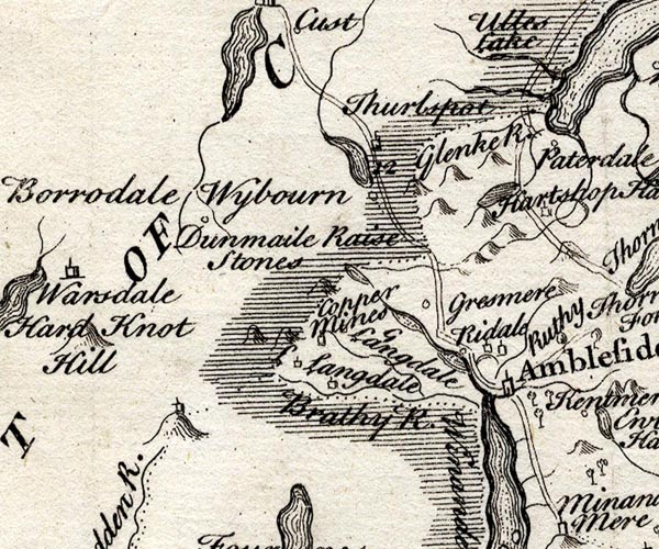 SMP2NYF.jpg "Thurlspot" Building. item:- Dove Cottage : 2007.38.59 Image © see bottom of page |
|
|
|
||
| :- |
Above Thirlspot. |
|
| Adams, John: 1988: Mines of the Lake District Fells: Dalesman Books (Lancaster, Lancashire)::
ISBN 0 85206 931 6 |
||
|
|
||
 Lakes Guides menu.