 Old Cumbria Gazetteer
 |
 |
|
| Tebay Station, Tebay | ||
| Tebay Station | ||
| Tebay Station Junction | ||
| Tebay Junction | ||
| site name:- | Lancaster and Carlisle Railway | |
| site name:- | South Durham and Lancashire Union Railway | |
| locality:- | Tebay | |
| civil parish:- | Tebay (formerly Westmorland) | |
| county:- | Cumbria | |
| locality type:- | railway station | |
| locality type:- | railway junction | |
| coordinates:- | NY61280366 | |
| 1Km square:- | NY6103 | |
| 10Km square:- | NY60 | |
| SummaryText:- | Opened 1852; closed 1968. | |
| SummaryText:- | the station junction and station are all one! | |
|
|
||
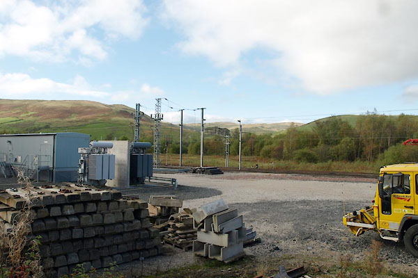 BTR41.jpg (taken 16.10.2010) |
||
|
|
||
| evidence:- | old map:- OS County Series (Wmd 28 12) placename:- Tebay Station item:- goods shed; engine shed; railway signal; railway milepost; pointsman's box; weighing machine |
|
| source data:- | Maps, County Series maps of Great Britain, scales 6 and 25
inches to 1 mile, published by the Ordnance Survey, Southampton,
Hampshire, from about 1863 to 1948.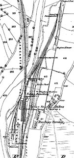 click to enlarge click to enlargeCSRY0177.jpg "Tebay Station / Pointsman's Box / Signal Box / S.P. / Signal Post / Engine House / Goods Shed / Weighing Machine / M.P. DARLINGTON 50" |
|
|
|
||
| evidence:- | old map:- Garnett 1850s-60s H placename:- Tebay and Orton Station |
|
| source data:- | Map of the English Lakes, in Cumberland, Westmorland and
Lancashire, scale about 3.5 miles to 1 inch, published by John
Garnett, Windermere, Westmorland, 1850s-60s.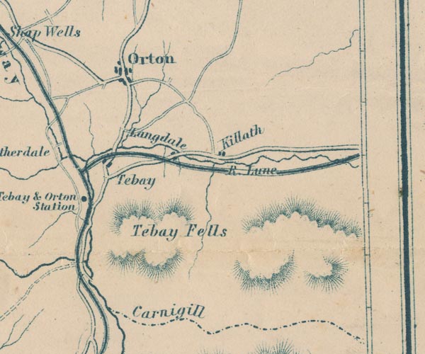 GAR2NY60.jpg "Tebay &Orton Station" dot by railway item:- JandMN : 82.1 Image © see bottom of page |
|
|
|
||
| evidence:- | old map:- LMS 1920s maps |
|
| source data:- | Railway map, lithograph, 23 pages of strip maps, The Journey in
Brief, the Route London to Carlisle, published by the London
Midland and Scottish Railway, LMS, 1920s.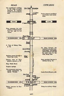 click to enlarge click to enlargeLS3p27.jpg "TO EDINBURGH 137¾ / TEBAY / FROM LONDON 262¼" "Tebay, junction for Darlington. / Tebay is a railway village." item:- JandMN : 95.2 Image © see bottom of page |
|
|
|
||
| hearsay:- |
Banking engines for the Shap climb were kept here. |
|
|
|
||
 Lakes Guides menu.