 Old Cumbria Gazetteer
 |
 |
|
| Taylorgill Force, Borrowdale | ||
| Taylorgill Force | ||
| Taylor Force | ||
| site name:- | Styhead Gill | |
| civil parish:- | Borrowdale (formerly Cumberland) | |
| county:- | Cumbria | |
| locality type:- | waterfall | |
| coordinates:- | NY229109 | |
| 1Km square:- | NY2210 | |
| 10Km square:- | NY21 | |
|
|
||
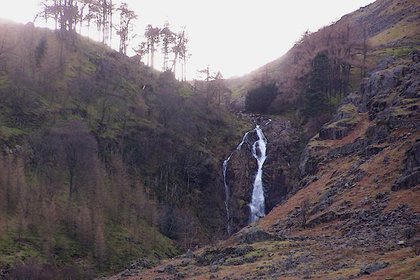
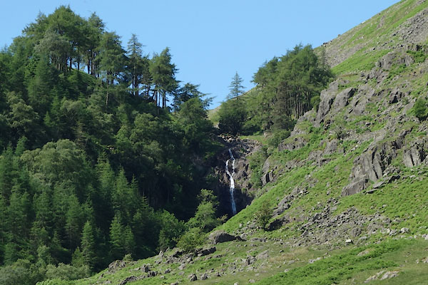 CAY70.jpg (taken 23.6.2014) 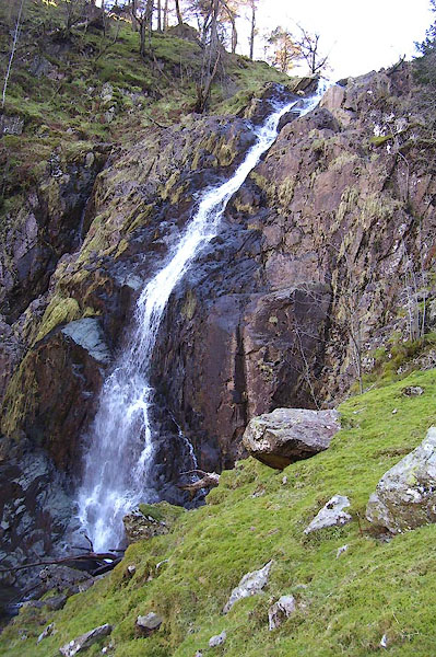 BNM92.jpg (taken 4.4.2007) |
||
|
|
||
| evidence:- | old map:- OS County Series (Cmd 75 1) placename:- Taylorgill Force |
|
| source data:- | Maps, County Series maps of Great Britain, scales 6 and 25
inches to 1 mile, published by the Ordnance Survey, Southampton,
Hampshire, from about 1863 to 1948. |
|
|
|
||
| evidence:- | old map:- Otley 1818 |
|
| source data:- | Map, uncoloured engraving, The District of the Lakes,
Cumberland, Westmorland, and Lancashire, scale about 4 miles to
1 inch, by Jonathan Otley, 1818, engraved by J and G Menzies,
Edinburgh, Scotland, published by Jonathan Otley, Keswick,
Cumberland, et al, 1833.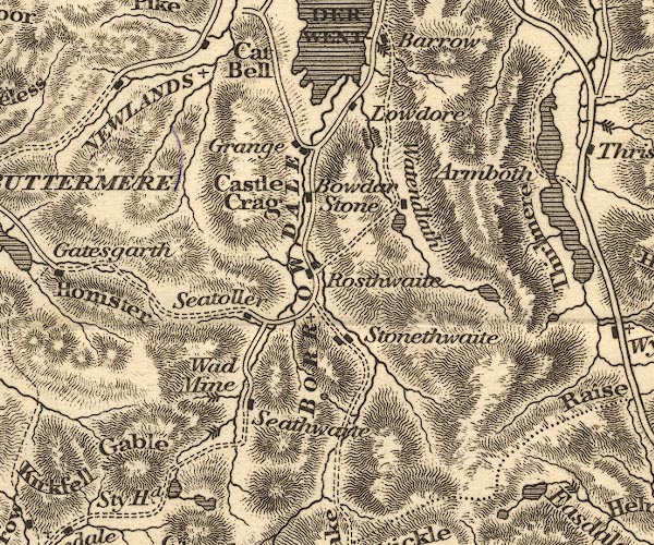 OT02NY21.jpg Marked by three chevrons across the stream. item:- JandMN : 48.1 Image © see bottom of page |
|
|
|
||
| evidence:- | descriptive text:- Otley 1823 (5th edn 1834) item:- fishing |
|
| source data:- | Guide book, A Concise Description of the English Lakes, the
mountains in their vicinity, and the roads by which they may be
visited, with remarks on the mineralogy and geology of the
district, by Jonathan Otley, published by the author, Keswick,
Cumberland now Cumbria, by J Richardson, London, and by Arthur
Foster, Kirkby Lonsdale, Cumbria, 1823; published 1823-49,
latterly as the Descriptive Guide to the English Lakes. goto source goto sourcePage 37:- "... Sty-head Tarn ... The stream running from thence towards Seathwaite, has some fine frothy breaks, and one grand waterfall, before it reaches the bottom of [the vale.]" goto sourcePage 45:- "Near the head of the Seathwaite branch of Borrowdale, the water from Sty-head Tarn is met by a dry gill called Taylor Gill; and near their junction there is a lofty waterfall, which is a good object from the road to Wasdale." |
|
|
|
||
| evidence:- | old map:- Garnett 1850s-60s H placename:- Taylors Gill |
|
| source data:- | Map of the English Lakes, in Cumberland, Westmorland and
Lancashire, scale about 3.5 miles to 1 inch, published by John
Garnett, Windermere, Westmorland, 1850s-60s.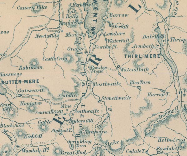 GAR2NY21.jpg "Taylors Gill" two lines across a stream, waterfall item:- JandMN : 82.1 Image © see bottom of page |
|
|
|
||
| evidence:- | old photograph:- Bell 1880s-1940s |
|
| source data:- | Photograph, sepia, Taylorgill Force, Styhead Gill, Borrowdale, Cumberland, by Herbert
Bell, Ambleside, Westmorland, 1890s.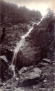 click to enlarge click to enlargeHB0396.jpg internegative at lower right:- "H. Bell." item:- Armitt Library : ALPS50 Image © see bottom of page |
|
|
|
||
| evidence:- | old print:- MacBride 1922 |
|
| source data:- | Print, colour, Styhead Gill, Borrowdale to Wastwater, by Alfred Heaton Cooper, published
by Adam and Charles Black, 4-6 Soho Square, London, 2nd edn 1928.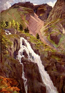 click to enlarge click to enlargeMB0116.jpg Tipped in opposite p.101 in Wild Lakeland by MacKenzie MacBride. printed at bottom:- "STYHEAD GILL (BORROWDALE TO WASTWATER)" signed at lower left:- "A. HEATON COOPER" item:- JandMN : 195.18 Image © see bottom of page |
|
|
|
||
| evidence:- | perhaps old print:- Rose 1832-35 |
|
| source data:- | Print, engraving, Waterfall, near Sty Head, Cumberland, by Thomas Allom, engraved
by S Lacey, 1833.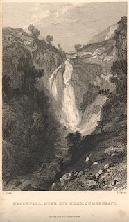 click to enlarge click to enlargeR265.jpg "Waterfall, near Sty Head, Cumberland" From the text description this could be Taylorgill Force on Styhead Gill. item:- JandMN : 96.20 Image © see bottom of page |
|
|
|
||
 BNG73.jpg Late afternoon. (taken 26.2.2007) |
||
|
|
||
Lakes Guides menu.