 Old Cumbria Gazetteer
 |
 |
|
| Swallowhurst, Bootle | ||
| Swallowhurst | ||
| civil parish:- | Bootle (formerly Cumberland) | |
| county:- | Cumbria | |
| locality type:- | buildings | |
| coordinates:- | SD10299101 | |
| 1Km square:- | SD1091 | |
| 10Km square:- | SD19 | |
|
|
||
| evidence:- | old map:- OS County Series (Cmd 85 7) placename:- Swallowhurst |
|
| source data:- | Maps, County Series maps of Great Britain, scales 6 and 25
inches to 1 mile, published by the Ordnance Survey, Southampton,
Hampshire, from about 1863 to 1948. |
|
|
|
||
| evidence:- | probably old map:- Donald 1774 (Cmd) |
|
| source data:- | Map, hand coloured engraving, 3x2 sheets, The County of Cumberland, scale about 1
inch to 1 mile, by Thomas Donald, engraved and published by Joseph Hodskinson, 29
Arundel Street, Strand, London, 1774.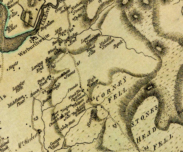 D4SD19SW.jpg "/ Herbert, Mr." house item:- Carlisle Library : Map 2 Image © Carlisle Library |
|
|
|
||
| evidence:- | database:- Listed Buildings 2010 placename:- Swallowhurst item:- date stone (1770) |
|
| source data:- | courtesy of English Heritage "SWALLOWHURST AND ATTACHED BARNS / / / BOOTLE / COPELAND / CUMBRIA / II / 76304 / SD1029391017" |
|
|
|
||
 Lakes Guides menu.