 Old Cumbria Gazetteer
 |
 |
|
| Stybarrow Dodd, St John's Castlerigg etc | ||
| Stybarrow Dodd | ||
| civil parish:- | St John's Castlerigg and Wythburn (formerly Cumberland) | |
| civil parish:- | Patterdale (formerly Westmorland) | |
| civil parish:- | Matterdale (formerly Cumberland) | |
| county:- | Cumbria | |
| locality type:- | hill | |
| locality type:- | boundary feature | |
| locality type:- | county boundary feature | |
| coordinates:- | NY34351896 | |
| 1Km square:- | NY3418 | |
| 10Km square:- | NY31 | |
| altitude:- | 2766 feet | |
| altitude:- | 843m | |
| old boundary | ||
| locality:- | Westmorland boundary | |
| locality:- | Cumberland boundary | |
|
|
||
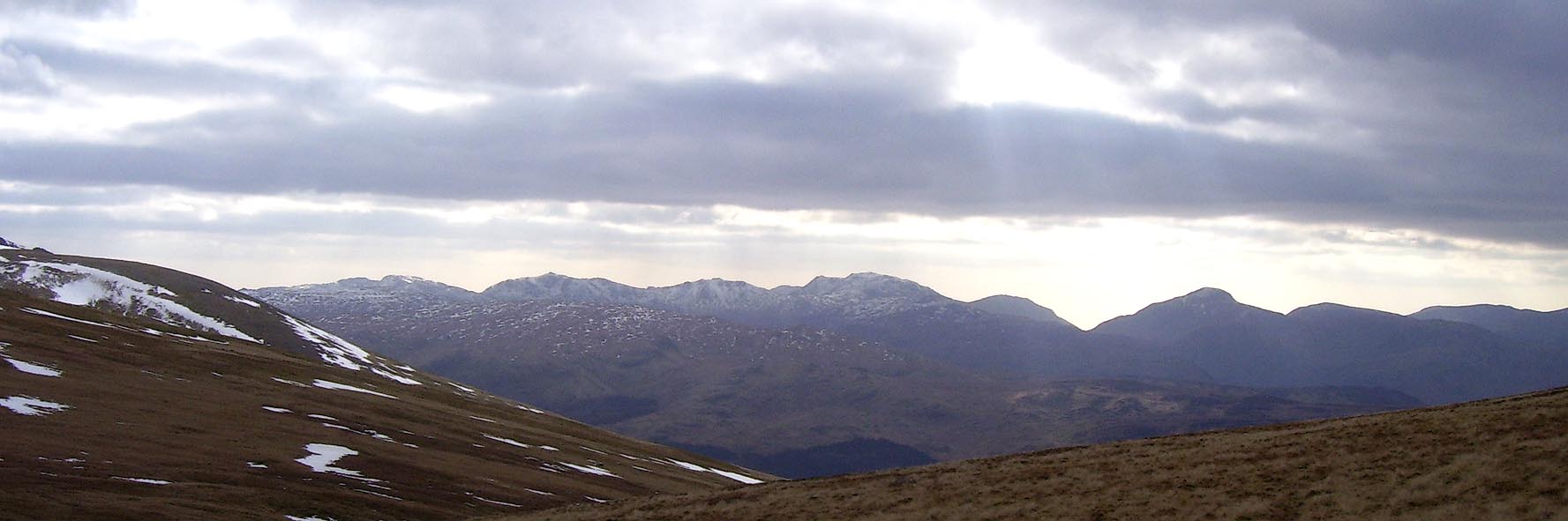 Click to enlarge BOV28.jpg Outline view from Stybarrow Dodd; Bowfell, Esk Pike, Scafell, Lingmell, Great Gable. (taken 17.3.2008) |
||
|
|
||
| evidence:- | old map:- OS County Series (Wmd 12 5) placename:- Stybarrow Dodd |
|
| source data:- | Maps, County Series maps of Great Britain, scales 6 and 25
inches to 1 mile, published by the Ordnance Survey, Southampton,
Hampshire, from about 1863 to 1948. |
|
|
|
||
| evidence:- | old map:- OS County Series (Cmd 65 13) placename:- Styebarrow Dod |
|
| source data:- | Maps, County Series maps of Great Britain, scales 6 and 25
inches to 1 mile, published by the Ordnance Survey, Southampton,
Hampshire, from about 1863 to 1948. |
|
|
|
||
 Lakes Guides menu.