 Old Cumbria Gazetteer
 |
 |
|
| Strickland Guard, Blennerhasset and Torpenhow | ||
| Strickland Guard | ||
| locality:- | Kirkland Guards | |
| civil parish:- | Bothel and Threapland (formerly Cumberland) | |
| county:- | Cumbria | |
| coordinates:- | NY187398 (?) | |
| 1Km square:- | NY1839 | |
| 10Km square:- | NY13 | |
| SummaryText:- | This might now be part of Kirkland Guards? | |
| references:- | Ogilby 1675 |
|
|
|
||
| evidence:- | old map:- Ogilby 1675 (plate 96) placename:- Strickland Guard |
|
| source data:- | Road strip map, hand coloured engraving, the Road from Kendal to
Cockermouth, and the Road from Egremond to Carlisle, scale about
1 inch to 1 mile, by John Ogilby, London, 1675.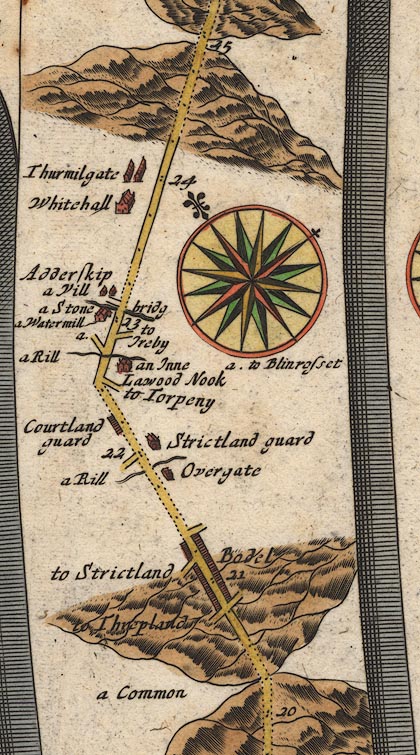 OG96Bm20.jpg In mile 22, Cumberland. "Strickland guard" house on the right of the road. item:- JandMN : 22 Image © see bottom of page |
|
|
|
||
| evidence:- | old map:- Bowen 1720 (plate 261) placename:- Strickland Guard |
|
| source data:- | Road strip map, uncoloured engraving, pl.261, the end of the
road from Kendal to Cockermouth and the road from Egremont to
Carlisle, scale about 2 miles to 1 inch, published by Emanuel
Bowen, St Katherines, London, 1720.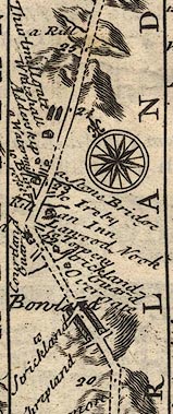 B261m20.jpg At mile 22 from Egremont. item:- Dove Cottage : Lowther.36 Image © see bottom of page |
|
|
|
||
| evidence:- | old map:- Bowen and Kitchin 1760 placename:- Strickland Guard |
|
| source data:- | Map, hand coloured engraving, A New Map of the Counties of
Cumberland and Westmoreland Divided into their Respective Wards,
scale about 4 miles to 1 inch, by Emanuel Bowen and Thomas
Kitchin et al, published by T Bowles, Robert Sayer, and John
Bowles, London, 1760.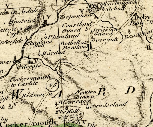 BO18NY13.jpg "Strickland Guard" circle and line item:- Armitt Library : 2008.14.10 Image © see bottom of page |
|
|
|
||
 Lakes Guides menu.