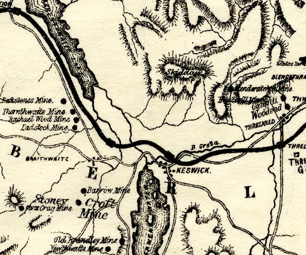


placename:- Stoneycroft Mine
item:- lead ore; galena; friable quartz; smelter; Son of Hagar, A; mine, accident; accident, mine
 goto source
page 90:- "STONEYCROFT MINE."
"Stoneycroft Mine is no doubt as ancient and possibly more ancient than Barrow Mine, but it enjoyed a very long period of rest, whereas Barrow Mine is vastly more extensive, and has probably had but few and short intervals of quietude during its long and chequered history. Galena is practically the only ore obtained from this mine, and the veinstone in which it is enclosed is largely composed of white, opaque, and somewhat friable quartz. In the lowest reach but one of the gill, the stream has excavated its course on the vein, and it was here that the old men found ore and commenced working. They built a dam higher up the gill, diverted the stream, and stoped out a considerable quantity of ore from its former bed. They afterwards sank a shaft, about seven fathoms deep at the eastern end of the stope, where the vein again enters the hill, and stoped out some ore to that depth."
 goto source
page 91:- "Afterwards, it was said, that the dam burst, and that some of the workmen were buried beneath the sand and mud with which the shaft was filled."
"The Mine was re-opened in 1846, by the Keswick Mining Co., and it was considered highly probable that some remains of the buried workmen might be found, but the climate and the surface soil of our northern country are more favourable for promoting rapid decay rather than for the preservation of human remains, and therefore, all that was found was some ancient tools, and about 40 or 50 feet of chain, the links of which were circular, and about 2½inches in diameter."
"The shaft was sunk ten fathoms deeper and two levels were driven off east and west. A water-wheel was erected to pump the water from the mine, and another to crush and stamp the ore, and a quantity of ore was raised, but not sufficient to create a hope that the mine might ultimately become a profitable one."
"Both Stoneycroft and Barrow Mines are clearly indicated in Mr. Hall Caine's book, entitled "A Son of Hagar." Barrow Mine by several references to the "Sandy Vein," and a vivid description of the running sand, and the disastrous results caused by it; while Stoneycroft Mine is indicated by a description of "a worked-out open cutting," and a "vast cleft cut into the side of the mountain, square on its base, vertical in its three grey walls sweeping up to a dizzy height, over which the brant sides of the green fell rose sheer into the sky.""
"The old smelt-mill in Stoneycroft gill is also frequently mentioned."
placename:- Stoney Croft Mine

PST2NY22.jpg
"Stoney Croft Mine"
mine symbol
item:- JandMN : 162.2
Image © see bottom of page
