 Old Cumbria Gazetteer
 |
 |
|
| included in:- |
 Buttermere lake Buttermere lake |
|
| viewpoint, Gatesgarth | ||
| locality:- | Gatesgarth | |
| civil parish:- | Buttermere (formerly Cumberland) | |
| county:- | Cumbria | |
| locality type:- | viewpoint | |
| coordinates:- | NY19521463 (about) | |
| 1Km square:- | NY1914 | |
| 10Km square:- | NY11 | |
|
|
||
| evidence:- | old map:- Crosthwaite 1783-94 (But/Cru/Low) |
|
| source data:- | Map, uncoloured engraving, An Accurate Map of Buttermere,
Crummock and Loweswater Lakes, scale about 3 inches to 1 mile,
by Peter Crosthwaite, Keswick, Cumberland, 1794, version
published 1800.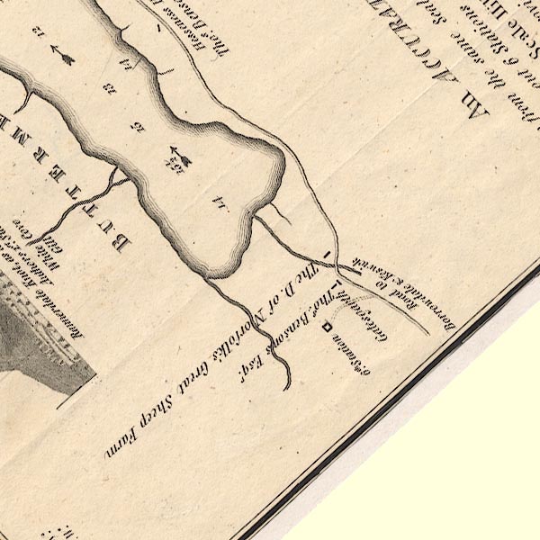 CT8NY11X.jpg "5th. Station" item:- Armitt Library : 1959.191.2 Image © see bottom of page |
|
|
|
||
| evidence:- | old map:- Crosthwaite 1783-94 (But/Cru/Low) placename:- station, Buttermere, Crosthwaite 6 |
|
| source data:- | Series of maps, An Accurate Map of the Matchless Lake of
Derwent, of the Grand Lake of Windermere, of the Beautiful Lake
of Ullswater, of Broadwater or Bassenthwaite Lake, of Coniston
Lake, of Buttermere, Crummock and Loweswater Lakes, and
Pocklington's Island, by Peter Crosthwaite, Kendal, Cumberland
now Cumbria, 1783 to 1794. "6th. Station" at the end of a short track from the road to Borrowdale. |
|
|
|
||
| indexing | ||
| person:- | map maker : Crosthwaite, Peter |
|
| place:- | Buttermere / Crummock Water / Loweswater | |
| date:- | 1794 |
|
| period:- | 18th century, late | |
| period:- | 1790s | |
| item:- | map; Accurate Map of Buttermere, Crummock and Loweswater Lakes |
|
|
|
||
Lakes Guides menu.