 Old Cumbria Gazetteer
 |
 |
|
| Starling Dodd, Ennerdale and Kinniside | ||
| Starling Dodd | ||
| civil parish:- | Ennerdale and Kinniside (formerly Cumberland) | |
| civil parish:- | Loweswater (formerly Cumberland) | |
| county:- | Cumbria | |
| locality type:- | hill | |
| coordinates:- | NY14201574 | |
| 1Km square:- | NY1415 | |
| 10Km square:- | NY11 | |
| altitude:- | 2077 feet | |
| altitude:- | 633m | |
|
|
||
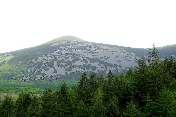 BPK35.jpg (taken 30.6.2008) 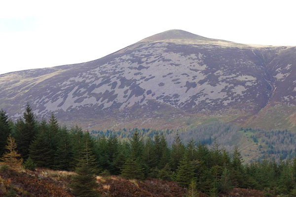 CEF86.jpg (taken 27.10.2015) |
||
|
|
||
| evidence:- | outline view:- Otley 1823 (8th edn 1849) placename:- Starling Dod |
|
| source data:- | Engraving, outline view of mountains, Ennerdale from a Field near Kirkland and Salter,
drawn by T Binns, engraved by O Jewitt, opposite p.20 of A Descriptive Guide of the
English Lakes, by Jonathan Otley, 8th edition, 1849.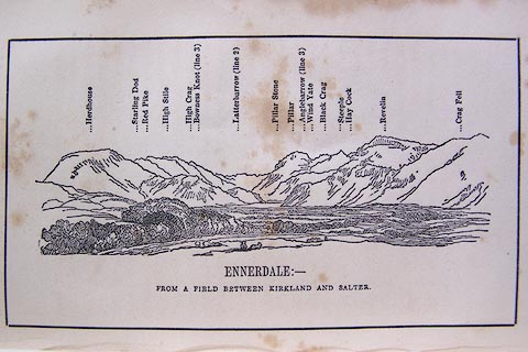 click to enlarge click to enlargeO80E11.jpg item:- Armitt Library : A1180.12 Image © see bottom of page |
|
|
|
||
 Lakes Guides menu.