 Old Cumbria Gazetteer
 |
 |
|
| Stanah, Legburthwaite | ||
| Stanah | ||
| locality:- | Legburthwaite | |
| civil parish:- | St John's Castlerigg and Wythburn (formerly Cumberland) | |
| county:- | Cumbria | |
| locality type:- | buildings | |
| coordinates:- | NY32021900 | |
| 1Km square:- | NY3219 | |
| 10Km square:- | NY31 | |
|
|
||
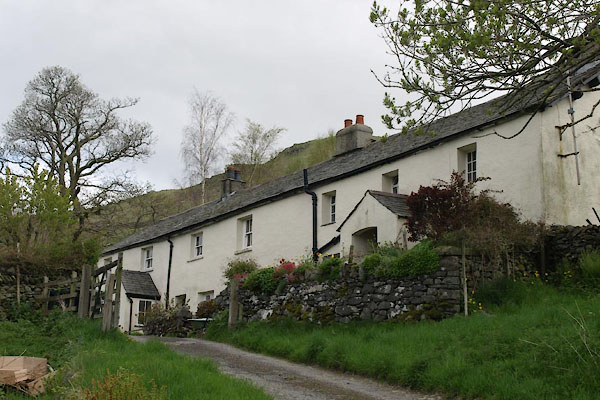 BYI48.jpg (taken 21.5.2013) |
||
|
|
||
| evidence:- | old map:- OS County Series (Cmd 64 16) placename:- Stanah |
|
| source data:- | Maps, County Series maps of Great Britain, scales 6 and 25
inches to 1 mile, published by the Ordnance Survey, Southampton,
Hampshire, from about 1863 to 1948. |
|
|
|
||
| evidence:- | probably old map:- Ogilby 1675 (plate 96) |
|
| source data:- | Road strip map, hand coloured engraving, the Road from Kendal to
Cockermouth, and the Road from Egremond to Carlisle, scale about
1 inch to 1 mile, by John Ogilby, London, 1675.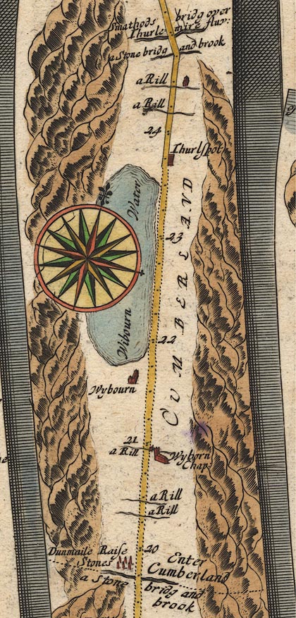 OG96m020.jpg In mile 24, Cumberland. House on the right of the road, on the bank of a river. item:- JandMN : 22 Image © see bottom of page |
|
|
|
||
| evidence:- | old map:- Clarke 1787 map (Ambleside to Keswick) placename:- Stanah |
|
| source data:- | Map, A Map of the Roads Lakes etc between Keswick and Ambleside,
scale about 2.5 ins to 1 mile, by James Clarke, engraved by S J
Neele, 352 Strand, published by James Clarke, Penrith,
Cumberland and in London etc, 1787.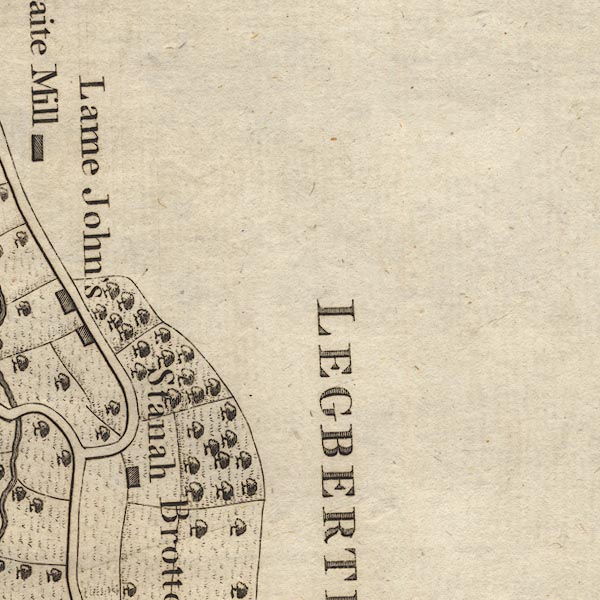 CL9NY31J.jpg "Stanah" item:- private collection : 10.9 Image © see bottom of page |
|
|
|
||
 Lakes Guides menu.