 Old Cumbria Gazetteer
 |
 |
|
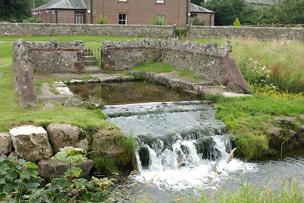
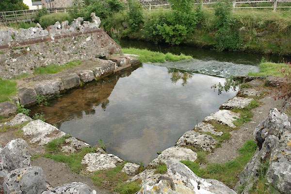
| St Helen's Well, Great Asby | ||
| St Helen's Well | ||
| locality:- | Great Asby | |
| civil parish:- | Asby (formerly Westmorland) | |
| county:- | Cumbria | |
| locality type:- | spring | |
| locality type:- | well | |
| coordinates:- | NY68171328 | |
| 1Km square:- | NY6813 | |
| 10Km square:- | NY61 | |
|
|
||
 BWZ81.jpg (taken 3.8.2012) 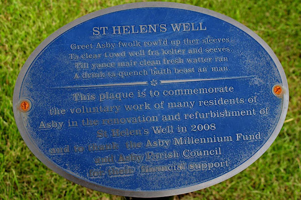 BWZ88.jpg (taken 3.8.2012) |
||
|
|
||
| evidence:- | old map:- OS County Series (Wmd 22 3) placename:- St Helen's Well |
|
| source data:- | Maps, County Series maps of Great Britain, scales 6 and 25
inches to 1 mile, published by the Ordnance Survey, Southampton,
Hampshire, from about 1863 to 1948. |
|
|
|
||
| evidence:- | drawing:- Butler 1982-92 |
|
| source data:- | St Helen's Well, Great Asby drawn by David Butler courtesy of David Butler 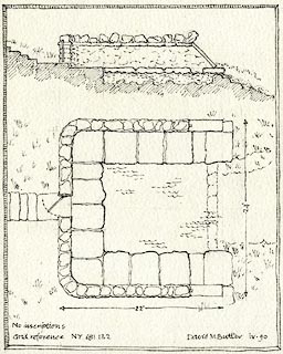 click to enlarge click to enlargePR1435.jpg item:- private collection : 377 Image © see bottom of page |
|
|
|
||
| evidence:- | database:- Listed Buildings 2010 placename:- St Helen's Well |
|
| source data:- | courtesy of English Heritage "ST HELEN'S WELL TO SOUTH OF ST HELEN'S ALMSHOUSES / / GREAT ASBY / ASBY / EDEN / CUMBRIA / II / 73251 / NY6817613282" |
|
| source data:- | courtesy of English Heritage "Spring in low rectangular enclosure of uncertain date, but probably altered in late C19 (early C19 accounts mention stone benches lining the walls, now no longer there). From roadway, steps lead down to wrought-iron gate in centre of north wall; wall continues on east and west sides. Slobbered rubble with sandstone coping topped by weathered limestone flags. Narrow path runs round internally next to wall. Water rises from large rectangular opening to flow into beck over steps at front; small secondary outflow under east wall." |
|
|
|
||
 BWZ87.jpg (taken 3.8.2012) 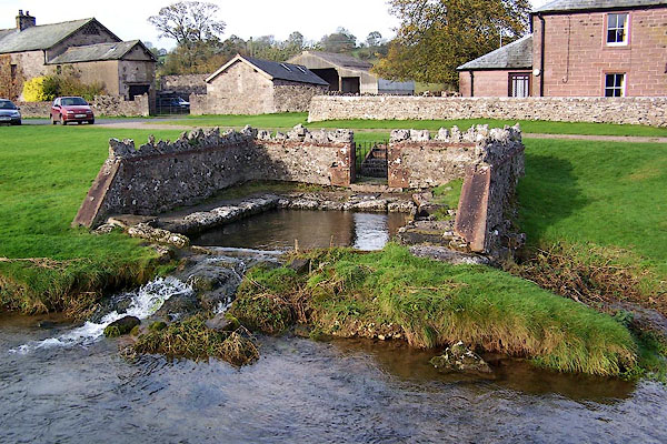 BJY39.jpg (taken 28.10.2005) |
||
|
|
||
| hearsay:- |
A local resident told us that the well never dries, even when the river, the Asby
Beck, fails. The pieces of limestone pavement on the walls were put there to frighten
the water spirits, to keep them within the spring. |
|
|
|
||
 Lakes Guides menu.