 Old Cumbria Gazetteer
 |
 |
|
|||||||||||||||||||||||||
| St Thomas, Crosscrake | |||||||||||||||||||||||||||
| St Thomas's Church | |||||||||||||||||||||||||||
| Crosscrake Church | |||||||||||||||||||||||||||
| locality:- | Crosscrake | ||||||||||||||||||||||||||
| civil parish:- | Stainton (formerly Westmorland) | ||||||||||||||||||||||||||
| county:- | Cumbria | ||||||||||||||||||||||||||
| locality type:- | church | ||||||||||||||||||||||||||
| coordinates:- | SD52368700 | ||||||||||||||||||||||||||
| 1Km square:- | SD5287 | ||||||||||||||||||||||||||
| 10Km square:- | SD58 | ||||||||||||||||||||||||||
| references:- | : 2005: Diocese of Carlisle, Directory 2004/5 |
||||||||||||||||||||||||||
|
|
|||||||||||||||||||||||||||
| MN photo:- |
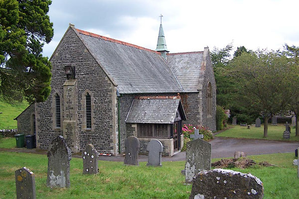
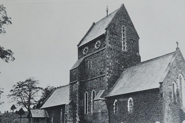
A chapel of ease was founded here by St Anslem, 1190. It became a church in 1875. |
||||||||||||||||||||||||||
 BJS30.jpg (taken 12.8.2005) 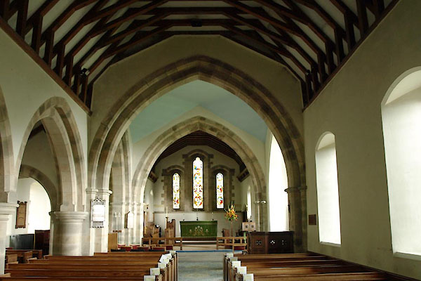 BTL22.jpg (taken 27.8.2010) |
|||||||||||||||||||||||||||
|
|
|||||||||||||||||||||||||||
| evidence:- | old map:- OS County Series (Wmd 42 4) |
||||||||||||||||||||||||||
| source data:- | Maps, County Series maps of Great Britain, scales 6 and 25
inches to 1 mile, published by the Ordnance Survey, Southampton,
Hampshire, from about 1863 to 1948. "Church (Per Curacy) / Grave Yard" |
||||||||||||||||||||||||||
|
|
|||||||||||||||||||||||||||
| evidence:- | old map:- Ogilby 1675 (plate 38) placename:- Grove Chappell |
||||||||||||||||||||||||||
| source data:- | Road strip map, hand coloured engraving, continuation of the
Road from London to Carlisle, scale about 1 inch to 1 mile, by
John Ogilby, London, 1675.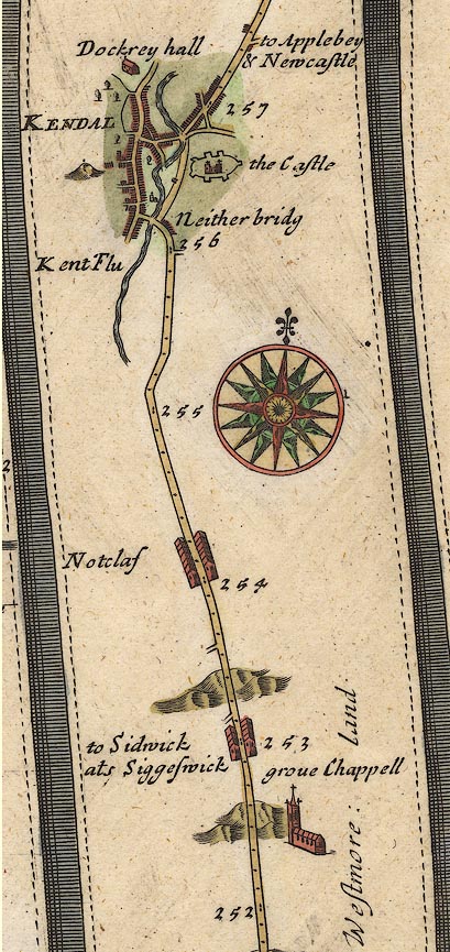 OG38m252.jpg In mile 252, Westmoreland. "grove Chappell" a church, off the road to the right. item:- JandMN : 21 Image © see bottom of page |
||||||||||||||||||||||||||
|
|
|||||||||||||||||||||||||||
| evidence:- | old map:- Bowen 1720 (plate 93) placename:- Grove Chapel |
||||||||||||||||||||||||||
| source data:- | Strip maps, uncoloured engravings, road maps, The Road from
London to Carlisle, scale about 2 miles to 1 inch, with sections
in Lancashire and Westmorland, published by Emanuel Bowen, St
Katherines, London, 1720.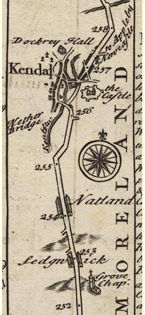 B093m252.jpg At mile 252-253. item:- Dove Cottage : 2007.38.100 Image © see bottom of page |
||||||||||||||||||||||||||
|
|
|||||||||||||||||||||||||||
| evidence:- | old map:- Badeslade 1742 placename:- Grove Church |
||||||||||||||||||||||||||
| source data:- | Map, uncoloured engraving, A Map of Westmorland North from
London, scale about 10 miles to 1 inch, with descriptive text,
by Thomas Badeslade, London, engraved and published by William
Henry Toms, Union Court, Holborn, London, 1742. click to enlarge click to enlargeBD12.jpg "Grove Church" circle, italic lowercase text; village, hamlet or locality item:- Dove Cottage : 2007.38.62 Image © see bottom of page |
||||||||||||||||||||||||||
|
|
|||||||||||||||||||||||||||
| evidence:- | old map:- Simpson 1746 map (Wmd) placename:- Grove Chapel |
||||||||||||||||||||||||||
| source data:- | Map, uncoloured engraving, Westmorland, scale about 8 miles to 1
inch, printed by R Walker, Fleet Lane, London, 1746.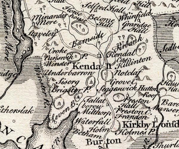 SMP2SDP.jpg "Grove C." item:- Dove Cottage : 2007.38.59 Image © see bottom of page |
||||||||||||||||||||||||||
|
|
|||||||||||||||||||||||||||
| evidence:- | old map:- Bowen and Kitchin 1760 placename:- Grove Church |
||||||||||||||||||||||||||
| source data:- | Map, hand coloured engraving, A New Map of the Counties of
Cumberland and Westmoreland Divided into their Respective Wards,
scale about 4 miles to 1 inch, by Emanuel Bowen and Thomas
Kitchin et al, published by T Bowles, Robert Sayer, and John
Bowles, London, 1760.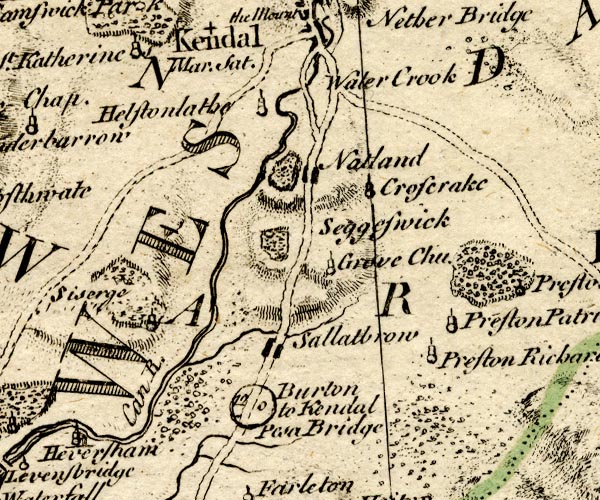 BO18SD48.jpg "Grove Chu." circle, tower item:- Armitt Library : 2008.14.10 Image © see bottom of page |
||||||||||||||||||||||||||
|
|
|||||||||||||||||||||||||||
| evidence:- | old map:- Jefferys 1770 (Wmd) placename:- Cross Craik Chapel |
||||||||||||||||||||||||||
| source data:- | Map, 4 sheets, The County of Westmoreland, scale 1 inch to 1
mile, surveyed 1768, and engraved and published by Thomas
Jefferys, London, 1770.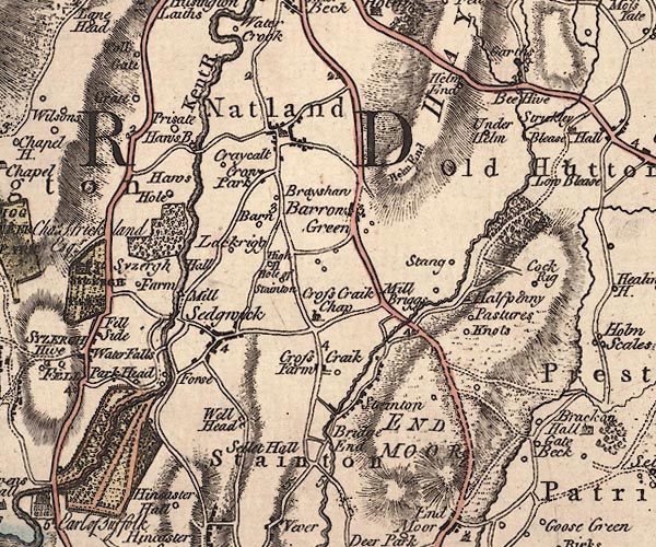 J5SD58NW.jpg "Cross Craik Chap" church item:- National Library of Scotland : EME.s.47 Image © National Library of Scotland |
||||||||||||||||||||||||||
|
|
|||||||||||||||||||||||||||
| evidence:- | old map:- Cary 1789 (edn 1805) |
||||||||||||||||||||||||||
| source data:- | Map, uncoloured engraving, Westmoreland, scale about 2.5 miles
to 1 inch, by John Cary, London, 1789; edition 1805.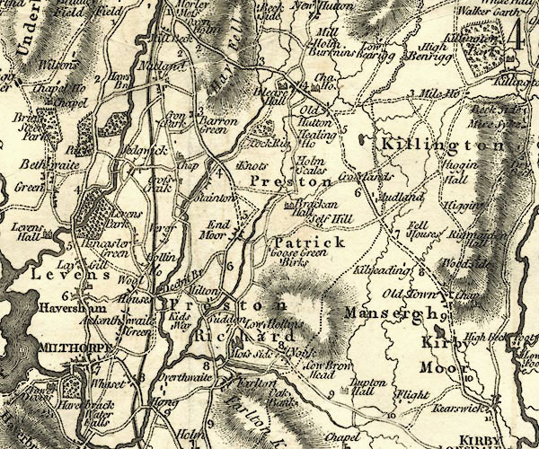 CY24SD58.jpg "Chap" church symbol; church or chapel item:- JandMN : 129 Image © see bottom of page |
||||||||||||||||||||||||||
|
|
|||||||||||||||||||||||||||
| evidence:- | probably old map:- Baker 1802 |
||||||||||||||||||||||||||
| source data:- | Perspective road maps with sections in Lancashire, Westmorland
and Cumberland, by J Baker, London 1802.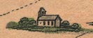 Bk03Vg14.jpg item:- private collection : 3 Image © see bottom of page |
||||||||||||||||||||||||||
|
|
|||||||||||||||||||||||||||
| evidence:- | old map:- Nurse 1918 |
||||||||||||||||||||||||||
| source data:- | Map, The Diocese of Carlisle, Cumberland, Westmorland, and
Lancashire North of the Sands, scale about 4 miles to 1 inch, by
Rev Euston J Nurse, published by Charles Thurnam and Sons, 11
English Street, Carlisle, Cumberland, 2nd edn 1939.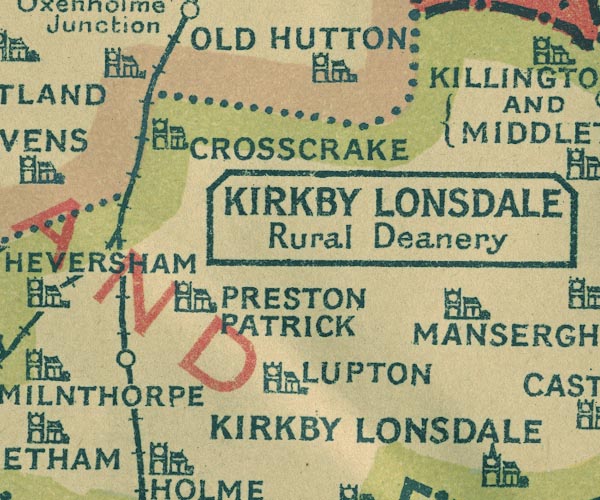 NUR1SD58.jpg "CROSSCRAKE" item:- JandMN : 27 Image © see bottom of page |
||||||||||||||||||||||||||
|
|
|||||||||||||||||||||||||||
 BTL29.jpg (taken 27.8.2010) |
|||||||||||||||||||||||||||
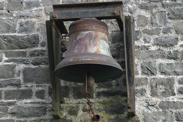
| The inscription ends:- |
|||||||||||||||||||||||||||
| "... LOUGHBOROUGH ENGLAND" |
|||||||||||||||||||||||||||
| presumably John Taylor and Co, Loughborough. |
|||||||||||||||||||||||||||
|
|
|||||||||||||||||||||||||||
 stained glass stained glass |
|||||||||||||||||||||||||||
|
|
|||||||||||||||||||||||||||
| kneelers |
|||||||||||||||||||||||||||
|
|
|||||||||||||||||||||||||||
| incumbents:- |
|
||||||||||||||||||||||||||
|
|
|||||||||||||||||||||||||||
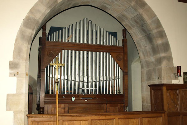 BXD28.jpg Organ. (taken 15.8.2012) 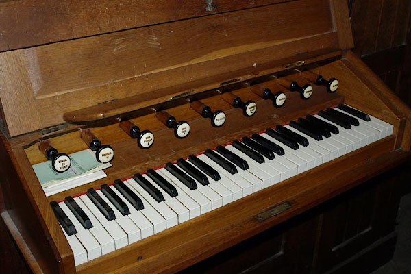 BXD29.jpg Organ. (taken 15.8.2012) 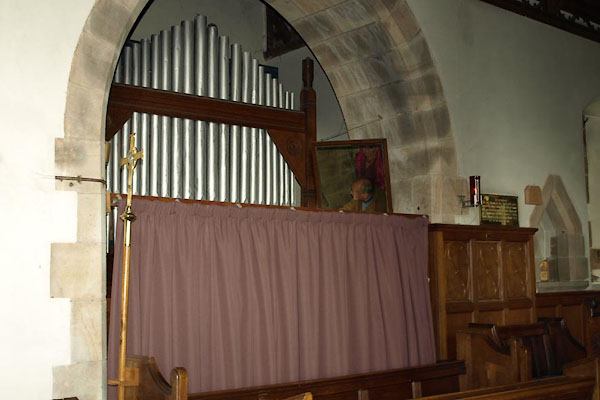 BTL26.jpg Organ and organist. (taken 27.8.2010) 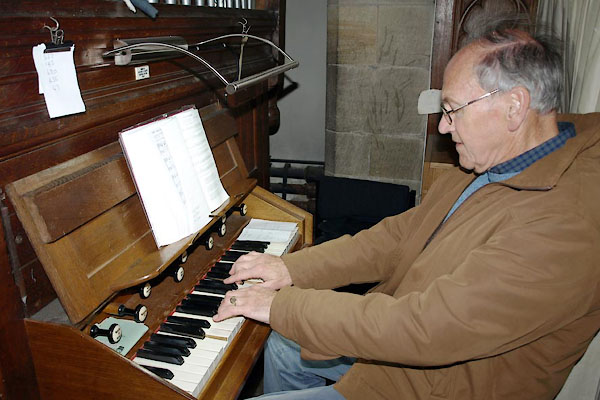 BTL24.jpg Organ and organist. (taken 27.8.2010) 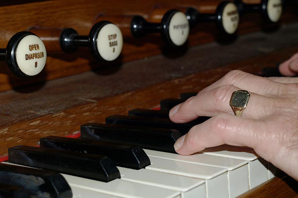 BTL25.jpg Organ and organist. (taken 27.8.2010) 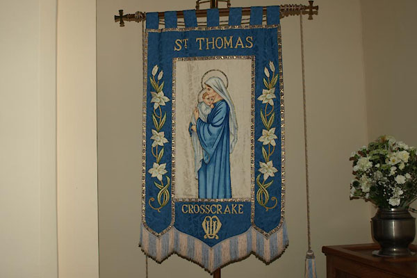 BXD27.jpg Mothers Union banner (taken 15.8.2012) 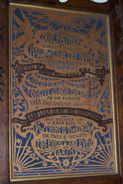 BJS31.jpg The Lord's Prayer in fretwork (taken 12.8.2005) 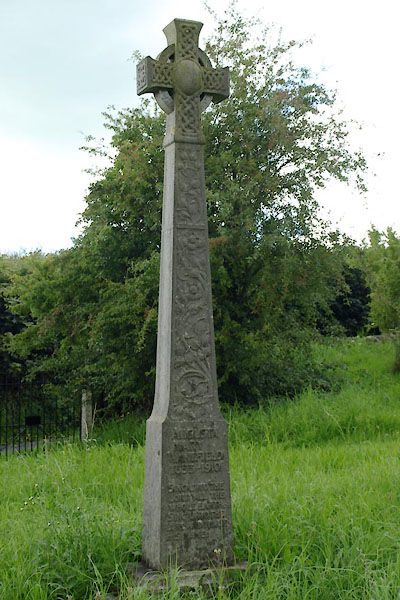 BTL27.jpg Grave stone of Mary Wakefield. (taken 27.8.2010) 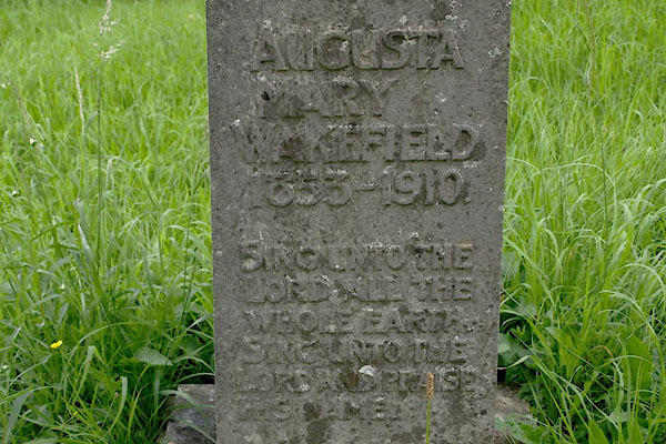 BTL28.jpg Grave stone of Mary Wakefield:- "AUGUSTA / MARY / WAKEFIELD / 1853-1910." "SING UNTO THE / LORD ALL THE / WHOLE EARTH. / SING UNTO THE / LORD AND PRAISE / HIS NAME." (taken 27.8.2010) |
|||||||||||||||||||||||||||
|
|
|||||||||||||||||||||||||||
 CBI15.jpg As built, 1875. (taken 1.8.2014) 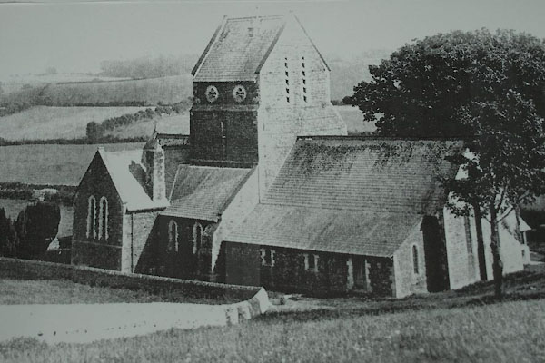 BTL20.jpg (taken 27.8.2010) 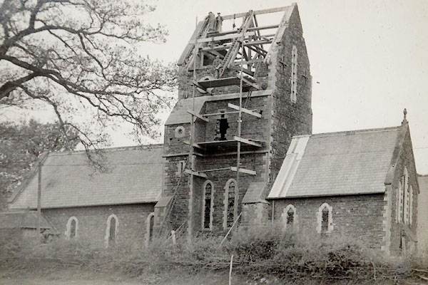 CBI13.jpg Restoration work, 1944. (taken 1.8.2014) 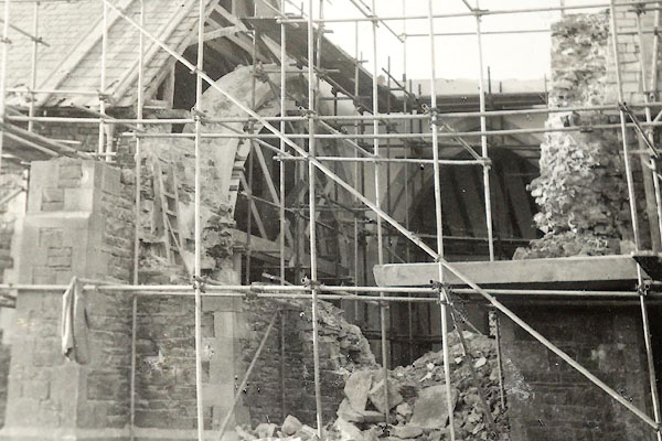 CBI14.jpg Restoration work, 1944. (taken 1.8.2014) 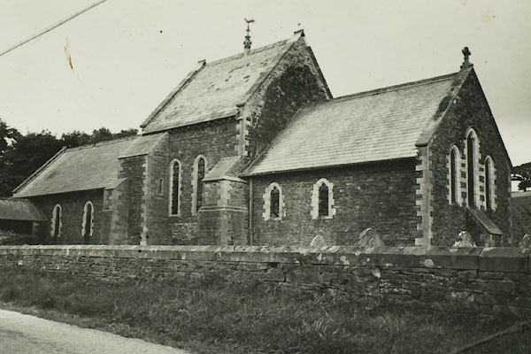 BTL21.jpg After work in 1964. (taken 27.8.2010) 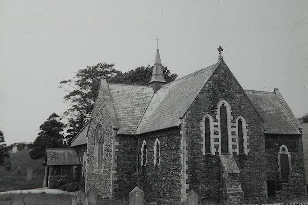 CBI17.jpg (taken 1.8.2014) |
|||||||||||||||||||||||||||
|
|
|||||||||||||||||||||||||||
| notes:- |
Anselm de Furness founded a chapel here in 1190; nothing remains of this early building.
A building survived, not always as a church, sometimes a school, to the 18th century.
In 1773 it was rebuilt 'in the purest ugliness' of the 18th century; improved and
enlarged 1849. A new church was built 50 yards east of the old, designed by Paley
and Austin, about 1875; tower repaired 1897; major repairs and alterations, 1944;
found structurally unsound, and restored, about 1962. |
||||||||||||||||||||||||||
| : : church leaflet |
|||||||||||||||||||||||||||
|
|
|||||||||||||||||||||||||||
| Paley and Austin series | |||||||||||||||||||||||||||
| person:- | architect : Paley, Edward G |
||||||||||||||||||||||||||
| person:- | architect : Austin, Hubert J |
||||||||||||||||||||||||||
| date:- | 1875 |
||||||||||||||||||||||||||
| New church in geometric decorated style. |
|||||||||||||||||||||||||||
|
|
|||||||||||||||||||||||||||
| dedication | |||||||||||||||||||||||||||
| person:- | : St Thomas |
||||||||||||||||||||||||||
| place:- | Crosscrake / Carlisle Diocese | ||||||||||||||||||||||||||
|
|
|||||||||||||||||||||||||||
 Lakes Guides menu.