 Old Cumbria Gazetteer
 |
 |
|
| St Patrick's Well, Patterdale | ||
| St Patrick's Well | ||
| locality:- | Patterdale | |
| civil parish:- | Patterdale (formerly Westmorland) | |
| county:- | Cumbria | |
| locality type:- | spring | |
| locality type:- | well | |
| locality type:- | water trough | |
| coordinates:- | NY38761662 | |
| 1Km square:- | NY3816 | |
| 10Km square:- | NY31 | |
|
|
||
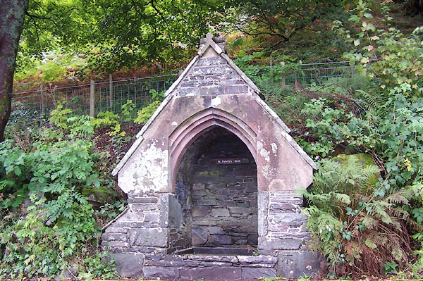 BJW75.jpg (taken 30.9.2005) |
||
|
|
||
| evidence:- | old map:- OS County Series (Wmd 12 11) placename:- St Patrick's Well |
|
| source data:- | Maps, County Series maps of Great Britain, scales 6 and 25
inches to 1 mile, published by the Ordnance Survey, Southampton,
Hampshire, from about 1863 to 1948. |
|
|
|
||
| evidence:- | old map:- Morden 1695 (Wmd) placename:- St Patricks Well |
|
| source data:- | Map, hand coloured engraving, Westmorland, scale about 2.5 miles to 1 inch, by Robert
Morden, published by Abel Swale, the Unicorn, St Paul's Churchyard, Awnsham, and John
Churchill, the Black Swan, Paternoster Row, London, 1695.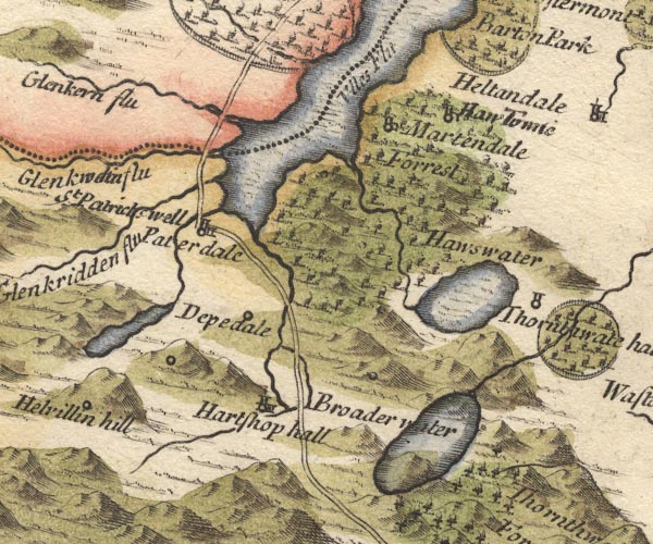 MD10NY41.jpg "St Patricks well" No symbol. item:- JandMN : 24 Image © see bottom of page |
|
|
|
||
| evidence:- | old map:- Bowen and Kitchin 1760 placename:- St Patricks Well |
|
| source data:- | Map, hand coloured engraving, A New Map of the Counties of
Cumberland and Westmoreland Divided into their Respective Wards,
scale about 4 miles to 1 inch, by Emanuel Bowen and Thomas
Kitchin et al, published by T Bowles, Robert Sayer, and John
Bowles, London, 1760.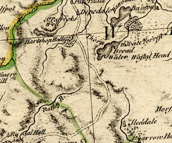 BO18NY30.jpg "St. Patricks Well" circle, tower item:- Armitt Library : 2008.14.10 Image © see bottom of page |
|
|
|
||
| evidence:- | old map:- Crosthwaite 1783-94 (Ull) placename:- St Patrick's Well |
|
| source data:- | Map, uncoloured engraving, Accurate Map of the Beautiful Lake of
Ullswater, scale about 3 inches to 1 mile, by Peter Crosthwaite,
Keswick, Cumberland, 1783, version published 1800.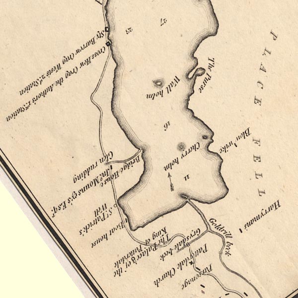 CT5NY31Y.jpg "St. Patrick's Well" item:- Armitt Library : 1959.191.7 Image © see bottom of page |
|
|
|
||
| evidence:- | old text:- Clarke 1787 placename:- St Patrick's Well |
|
| source data:- | Guide book, A Survey of the Lakes of Cumberland, Westmorland,
and Lancashire, written and published by James Clarke, Penrith,
Cumberland, and in London etc, 1787; published 1787-93. goto source goto sourcePage 32:- "... A little below the Hall [Patterdale] is a well called St Patrick's Well, where it is said that saint baptized several persons in the year 540, when he was shipwrecked upon Duddon Sands, in his road from Dublin. It was surrounded with four square stones, but the road being repaired, they were removed, and never set up again; although Dr Osbaldeston Bishop of Carlisle, and the Dean of Exeter, when they visited this part, actually paid a man for setting them up, being unwilling that so early a piece of Christian antiquity should be destroyed. ..." |
|
|
|
||
| evidence:- | old map:- Clarke 1787 map (Ullswater) placename:- St Patrick's Well |
|
| source data:- | Map, A Map of the Lake Ullswater and its Environs, scale about
6.5 ins to 1 mile, by James Clarke, engraved by S J Neele, 352
Strand, published by James Clarke, Penrith, Cumberland and in
London etc, 1787.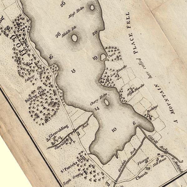 CL4NY31Y.jpg "St. Patrick's Well" item:- private collection : 10.4 Image © see bottom of page |
|
|
|
||
| evidence:- | drawing:- Butler 1982-92 |
|
| source data:- | St Patrick's Well, Patterdale drawn by David Butler courtesy of David Butler 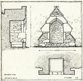 click to enlarge click to enlargePR1468.jpg item:- private collection : 377 Image © see bottom of page |
|
|
|
||
| Wainwright, A: 1955: Book 1 Eastern Fells: Westmorland Gazette (Kendal, Westmorland)::
Birkhouse Moor (2) |
||
|
|
||
| hearsay:- |
St Patrick baptised local residents, about 540. |
|
|
|
||
Lakes Guides menu.