 Old Cumbria Gazetteer
 |
 |
|
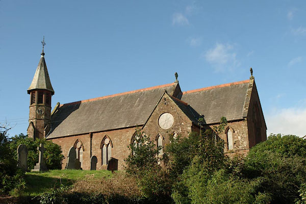
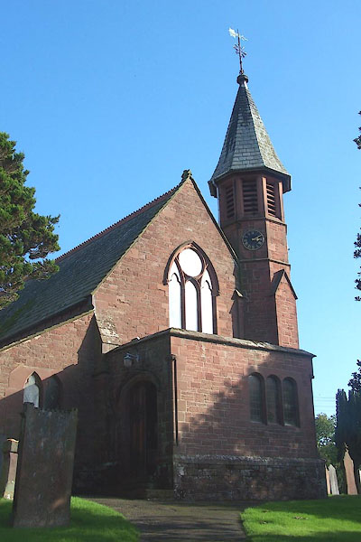
| St John, Beckermet | ||
| St John's Church | ||
| Beckermet Church | ||
| locality:- | Beckermet | |
| civil parish:- | St John Beckermet (formerly Cumberland) | |
| county:- | Cumbria | |
| locality type:- | church | |
| coordinates:- | NY01870671 | |
| 1Km square:- | NY0106 | |
| 10Km square:- | NY00 | |
| references:- | : 2005: Diocese of Carlisle, Directory 2004/5 |
|
|
|
||
 BVM11.jpg (taken 7.10.2011) 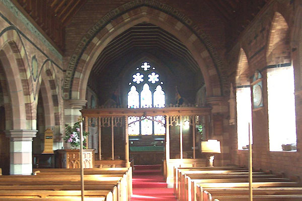 BMW02.jpg (taken 13.10.2006) |
||
|
|
||
| evidence:- | old map:- OS County Series (Cmd 72 16) placename:- St. John's Church |
|
| source data:- | Maps, County Series maps of Great Britain, scales 6 and 25
inches to 1 mile, published by the Ordnance Survey, Southampton,
Hampshire, from about 1863 to 1948. |
|
|
|
||
| evidence:- | old map:- Saxton 1579 placename:- St Johns Beckarmond |
|
| source data:- | Map, hand coloured engraving, Westmorlandiae et Cumberlandiae Comitatus ie Westmorland
and Cumberland, scale about 5 miles to 1 inch, by Christopher Saxton, London, engraved
by Augustinus Ryther, 1576, published 1579-1645.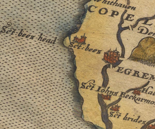 Sax9NX91.jpg Church, symbol for a parish or village, with a parish church. "Sct Johns Beckarmond" item:- private collection : 2 Image © see bottom of page |
|
|
|
||
| evidence:- | old map:- Mercator 1595 (edn?) placename:- St John Beckarmond |
|
| source data:- | Map, hand coloured engraving, Northumbria, Cumberlandia, et
Dunelmensis Episcopatus, ie Northumberland, Cumberland and
Durham etc, scale about 6.5 miles to 1 inch, by Gerard Mercator,
Duisberg, Germany, about 1595. MER8CumE.jpg "St. Joh. Beckarmond" circle item:- JandMN : 169 Image © see bottom of page |
|
|
|
||
| evidence:- | old map:- Jansson 1646 placename:- St Johns Bekarmond |
|
| source data:- | Map, hand coloured engraving, Cumbria and Westmoria, ie
Cumberland and Westmorland, scale about 3.5 miles to 1 inch, by
John Jansson, Amsterdam, Netherlands, 1646.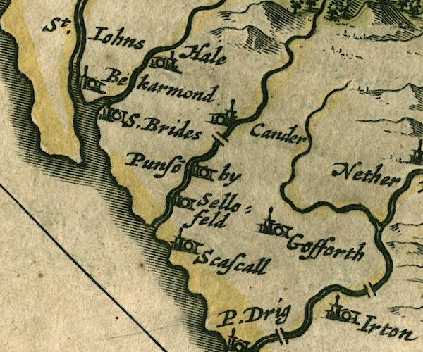 JAN3NY00.jpg "St. Iohns Bekarmond" Buildings and tower. item:- JandMN : 88 Image © see bottom of page |
|
|
|
||
| evidence:- | old map:- Morden 1695 (Cmd) placename:- St Johns |
|
| source data:- | Map, uncoloured engraving, Cumberland, scale about 4 miles to 1
inch, by Robert Morden, 1695, published by Abel Swale, the
Unicorn, St Paul's Churchyard, Awnsham, and John Churchill, the
Black Swan, Paternoster Row, London, 1695-1715.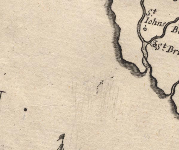 MD12NX90.jpg "St. Iohns [Bekermet]" Circle. item:- JandMN : 90 Image © see bottom of page |
|
|
|
||
| evidence:- | old map:- Bowen and Kitchin 1760 placename:- St Johns Beckermee |
|
| source data:- | Map, hand coloured engraving, A New Map of the Counties of
Cumberland and Westmoreland Divided into their Respective Wards,
scale about 4 miles to 1 inch, by Emanuel Bowen and Thomas
Kitchin et al, published by T Bowles, Robert Sayer, and John
Bowles, London, 1760.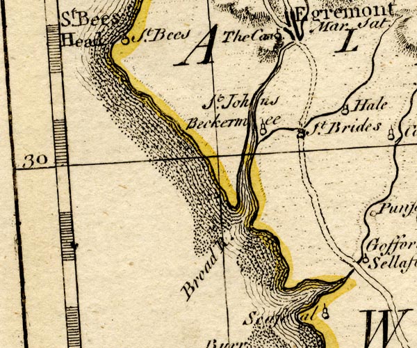 BO18NX90.jpg "St. Johns Beckermee" circle, tower item:- Armitt Library : 2008.14.10 Image © see bottom of page |
|
|
|
||
| evidence:- | old map:- Donald 1774 (Cmd) placename:- St Johns |
|
| source data:- | Map, hand coloured engraving, 3x2 sheets, The County of Cumberland, scale about 1
inch to 1 mile, by Thomas Donald, engraved and published by Joseph Hodskinson, 29
Arundel Street, Strand, London, 1774.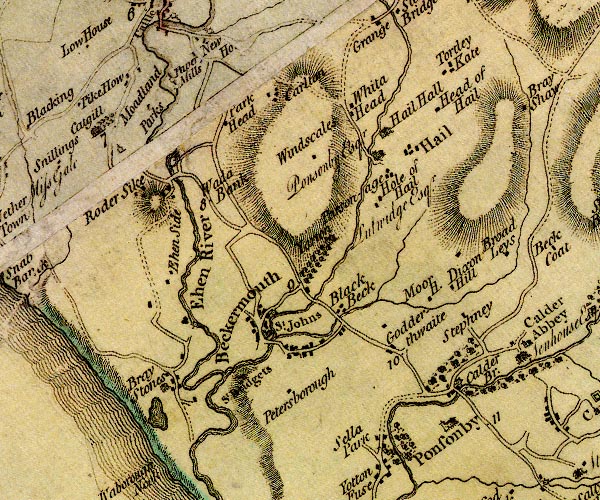 D4NY00NW.jpg "St. Johns" church item:- Carlisle Library : Map 2 Image © Carlisle Library |
|
|
|
||
| evidence:- | old map:- Nurse 1918 |
|
| source data:- | Map, The Diocese of Carlisle, Cumberland, Westmorland, and
Lancashire North of the Sands, scale about 4 miles to 1 inch, by
Rev Euston J Nurse, published by Charles Thurnam and Sons, 11
English Street, Carlisle, Cumberland, 2nd edn 1939.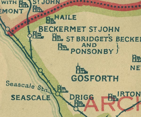 NUR1NY00.jpg "BECKERMET ST. JOHN" item:- JandMN : 27 Image © see bottom of page |
|
|
|
||
| evidence:- | database:- Listed Buildings 2010 placename:- Church of St John the Baptist |
|
| source data:- | courtesy of English Heritage "CHURCH OF ST JOHN THE BAPTIST / / MORASS ROAD / ST JOHN BECKERMET / COPELAND / CUMBRIA / II / 76371 / NY0188806714" |
|
| source data:- | courtesy of English Heritage "Church. 1878-9. By J Birtley of Kendal. Dressed stone with ashlar dressings and slate roof with tile cresting. Nave, south-west tower, north aisle, west narthex and chancel with north vestry and south organ loft. Coped gables. 4-bay nave has 2-light windows to south elevation, octagonal tower to south-west angle has flat gabled buttresses, straight-headed louvred bell openings and pyramidal roof. Lean-to narthex has 2 pointed lights over, and window of 3 elliptical-headed lights; Tudor-headed north door; nook shafts. Lean-to aisle has paired lights with shouldered lintels. Chancel has weathered base and sill course, 3-light east window, 2 lancets to south; gabled organ loft has 2 lancets and rose to south, entrance with flat gable to west, east lateral stack and 2 C18 headstones. Lean-to vestry has east entrance with shouldered lintel, 3 lights with shouldered lintel to north. Interior: 4-bay arcade on octagonal and round piers, spandrels and wall above of brick and stone polychrome with block letter inscription. Chancel arch has inscription round, and traceried screen, c.1920. Arch to organ loft with wall plate carried across recess. Block letter inscription above altar: Ten Commandments, etc. Some Anglo-Danish cross fragments, etc. Victorian royal arms." |
|
|
|
||
| evidence:- | database:- Listed Buildings 2010 |
|
| source data:- | courtesy of English Heritage "FONT APPROXIMATELY 15 METRES TO NORTH OF ST JOHN'S CHURCH / / MORASS ROAD / ST JOHN BECKERMET / COPELAND / CUMBRIA / II / 76372 / NY0187306729" |
|
| source data:- | courtesy of English Heritage "Font. Date uncertain, probably medieval. Ashlar. Plain octagonal font on octagonal base; shallow bowl with drain. Placed in present position in 1930s." |
|
|
|
||
 cross cross |
||
|
|
||
| cross slabs |
||
|
|
||
 BMW01.jpg (taken 13.10.2006) 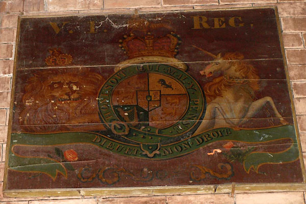 BVM10.jpg Coat of arms, Victoria. (taken 7.10.2011) 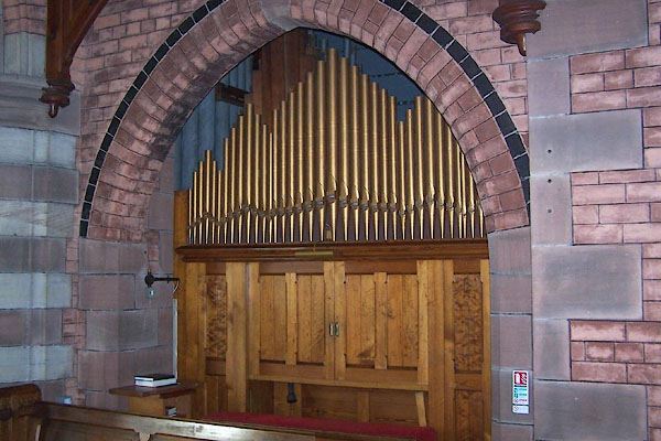 BMW05.jpg Organ, Forster and Andrews, Hull, 1892. (taken 13.10.2006) 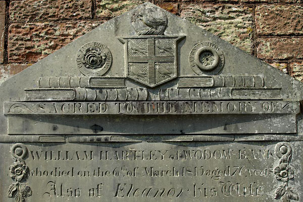 BQW96.jpg Gravestone:- "SACRED TO THE MEMORY OF / WILLIAM HARTLEY of WODOW BANK / who died on the 6th. of March 1815 aged 70 years / ..." (taken 25.6.2009) 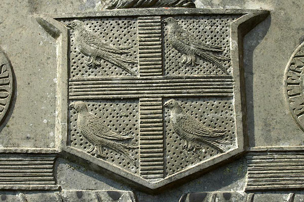 BQW97.jpg Gravestone, coat of arms of William Hartley. (taken 25.6.2009) 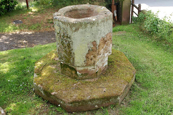 BQW98.jpg An old font, restored 1938, in the churchyard. (taken 25.6.2009) 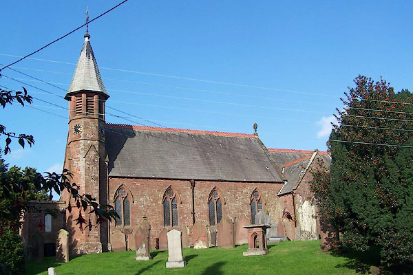 BMW03.jpg (taken 13.10.2006) |
||
|
|
||
| notes:- |
There was a church on the site in 1262, hen it was granted to Calder Abbey. A new
church was built about 1811; it was built without foundations to save expense. So
it became unsafe, was demolished and rebuilt in 1878-879. The porch was added in 1929.
The south door, leading to the choir vestry, was the west door of the 12th century
church. |
|
| : : church leaflet |
||
|
|
||
| dedication | ||
| person:- | : St John |
|
| place:- | Beckermet / Carlisle Diocese | |
|
|
||
 Lakes Guides menu.