 Old Cumbria Gazetteer
 |
 |
|
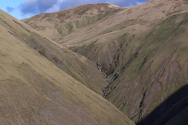
| Spout, Tebay | ||
| Spout The | ||
| locality:- | Howgill Fells | |
| civil parish:- | Sedbergh (formerly Yorkshire) | |
| civil parish:- | Tebay (formerly Westmorland) | |
| county:- | Cumbria | |
| locality type:- | waterfall | |
| coordinates:- | SD64579945 | |
| 1Km square:- | SD6499 | |
| 10Km square:- | SD69 | |
|
|
||
 BPU01.jpg (taken 27.10.2008) |
||
|
|
||
| evidence:- | old map:- OS County Series (Wmd 35) placename:- Spout, The |
|
| source data:- | Maps, County Series maps of Great Britain, scales 6 and 25
inches to 1 mile, published by the Ordnance Survey, Southampton,
Hampshire, from about 1863 to 1948. "The Spout" on county boundary |
|
|
|
||
 Lakes Guides menu.