 |
 |
   |
|
|
|
Spital |
|
St Leonard's Hospital |
| Street:- |
Appleby Road |
| civil parish:- |
Kendal (formerly Westmorland) |
| county:- |
Cumbria |
| locality type:- |
buildings |
| coordinates:- |
SD52669431 |
| 1Km square:- |
SD5294 |
| 10Km square:- |
SD59 |
|
|
|

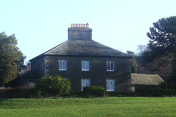
CEN37.jpg (taken 29.1.2016)
|
|
|
| evidence:- |
old map:- OS County Series (Wmd 38 4)
placename:- Spital
placename:- St Leonard's Hospital
|
| source data:- |
Maps, County Series maps of Great Britain, scales 6 and 25
inches to 1 mile, published by the Ordnance Survey, Southampton,
Hampshire, from about 1863 to 1948.
"Spital (Site of St. Leonard's Hospital)"
|
|
|
| evidence:- |
hearth tax returns:- Hearth Tax 1675
placename:- Spittle
|
| source data:- |
Records, hearth tax survey returns, Westmorland, 1674/75.
"Spittle"
in "Skalthwaite-rigge"
|
|
|
| evidence:- |
old map:- Jefferys 1770 (Wmd)
placename:- Spittle
|
| source data:- |
Map, 4 sheets, The County of Westmoreland, scale 1 inch to 1
mile, surveyed 1768, and engraved and published by Thomas
Jefferys, London, 1770.

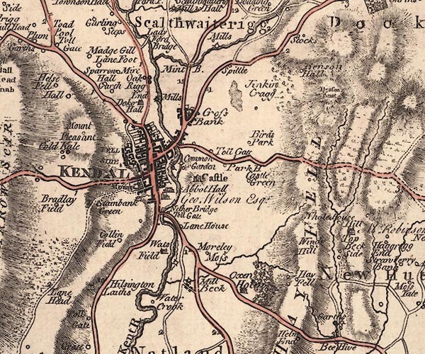
J5SD59SW.jpg
"Spittle"
circle, labelled in italic lowercase text; settlement, farm, house, or hamlet?
item:- National Library of Scotland : EME.s.47
Image © National Library of Scotland |
|
|
| evidence:- |
old text:- Pennant 1773
placename:- Spittle, The
item:- leper
|
| source data:- |
Book, A Tour from Downing to Alston Moor, 1773, by Thomas
Pennant, published by Edward Harding, 98 Pall Mall, London, 1801.
 goto source goto source
Pennant's Tour 1773, page 121 "I left Kendal, and not far from thence passed by the Spittle, once an hospital for lepers, valued at the dissolution at 11l. 4s. 3d. a year. ..."
|
|
|
| evidence:- |
old text:- Camden 1789 (Gough Additions)
placename:- Spittle
|
| source data:- |
Book, Britannia, or A Chorographical Description of the Flourishing Kingdoms of England,
Scotland, and Ireland, by William Camden, 1586, translated from the 1607 Latin edition
by Richard Gough, published London, 1789.
 goto source goto source
Page 152:- "... Here was an hospital founded for lepers by Henry II. valued at £.6. per annum,
and still called the Spittle, ..."
|
|
|
| evidence:- |
old map:- Cary 1789 (edn 1805)
placename:- Spittle
|
| source data:- |
Map, uncoloured engraving, Westmoreland, scale about 2.5 miles
to 1 inch, by John Cary, London, 1789; edition 1805.

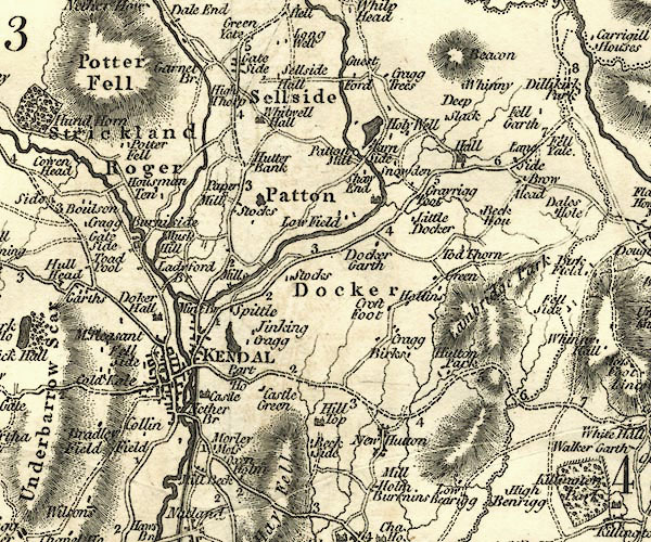
CY24SD59.jpg
"Spittle"
block/s, labelled in italic lowercase; house, or hamlet
item:- JandMN : 129
Image © see bottom of page
|
|
|
| evidence:- |
old map:- Cooke 1802
placename:- Spittle
|
| source data:- |
Map, Westmoreland ie Westmorland, scale about 12 miles to 1
inch, by George Cooke, 1802, published by Sherwood, Jones and
Co, Paternoster Road, London, 1824.
 click to enlarge click to enlarge
GRA1Wd.jpg
"Spittle"
blocks, italic lowercase text, village, hamlet, locality
item:- Hampshire Museums : FA2000.62.4
Image © see bottom of page
|
|
|
| evidence:- |
old map:- Wallis 1810 (Wmd)
placename:- Spittle
|
| source data:- |
Road map, Westmoreland, scale about 19 miles to 1 inch, by James
Wallis, 77 Berwick Street, Soho, 1810, published by W Lewis,
Finch Lane, London, 1835?
 click to enlarge click to enlarge
WAL5.jpg
"Spittle"
village, hamlet, house, ...
item:- JandMN : 63
Image © see bottom of page
|
|
|
| evidence:- |
old map:- Hall 1820 (Wmd)
placename:- Spittle
|
| source data:- |
Map, hand coloured engraving, Westmoreland ie Westmorland, scale
about 14.5 miles to 1 inch, by Sidney Hall, London, 1820,
published by Samuel Leigh, 18 Strand, London, 1820-31.
 click to enlarge click to enlarge
HA18.jpg
"Spittle"
circle, italic lowercase text; settlement
item:- Armitt Library : 2008.14.58
Image © see bottom of page
|
|
|
| evidence:- |
database:- Listed Buildings 2010
placename:- Spital Farm
|
| source data:- |
courtesy of English Heritage
"SPITAL FARMHOUSE / / APPLEBY ROAD / KENDAL / SOUTH LAKELAND / CUMBRIA / II / 75348
/ SD5272994313"
|
|
|
| evidence:- |
database:- Listed Buildings 2010
|
| source data:- |
courtesy of English Heritage
"THRESHING BARN AND GIN GANG TO NORTH EAST OF SPITAL FARMHOUSE / / APPLEBY ROAD / KENDAL
/ SOUTH LAKELAND / CUMBRIA / II / 75349 / SD5268694334"
|
|
|
notes:-
|
The hospital had a mill. It may have been one of the mills at Meal Bank.
|
|
Somervell, John: 1930: Water Power Mills of South Westmorland
|
|
|


 goto source
 goto source
 click to enlarge
 click to enlarge
 click to enlarge