 Old Cumbria Gazetteer
 |
 |
|
| Spadeadam Forest, Kingwater | ||
| Spadeadam Forest | ||
| Spadeadam Waste | ||
| civil parish:- | Kingwater (formerly Cumberland) | |
| civil parish:- | Waterhead (formerly Cumberland) | |
| county:- | Cumbria | |
| locality type:- | forest | |
| coordinates:- | NY632727 (etc etc) | |
| 1Km square:- | NY6372 | |
| 10Km square:- | NY67 | |
|
|
||
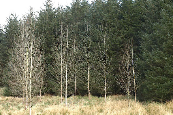
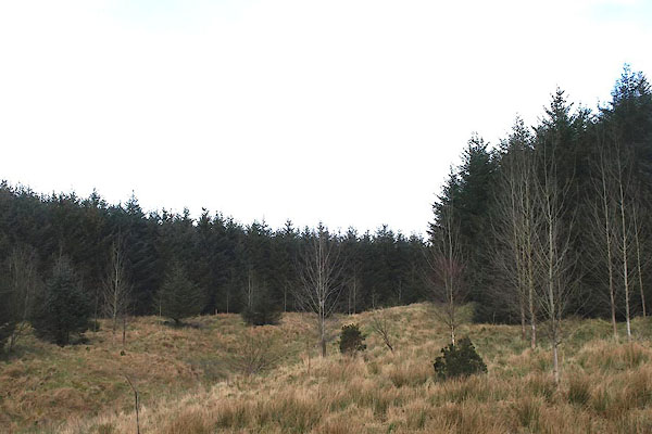 BOV75.jpg Near Moscow, Waterhead. (taken 21.3.2007) 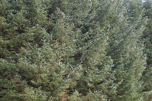 BOV76.jpg Near Moscow, Waterhead. (taken 21.3.2007) |
||
|
|
||
| evidence:- | old map:- OS County Series (Cmd 8 8) placename:- Spadeadam Waste |
|
| source data:- | Maps, County Series maps of Great Britain, scales 6 and 25
inches to 1 mile, published by the Ordnance Survey, Southampton,
Hampshire, from about 1863 to 1948. OS County Series (Cmd 9 5) |
|
|
|
||
| evidence:- | old map:- Donald 1774 (Cmd) placename:- Spadeadam Waste |
|
| source data:- | Map, hand coloured engraving, 3x2 sheets, The County of Cumberland, scale about 1
inch to 1 mile, by Thomas Donald, engraved and published by Joseph Hodskinson, 29
Arundel Street, Strand, London, 1774.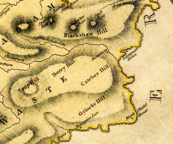 D4NY67SE.jpg "SPADEADAM WASTE" locality item:- Carlisle Library : Map 2 Image © Carlisle Library |
|
|
|
||
| evidence:- | old map:- Donald 1774 (Cmd) placename:- Spadeadam Waste |
|
| source data:- | Map, hand coloured engraving, 3x2 sheets, The County of Cumberland, scale about 1
inch to 1 mile, by Thomas Donald, engraved and published by Joseph Hodskinson, 29
Arundel Street, Strand, London, 1774.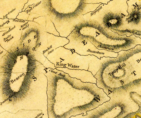 D4NY67SW.jpg "SPADEADAM WASTE" locality item:- Carlisle Library : Map 2 Image © Carlisle Library |
|
|
|
||
| evidence:- | old map:- Donald 1774 (Cmd) placename:- Spadeadam Waste |
|
| source data:- | Map, hand coloured engraving, 3x2 sheets, The County of Cumberland, scale about 1
inch to 1 mile, by Thomas Donald, engraved and published by Joseph Hodskinson, 29
Arundel Street, Strand, London, 1774. D4NY67SE.jpg "SPADEADAM WASTE" locality item:- Carlisle Library : Map 2 Image © Carlisle Library |
|
|
|
||
| evidence:- | old map:- Donald 1774 (Cmd) placename:- Spadeadam Waste |
|
| source data:- | Map, hand coloured engraving, 3x2 sheets, The County of Cumberland, scale about 1
inch to 1 mile, by Thomas Donald, engraved and published by Joseph Hodskinson, 29
Arundel Street, Strand, London, 1774. D4NY67SW.jpg "SPADEADAM WASTE" locality item:- Carlisle Library : Map 2 Image © Carlisle Library |
|
|
|
||
| evidence:- | old map:- Moll 1784 (Cmd) placename:- Wast, The placename:- Lowes Forest |
|
| source data:- | "The Wast." "Lowes For." |
|
|
|
||
| evidence:- | old map:- Ford 1839 map placename:- Spadeadam Waste |
|
| source data:- | Map, uncoloured engraving, Map of the Lake District of
Cumberland, Westmoreland and Lancashire, scale about 3.5 miles
to 1 inch, published by Charles Thurnam, Carlisle, and by R
Groombridge, 5 Paternoster Row, London, 3rd edn 1843.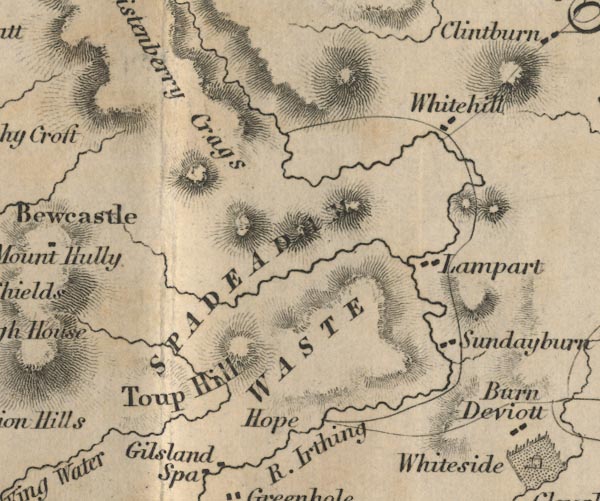 FD02NY67.jpg "SPADEADAM WASTE" Area. item:- JandMN : 100.1 Image © see bottom of page |
|
|
|
||
| evidence:- | old print:- placename:- Waste of Cumberland |
|
| source data:- | Print, uncoloured engraving, Waste of Cumberland, Spadeadam, drawn by Copley Fielding,
engraved by Edward Finden, published by Chapman and Hall, 186 Strand, London, 1832.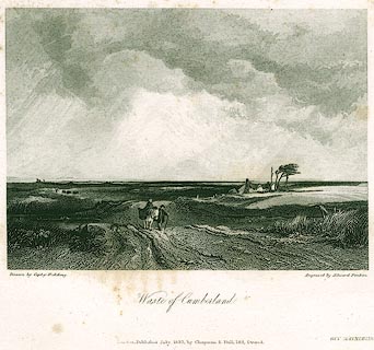 click to enlarge click to enlargePR0304.jpg With lonely travellers, on foot and horse with panniers. Used in an edition of Guy Mannering by Sir Walter Scott. printed at bottom left, right, centre:- "Drawn by Copley Fielding. / Engraved by Edward Finden. / Waste of Cumberland. / London. Published July 1832, by Chapman &Hall, 186, Strand." printed at bottom right:- "GUY MANNERING" item:- Dove Cottage : 2008.107.304 Image © see bottom of page |
|
|
|
||
 BOV77.jpg Near Moscow, Waterhead. (taken 21.3.2007) 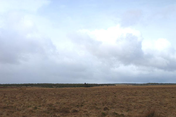 BOV78.jpg The waste ... (taken 21.3.2007) |
||
|
|
||
| MN photo:- |
||
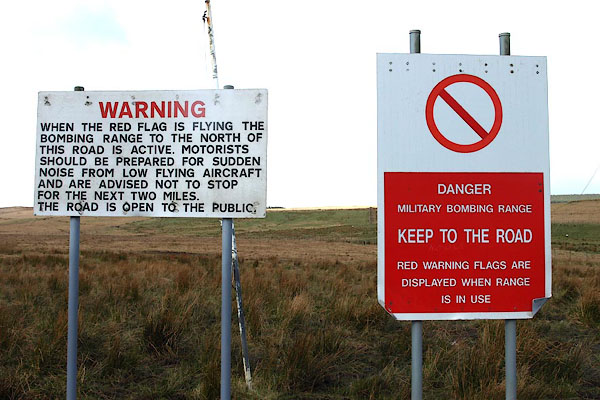 BOV81.jpg Range warning signs. (taken 21.3.2008) 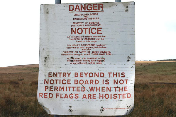 BOV82.jpg Range warning sign. (taken 21.3.2008) |
||
|
|
||
 Lakes Guides menu.