 Old Cumbria Gazetteer
 |
 |
|
| Soutermoor, Stapleton | ||
| Soutermoor | ||
| civil parish:- | Stapleton (formerly Cumberland) | |
| county:- | Cumbria | |
| locality type:- | buildings | |
| coordinates:- | NY48817111 | |
| 1Km square:- | NY4871 | |
| 10Km square:- | NY47 | |
|
|
||
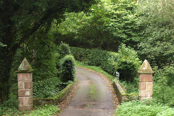 BZJ84.jpg Gate piers at the bridge over Kirk Burn. (taken 27.9.2013) |
||
|
|
||
| evidence:- | old map:- OS County Series (Cmd 7 15) placename:- Soutermoor |
|
| source data:- | Maps, County Series maps of Great Britain, scales 6 and 25
inches to 1 mile, published by the Ordnance Survey, Southampton,
Hampshire, from about 1863 to 1948. |
|
|
|
||
| evidence:- | old map:- Burghley 1590 (facsimile) placename:- Sowtermore |
|
| source data:- | Facsimile map, A Platt of the Opposete Border of Scotland to ye West Marches of England,
parts of Cumberland and Scotland including the Debateable Land, from a manuscript
drawn for William Cecil, Lord Burghley, about 1590, published by R B Armstrong, 1897. courtesy of the National Library of Scotland 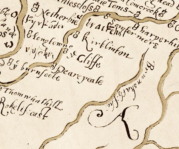 M048NY46.jpg "Sowtermore" circle, tower item:- National Library of Scotland : MS6113 f.267 Image © National Library of Scotland |
|
|
|
||
| evidence:- | old map:- Donald 1774 (Cmd) placename:- Souter Moor |
|
| source data:- | Map, hand coloured engraving, 3x2 sheets, The County of Cumberland, scale about 1
inch to 1 mile, by Thomas Donald, engraved and published by Joseph Hodskinson, 29
Arundel Street, Strand, London, 1774. D4NY47SE.jpg "Souter Moor" locality item:- Carlisle Library : Map 2 Image © Carlisle Library |
|
|
|
||
| evidence:- | database:- Listed Buildings 2010 placename:- Soutermoor |
|
| source data:- | courtesy of English Heritage "SOUTERMOOR / / / STAPLETON / CARLISLE / CUMBRIA / II / 78171 / NY4881071114" |
|
|
|
||
| evidence:- | database:- Listed Buildings 2010 |
|
| source data:- | courtesy of English Heritage "GARDEN WALL ADJOINING SOUTH WEST CORNER OF SOUTERMOOR / / / STAPLETON / CARLISLE / CUMBRIA / II / 78173 / NY4879771091" |
|
|
|
||
| evidence:- | database:- Listed Buildings 2010 item:- date stone (1799) |
|
| source data:- | courtesy of English Heritage "BARN TO WEST OF SOUTERMOOR / / / STAPLETON / CARLISLE / CUMBRIA / II / 78172 / NY4878071109" |
|
|
|
||
 BZJ85.jpg At the lane entrance. (taken 27.9.2013)  BZJ86.jpg At the lane entrance. (taken 27.9.2013) |
||
|
|
||
| notes:- |
site of an early stone house or a tower |
|
| Perriam, D R &Robinson, J: 1998: Medieval Fortified Buildings of Cumbria: CWAAS::
ISBN 1 873124 23 6 |
||
|
|
||
 Lakes Guides menu.