 Old Cumbria Gazetteer
 |
 |
|
| Snuffmill, Dacre | ||
| Snuffmill | ||
| Snuffmill Cottage | ||
| site name:- | Kirk Sike | |
| civil parish:- | Dacre (formerly Cumberland) | |
| county:- | Cumbria | |
| locality type:- | buildings | |
| locality type:- | mill (ex) | |
| locality type:- | water mill | |
| locality type:- | snuff mill | |
| coordinates:- | NY48982753 | |
| 1Km square:- | NY4827 | |
| 10Km square:- | NY42 | |
|
|
||
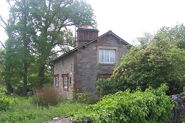 BMF77.jpg (taken 8.6.2006) |
||
|
|
||
| evidence:- | old map:- OS County Series (Cmd 58 11) placename:- Snuffmill |
|
| source data:- | Maps, County Series maps of Great Britain, scales 6 and 25
inches to 1 mile, published by the Ordnance Survey, Southampton,
Hampshire, from about 1863 to 1948. |
|
|
|
||
| evidence:- | probably old map:- Jefferys 1770 (Wmd) |
|
| source data:- | Map, 4 sheets, The County of Westmoreland, scale 1 inch to 1
mile, surveyed 1768, and engraved and published by Thomas
Jefferys, London, 1770.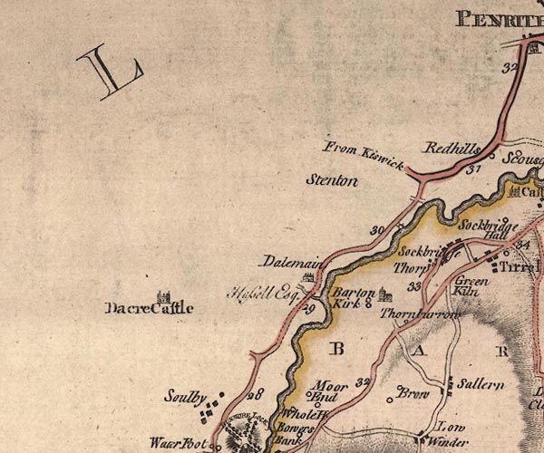 J5NY42NE.jpg circle with rays; water mill item:- National Library of Scotland : EME.s.47 Image © National Library of Scotland |
|
|
|
||
| evidence:- | old map:- Donald 1774 (Cmd) |
|
| source data:- | Map, hand coloured engraving, 3x2 sheets, The County of Cumberland, scale about 1
inch to 1 mile, by Thomas Donald, engraved and published by Joseph Hodskinson, 29
Arundel Street, Strand, London, 1774.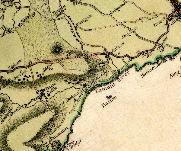 D4NY42NE.jpg "Mill" circle with rays, mill wheel; a water mill downstream of Dalemain item:- Carlisle Library : Map 2 Image © Carlisle Library |
|
|
|
||
 Lakes Guides menu.