 Old Cumbria Gazetteer
 |
 |
|
| Skelsmergh Fell, Skelsmergh | ||
| Skelsmergh Fell | ||
| civil parish:- | Skelsmergh (formerly Westmorland) | |
| civil parish:- | Whitwell and Selside (formerly Westmorland) | |
| county:- | Cumbria | |
| locality type:- | hill | |
| locality type:- | fell | |
| 1Km square:- | SD5396 (?) | |
| 10Km square:- | SD59 | |
|
|
||
| evidence:- | old map:- Ogilby 1675 (plate 38) placename:- Skeesmore Fell |
|
| source data:- | Road strip map, hand coloured engraving, continuation of the
Road from London to Carlisle, scale about 1 inch to 1 mile, by
John Ogilby, London, 1675.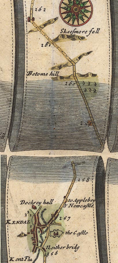 OG38m257.jpg In mile 261, Westmorland. Road skirts a hill:- "Skeesmore fell" item:- JandMN : 21 Image © see bottom of page |
|
|
|
||
| evidence:- | old map:- Bowen 1720 (plate 94) placename:- Skelsmore Fell |
|
| source data:- | Strip maps, uncoloured engravings, road maps, The Road from
London to Carlisle, scale about 2 miles to 1 inch, with sections
in Lancashire and Westmorland, published by Emanuel Bowen, St
Katherines, London, 1720.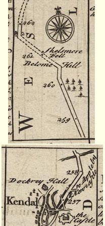 B094m257.jpg At mile 261. item:- Dove Cottage : 2007.38.100 Image © see bottom of page |
|
|
|
||
 Lakes Guides menu.