 Old Cumbria Gazetteer
 |
 |
|
| Shaw Beck | ||
| runs into:- |  Skeggles Water Skeggles Water |
|
|
|
||
| civil parish:- | Kentmere (formerly Westmorland) | |
| county:- | Cumbria | |
| locality type:- | river | |
| 1Km square:- | NY4703 | |
| 10Km square:- | NY40 | |
|
|
||
| evidence:- | old map:- OS County Series (Wmd 27 10) placename:- Shaw Beck |
|
| source data:- | Maps, County Series maps of Great Britain, scales 6 and 25
inches to 1 mile, published by the Ordnance Survey, Southampton,
Hampshire, from about 1863 to 1948. |
|
|
|
||
| evidence:- | old map:- Hodgson 1828 |
|
| source data:- | Map, 4 sheets, Plan of the County of Westmorland, scale about 1
1/3 inches to 1 mile, by Thomas Hodgson, 1823-25, engraved by W
R Gardner, Harpur Street, London, published by Thomas Hodgson,
Lancaster, and perhaps by C Smith, 172 Strand, London,1828. |
|
|
|
||
| evidence:- | map:- OS Six Inch (1956) placename:- Shaw Beck |
|
| source data:- | Map series, various editions with the national grid, scale about
6 inches to 1 mile, published by the Ordnance Survey,
Southampton, Hampshire, scale 1 to 10560 from 1950s to 1960s,
then 1 to 10000 from 1960s to 2000s, superseded by print on
demand from digital data.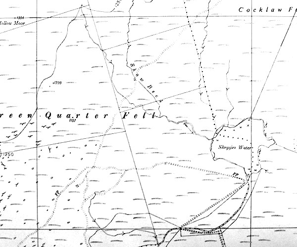 SINY4703.jpg "Shaw Beck" |
|
|
|
||
Lakes Guides menu.