 Old Cumbria Gazetteer
 |
 |
|
| Shap Station, Shap | ||
| Shap Station | ||
| site name:- | Lancaster and Carlisle Railway | |
| locality:- | Shap | |
| civil parish:- | Shap (formerly Westmorland) | |
| county:- | Cumbria | |
| locality type:- | railway station | |
| coordinates:- | NY56701439 | |
| 1Km square:- | NY5614 | |
| 10Km square:- | NY51 | |
| SummaryText:- | Opened with the railway 1846; closed 1968. | |
|
|
||
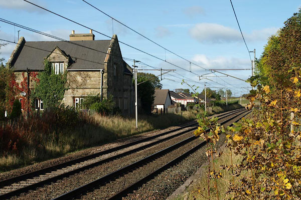
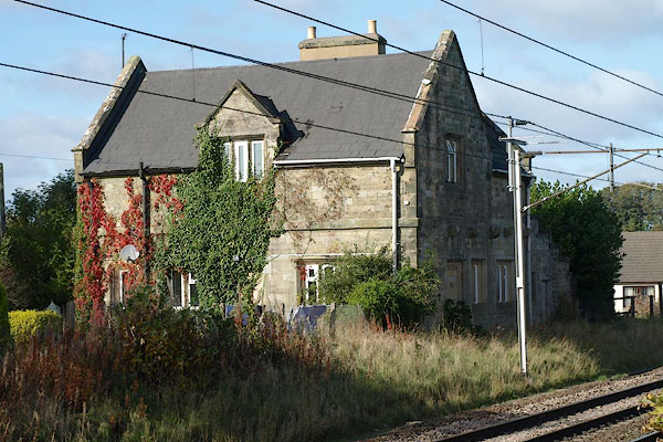 BRS84.jpg (taken 16.10.2009) 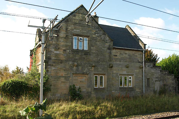 BRS85.jpg (taken 16.10.2009) |
||
|
|
||
| evidence:- | old map:- OS County Series (Wmd 14 14) placename:- Shap Station item:- railway signal; railway milepost |
|
| source data:- | Maps, County Series maps of Great Britain, scales 6 and 25
inches to 1 mile, published by the Ordnance Survey, Southampton,
Hampshire, from about 1863 to 1948.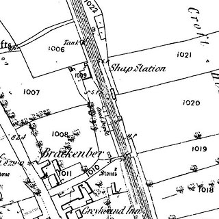 click to enlarge click to enlargeCSRY0179.jpg "Shap Station / S.P. / M.P. / Coal Depot" |
|
|
|
||
| evidence:- | old map:- Garnett 1850s-60s H |
|
| source data:- | Map of the English Lakes, in Cumberland, Westmorland and
Lancashire, scale about 3.5 miles to 1 inch, published by John
Garnett, Windermere, Westmorland, 1850s-60s.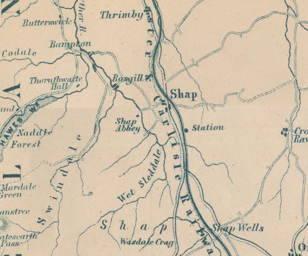 GAR2NY51.jpg "Station" dot by railway item:- JandMN : 82.1 Image © see bottom of page |
|
|
|
||
| evidence:- | probably fiction:- Trollope 1864 placename:- Shap |
|
| source data:- |  goto source goto sourcechapter 38 The inn at Shap "... He himself [George] reached the place late in the evening by train from London. There is a station at Shap, by which the railway company no doubt conceives that it has conferred on that somewhat rough and remote locality all the advantages of a refined civilization; but I doubt whether the Shappites have been thankful for the favour. The landlord at the inn, for one, is not thankful, Shap had been a place owing all such life as it had possessed to coachinng and posting. It had been a stage on the high road from Lancaster to Carlisle, ... it had had its glory in its coaching and posting. I have no doubt that there are men and women who look back with a fond regret to the palmy days of Shap." |
|
|
|
||
| evidence:- | old map:- LMS 1920s maps |
|
| source data:- | Railway map, lithograph, 23 pages of strip maps, The Journey in
Brief, the Route London to Carlisle, published by the London
Midland and Scottish Railway, LMS, 1920s.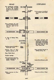 click to enlarge click to enlargeLS3p27.jpg "TO EDINBURGH 130¼ / SHAP / FROM LONDON 269¾" item:- JandMN : 95.2 Image © see bottom of page |
|
|
|
||
 BRS86.jpg View N. (taken 16.10.2009) 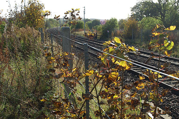 BRS87.jpg View S. (taken 16.10.2009) |
||
|
|
||
Lakes Guides menu.