 Old Cumbria Gazetteer
 |
 |
|
| Setmurthy Common, Setmurthy | ||
| Setmurthy Common | ||
| locality:- | Setmurthy | |
| civil parish:- | Setmurthy (formerly Cumberland) | |
| county:- | Cumbria | |
| locality type:- | common | |
| locality type:- | wood | |
| coordinates:- | NY16583184 (etc) | |
| 1Km square:- | NY1631 | |
| 10Km square:- | NY13 | |
|
|
||
| evidence:- | old map:- OS County Series (Cmd 55 2) placename:- Setmurthy Common |
|
| source data:- | Maps, County Series maps of Great Britain, scales 6 and 25
inches to 1 mile, published by the Ordnance Survey, Southampton,
Hampshire, from about 1863 to 1948. |
|
|
|
||
| evidence:- | old map:- |
|
| source data:- | Road strip map, hand coloured engraving, the Road from Kendal to
Cockermouth, and the Road from Egremond to Carlisle, scale about
1 inch to 1 mile, by John Ogilby, London, 1675.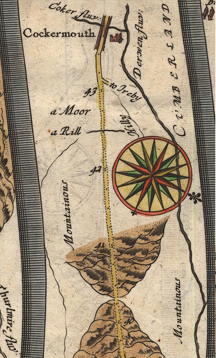 OG96m040.jpg In miles 39 and 40, Cumberland. Road ascends and descends a large hill. "Mountainous" labelling the area right of the road. item:- JandMN : 22 Image © see bottom of page |
|
| source data:- | Road strip map, hand coloured engraving, the Road from Kendal to
Cockermouth, and the Road from Egremond to Carlisle, scale about
1 inch to 1 mile, by John Ogilby, London, 1675.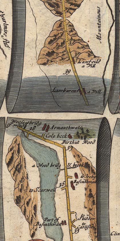 OG96m035.jpg item:- JandMN : 22 Image © see bottom of page |
|
|
|
||
 Lakes Guides menu.