 Old Cumbria Gazetteer
 |
 |
|
| Seathwaite Fells, Dunnerdale-with-Seathwaite | ||
| Seathwaite Fells | ||
| civil parish:- | Dunnerdale-with-Seathwaite (formerly Lancashire) | |
| county:- | Cumbria | |
| locality type:- | hill | |
| locality type:- | fell | |
| coordinates:- | SD25319781 (etc) | |
| 1Km square:- | SD2597 | |
| 10Km square:- | SD29 | |
|
|
||
| evidence:- | outline view:- Tattersall 1836 placename:- Seathwaite Fells |
|
| source data:- | Print, engraving, Upper Reach, Coniston, Cumberland, drawn by George Tattersall, engraved
by W F Topham, published by Sherwood and Co, Paternoster Row, London, about 1836.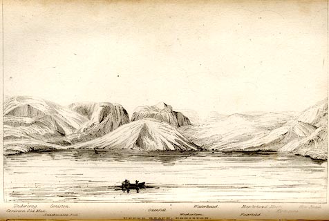 click to enlarge click to enlargeTAT106.jpg The print is captioned with mountain names and acts as an outline view. Tipped in opposite p.35 of The Lakes of England, by George Tattersall. printed at bottom:- "UPPER REACH, CONISTON." printed at bottom left to right:- "Coniston Old Man. / Undercrag. / Seathwaite Fells. / Coniston. / Oxenfell. / Wetherlam. / Waterhead. / Fairfield. / Hawkshead Moor. / Kirkstone. / How Head." item:- Armitt Library : A1204.7 Image © see bottom of page |
|
|
|
||
| evidence:- | old map:- Garnett 1850s-60s H placename:- Seathwaite |
|
| source data:- | Map of the English Lakes, in Cumberland, Westmorland and
Lancashire, scale about 3.5 miles to 1 inch, published by John
Garnett, Windermere, Westmorland, 1850s-60s.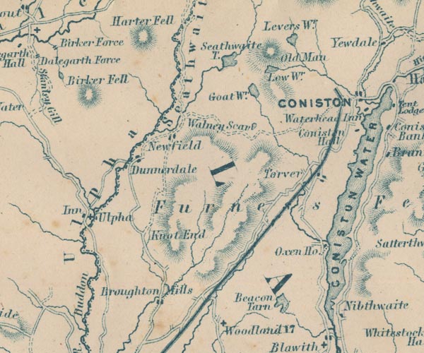 GAR2SD29.jpg "Seathwaite" area, river valley item:- JandMN : 82.1 Image © see bottom of page |
|
|
|
||
 Lakes Guides menu.