 Old Cumbria Gazetteer
 |
 |
|
| Scales Farm, Threlkeld | ||
| Scales Farm | ||
| locality:- | Scales | |
| civil parish:- | Threlkeld (formerly Cumberland) | |
| county:- | Cumbria | |
| locality type:- | buildings | |
| coordinates:- | NY34282691 | |
| 1Km square:- | NY3426 | |
| 10Km square:- | NY32 | |
|
|
||
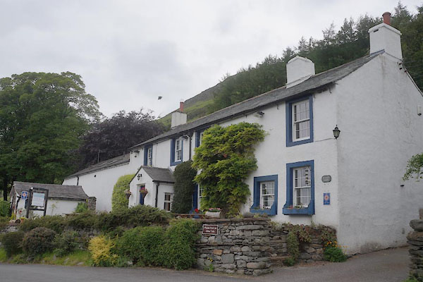 CAX29.jpg (taken 13.6.2014) |
||
|
|
||
| evidence:- | old map:- Otley 1818 placename:- Scales |
|
| source data:- | Map, uncoloured engraving, The District of the Lakes,
Cumberland, Westmorland, and Lancashire, scale about 4 miles to
1 inch, by Jonathan Otley, 1818, engraved by J and G Menzies,
Edinburgh, Scotland, published by Jonathan Otley, Keswick,
Cumberland, et al, 1833.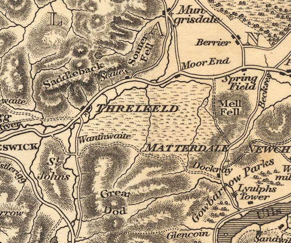 OT02NY32.jpg item:- JandMN : 48.1 Image © see bottom of page |
|
|
|
||
 Lakes Guides menu.