 Old Cumbria Gazetteer
 |
 |
|
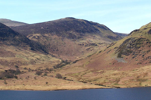
| Scale Knott, Loweswater | ||
| Scale Knott | ||
| civil parish:- | Loweswater (formerly Cumberland) | |
| county:- | Cumbria | |
| locality type:- | rocks | |
| coordinates:- | NY152177 | |
| 1Km square:- | NY1517 | |
| 10Km square:- | NY11 | |
|
|
||
 BLY24.jpg (taken 24.4.2006) |
||
|
|
||
| evidence:- | old map:- OS County Series (Cmd 69 1) placename:- Scale Knott |
|
| source data:- | Maps, County Series maps of Great Britain, scales 6 and 25
inches to 1 mile, published by the Ordnance Survey, Southampton,
Hampshire, from about 1863 to 1948. |
|
|
|
||
| evidence:- | outline view:- Tattersall 1836 (version 1869) placename:- Scale Knot |
|
| source data:- | Print, hand coloured, Crummock Lake, from the East, Buttermere, Cumberland, drawn
by George Tattersall, 1836, engraved by W F Topham, published by T J Allman, 463 Oxford
Street, London, 1869.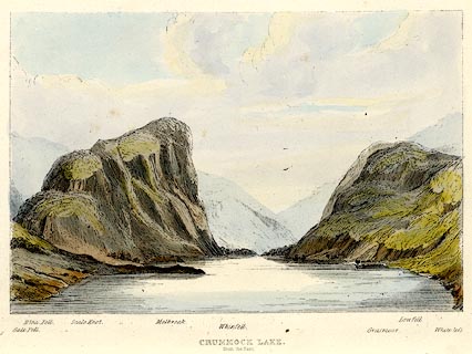 click to enlarge click to enlargeTAT211.jpg Included in The Lakes of England, by W F Topham. printed at bottom:- "CRUMMOCK LAKE, / from the East." printed at bottom:- "Gale Fell. / Blea Fell. / Scale Knot. / Melbreak. / Whinfell. / Grasmoor. / Low Fell. / Whiteless." item:- Armitt Library : A1067.11 Image © see bottom of page |
|
|
|
||
| evidence:- | outline view:- Tattersall 1836 placename:- Scale Knot |
|
| source data:- | Print, engraving, Crummock Lake, from the East, Buttermere, Cumberland, drawn by George
Tattersall, engraved by W F Topham, published by Sherwood and Co, Paternoster Row,
London, about 1836.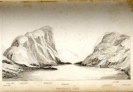 click to enlarge click to enlargeTAT128.jpg The print is captioned with mountain names and acts as an outline view. Tipped in opposite p.74 of The Lakes of England, by George Tattersall. printed at bottom:- "CRUMMOCK LAKE. / from the East." printed at bottom left to right:- "Gale Fell. / Blea Fell. / Scale Knot. / Melbreak. / Whinfell. / Grasmoor. / Lowfell. / Whiteless." item:- Armitt Library : A1204.29 Image © see bottom of page |
|
|
|
||
 Lakes Guides menu.