 Old Cumbria Gazetteer
 |
 |
|
| Saw Crag, Wythop | ||
| Saw Crag | ||
| civil parish:- | Wythop (formerly Cumberland) | |
| county:- | Cumbria | |
| locality type:- | rocks | |
| coordinates:- | NY203306 | |
| 1Km square:- | NY2030 | |
| 10Km square:- | NY23 | |
| references:- | Crosthwaite 1783-94 |
|
|
|
||
| evidence:- | old map:- Crosthwaite 1783-94 (Bas) placename:- Saw Crag |
|
| source data:- | Map, uncoloured engraving, An Accurate Map of Broadwater or
Bassenthwaite Lake, scale about 3 inches to 1 mile, by Peter
Crosthwaite, Keswick, Cumberland, 1783, version published 1800.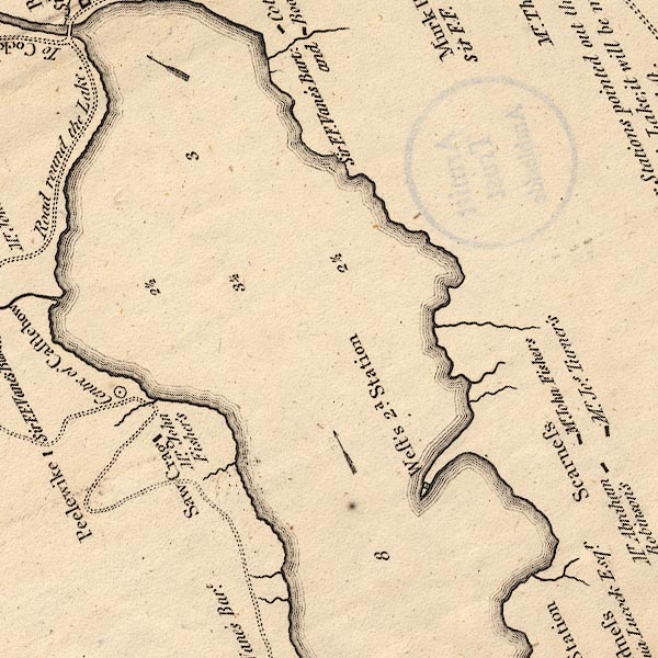 CT6NY23A.jpg "Saw Crag / Mr. John Fisher's" item:- Armitt Library : 1959.191.4 Image © see bottom of page |
|
|
|
||
| evidence:- | old text:- Clarke 1787 placename:- Sawyers Cragg |
|
| source data:- | Guide book, A Survey of the Lakes of Cumberland, Westmorland,
and Lancashire, written and published by James Clarke, Penrith,
Cumberland, and in London etc, 1787; published 1787-93. goto source goto sourcePage 93:- "... along Wythop-brow, ... Passing Beck Wythop and Smiddy Green, which form two beautiful little openings (as if from night to day) we come to Sawyers Cragg; here the road takes a curious turn, as may be seen from the plan, No VIII. ..." |
|
|
|
||
| evidence:- | probably old map:- Clarke 1787 map (Bassenthwaite Lake) placename:- Scarr Cragg |
|
| source data:- | Map, A Map of Broadwater and its Environs, ie Bassenthwaite
Lake, scale about 6.5 ins to 1 mile, by James Clarke, engraved
by Neele, 352 Strand, published by James Clarke, Penrith,
Cumberland and in London etc, 1787.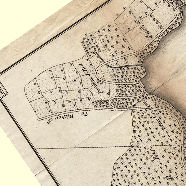 CL8NY13V.jpg "Scarr Cragg" item:- private collection : 10.8 Image © see bottom of page |
|
|
|
||
| evidence:- | old map:- Ford 1839 map placename:- Sarcrag |
|
| source data:- | Map, uncoloured engraving, Map of the Lake District of
Cumberland, Westmoreland and Lancashire, scale about 3.5 miles
to 1 inch, published by Charles Thurnam, Carlisle, and by R
Groombridge, 5 Paternoster Row, London, 3rd edn 1843.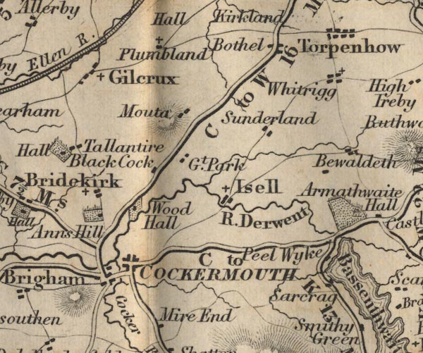 FD02NY13.jpg "Sarcrag" item:- JandMN : 100.1 Image © see bottom of page |
|
|
|
||
Lakes Guides menu.