 Old Cumbria Gazetteer
 |
 |
|
| Sand Gate, Lower Holker | ||
| Sand Gate | ||
| locality:- | sands road, Cartmel Sands | |
| civil parish:- | Lower Holker (formerly Lancashire) | |
| county:- | Cumbria | |
| locality type:- | buildings | |
| coordinates:- | SD355757 | |
| 1Km square:- | SD3575 | |
| 10Km square:- | SD37 | |
|
|
||
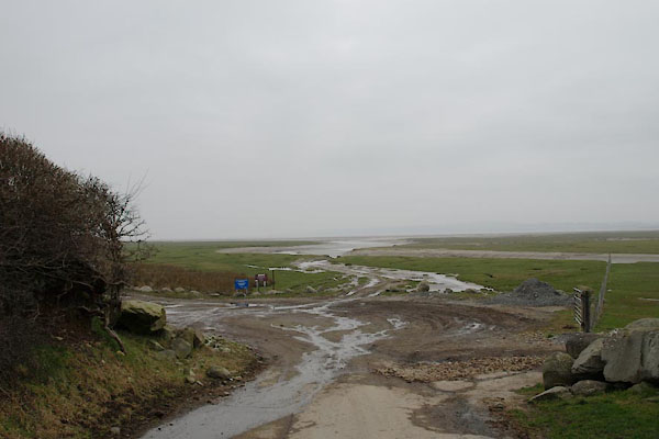 BUE42.jpg ... inviting? (taken 4.3.2011) |
||
|
|
||
| evidence:- | perhaps old map:- West 1784 map placename:- Holker Gate |
|
| source data:- | Map, hand coloured engraving, A Map of the Lakes in Cumberland,
Westmorland and Lancashire, scale about 3.5 miles to 1 inch,
engraved by Paas, 53 Holborn, London, about 1784.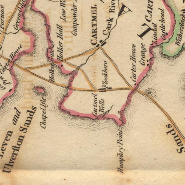 Ws02SD37.jpg item:- Armitt Library : A1221.1 Image © see bottom of page |
|
|
|
||
 Lakes Guides menu.