 Old Cumbria Gazetteer
 |
 |
|
| Sadgill Wood, Longsleddale | ||
| Sadgill Wood | ||
| locality:- | Sadgill | |
| civil parish:- | Longsleddale (formerly Westmorland) | |
| county:- | Cumbria | |
| locality type:- | wood | |
| coordinates:- | NY48080555 (etc) | |
| 1Km square:- | NY4805 | |
| 10Km square:- | NY40 | |
|
|
||
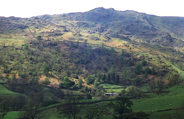 BJK14.jpg Low Sadgill and Rough Crags, Sadgill Wood, etc, from the side of Ancrow Brow. (taken 2.5.2005) |
||
|
|
||
| evidence:- | old map:- OS County Series (Wmd 27 6) placename:- Sadgill Wood |
|
| source data:- | Maps, County Series maps of Great Britain, scales 6 and 25
inches to 1 mile, published by the Ordnance Survey, Southampton,
Hampshire, from about 1863 to 1948. Parcels 171 5.733 acres, 172 1.523 acres, 174 17.774 acres? |
|
|
|
||
| evidence:- | old map:- OS 1881-82 New Series (outline edition) placename:- Sadgill Wood |
|
| source data:- | Map, engraving, area north of Kendal, Westmorland, New Series
one inch map, outline edition, sheet 39, scale 1 inch to 1 mile,
published by the Ordnance Survey, Southampton, Hampshire,
1881-82.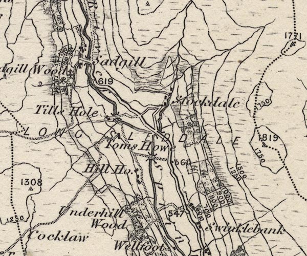 O21NY40X.jpg "Sadgill Wood" item:- JandMN : 61 Image © see bottom of page |
|
|
|
||
| evidence:- | species list:- item:- arum lily; flower; Arum maculatum item:- betony; flower; Betonica officinalis item:- wavy bittercress (?); bittercress; flower; Cardamine flexuosa (?) item:- bluebell; Endymion non-scriptus; flower; Hyacinthoides non-scriptus item:- bramble; flower; Rubus sp item:- creeping buttercup; buttercup; flower; Ranunculus repens item:- meadow buttercup; buttercup; flower; Ranunculus acris item:- heath bedstraw; bedstraw; flower; Galium saxatile item:- hedge bedstraw; bedstraw; flower; Galium mollugo (?) item:- enchanter's nightshade; flower; Circaea lutetiana item:- eyebright; flower; Euphrasia sp item:- foxglove; flower; Digitalis purpurea item:- herb robert; flower; Geranium robertianum item:- lady's mantle; flower; Alchemilla glabra item:- meadowsweet; flower; Filipendula ulmaria item:- common mouse ear; mouse ear; flower; Cerastium fontanum item:- yellow pimpernel; pimpernel; flower; Lysimachia nemorum item:- ribwort plantain; plantain; flower; Plantago lanceolata item:- raspberry; flower; Rubus idaeus item:- common sorrel; flower; Rumex acetosa item:- sheeps sorrel; sorrel; flower; Rumex acetosella item:- wood sorrel; sorrel; flower; Oxalis acetosella item:- selfheal; flower; Prunella vulgaris item:- common speedwell; speedwell; flower; Veronica officinalis item:- wood speedwell; speedwell; flower; Veronica montana item:- barren strawberry; strawberry; flower; Potentilla sterilis item:- marsh thistle; thistle; flower; Cirsium palustre item:- tormentil; flower; Potentilla anglica item:- dog violet; violet; flower; Viola canina item:- broadleaved willow herb; willow herb, broadleaved; flower; Epilobium montanum item:- rosebay willow herb; willow herb, rosebay; flower; Epilobium angustifolium item:- wood sage; flower; Teucrium scorodonia item:- wood avens; avens; flower; Geum urbanum item:- hedge woundwort; woundwort; flower; Stachys sylvatica item:- yarrow; flower; Achillea millefolium item:- birch; tree; Betula alba item:- bird cherry; cherry; tree; Prunus padus item:- hazel; tree; Corylus avellana item:- holly; tree; Ilex aquifolium item:- larch; tree; Larix sp item:- oak; tree; Quercus sp item:- sycamore; tree; Acer pseudoplatanus item:- bracken; Pteridium aquilinum item:- oak fern (?); fern; Gymnocarpium dryopteris item:- broad buckler fern; fern; Dryopteris dilatata item:- common bent (?); bent; grass; Agrostis capillaris (?) item:- crested dog's tail; dog's tail; grass; Cynosurus cristatus item:- fescue; grass; Festuca sp item:- sweet vernal grass; vernal grass; grass; Anthoxanthum odoratum item:- tufted hair grass; hair grass; grass; Deschampsia caespitosa item:- wavy hair grass; hair grass; grass; Deschampsia flexuosa item:- yellow oat grass; oat grass; grass; Trisetum flavescens item:- yorkshire fog; grass; Holcus lanatus item:- soft rush; rush; flower; Juncus effusus item:- common yellow sedge; sedge; Carex demissa |
|
| source data:- | Species list:- "Flowers at Sadgill" written by a group of botanists from the Kendal natural history group? after a field trip on one July day. |
|
|
|
||
 Forestry 25 February 2014 Forestry 25 February 2014 |
||
|
|
||
| Forestry 5 March 2014 |
||
|
|
||
| Forestry 18 March 2014 |
||
|
|
||
| evidence:- | map:- OS Six Inch (1956) placename:- Sadgill Wood |
|
| source data:- | Map series, various editions with the national grid, scale about
6 inches to 1 mile, published by the Ordnance Survey,
Southampton, Hampshire, scale 1 to 10560 from 1950s to 1960s,
then 1 to 10000 from 1960s to 2000s, superseded by print on
demand from digital data.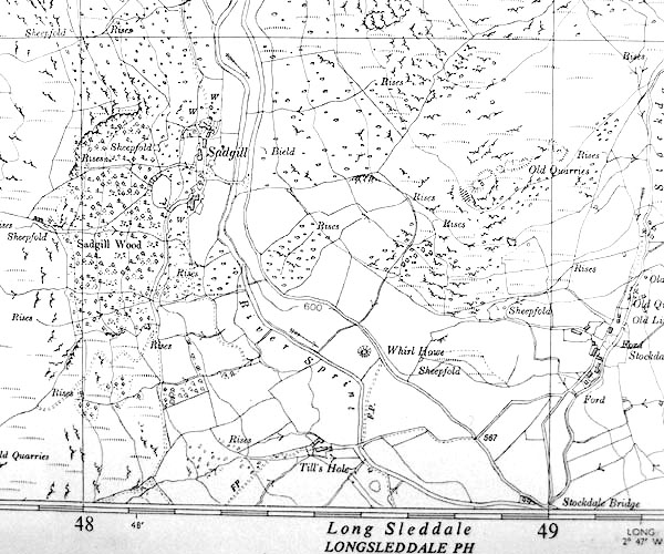 SINY4805.jpg "Sadgill Wood" |
|
|
|
||
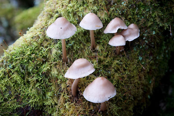 CFS17.jpg Fungus. (taken 14.11.2016) 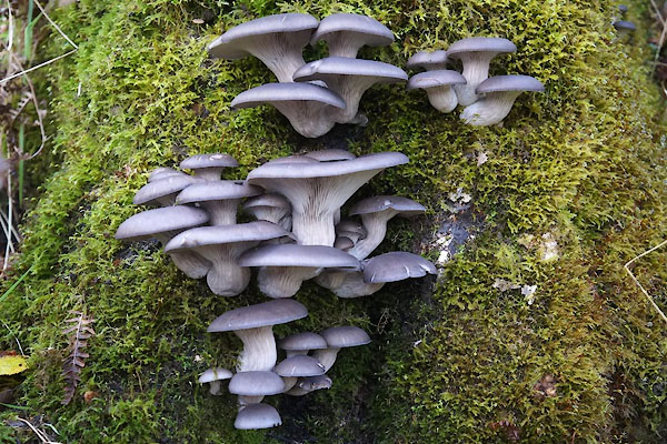 CFS18.jpg Fungus. (taken 14.11.2016) 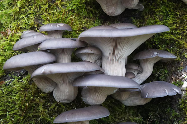 CFS19.jpg Fungus. (taken 14.11.2016) 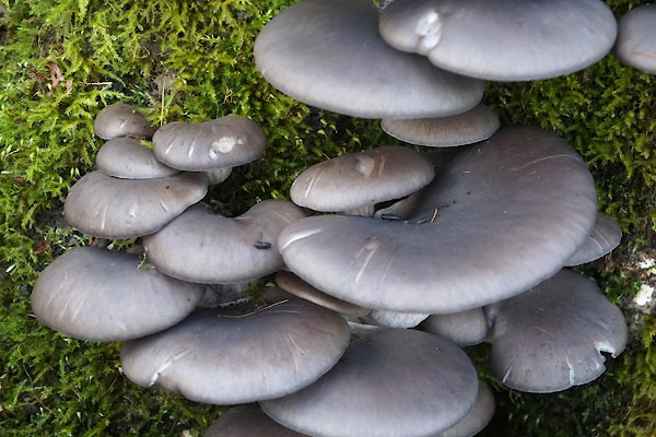 CFS20.jpg Fungus. (taken 14.11.2016) |
||
|
|
||
 Lakes Guides menu.