 Old Cumbria Gazetteer
 |
 |
|
| Sadgill Bridge, Longsleddale | ||
| Sadgill Bridge | ||
| site name:- | Sprint, River | |
| locality:- | Sadgill | |
| civil parish:- | Longsleddale (formerly Westmorland) | |
| county:- | Cumbria | |
| locality type:- | packhorse bridge | |
| locality type:- | bridge | |
| locality type:- | flood | |
| coordinates:- | NY48320569 | |
| 1Km square:- | NY4805 | |
| 10Km square:- | NY40 | |
| references:- | Hinchcliffe, Ernest: 1994: Packhorse Bridges of England: Cicerone Press (Milnthorpe,
Cumbria) |
|
|
|
||
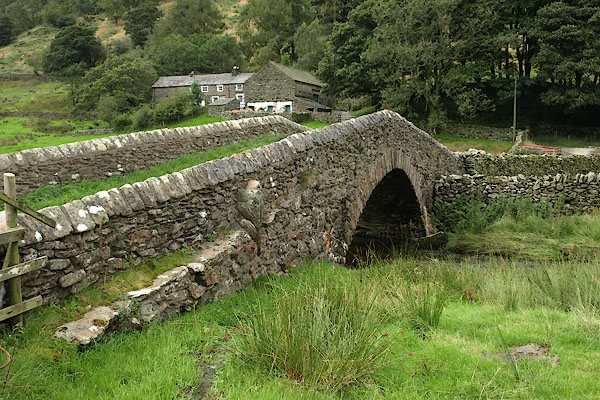 BRI21.jpg North side; notice the discontinuity in the stonework, suggesting the line of the older bridge arch, with no parapet. (taken 27.8.2009) 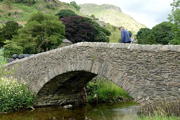 BQZ75.jpg South side; the stonework has no discontinuity, suggesting this is the newer side, parapet and bridge face built as one. (taken 7.7.2009) 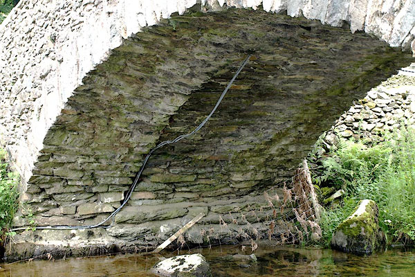 BQZ77.jpg Looking underneath; notice the join in the arch, where the cable lies, and the different footings; probably the older arch on the right - north side, newer addition on the left - south side. (taken 7.7.2009) |
||
|
|
||
| evidence:- | old map:- OS County Series (Wmd 27 6) |
|
| source data:- | Maps, County Series maps of Great Britain, scales 6 and 25
inches to 1 mile, published by the Ordnance Survey, Southampton,
Hampshire, from about 1863 to 1948. OS County Series (Wmd 27 7) 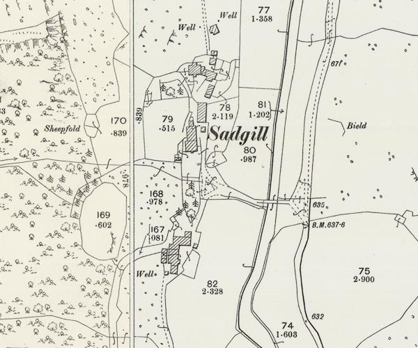 C5E001.jpg |
|
|
|
||
| evidence:- | old photograph:- |
|
| source data:- | River Sprint and Sadgill Bridge by J H Hogg, Kendal, 1900s.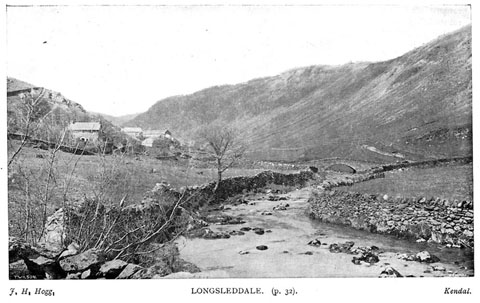 click to enlarge click to enlargeBII37.jpg in guide book, Kendal Illustrated, published by T Wilson, Kendal, Westmorland, 1900s. "LONGSLEDDALE" item:- private collection : 58 Image © see bottom of page |
|
|
|
||
| evidence:- | old map:- Hodgson 1828 |
|
| source data:- | Map, hand coloured engraving, 4 sheets mounted together on linen and rolled, Plan
of the County of Westmorland, scale about 1.25 inches to 1 mile, by Thomas Hodgson,
engraved by W R Gardner, Harpur Street, London, published by Thomas Hodgson, Lancaster,
and perhaps by C Smith, 172 Strand, London,1828. HDG6lsl3.jpg map courtesy of Mark Cropper item:- private collection : 371 Image © see bottom of page |
|
|
|
||
| evidence:- | records:- Curwen 1926 placename:- Sad Gill Bridge |
|
| source data:- | Records Relating to the Barony of Kendale, supplementary vol.3,
edited by John F Curwen, published by Titus Wilson and Son,
Kendal, Westmorland, 1926. CURWEN01.txt "1717 May 3 : The inhabitants of Long Sleddale, Langdale, Grasmere, Rydal and Loughrigg, Ambleside, Troutbeck, Kentmere and several other townships in the Barony of Kendall, show that the great road and public highway between Hawksyde, Ambleside, Shap, Penrith and Appleby, very much used by travellers, drovers and others having occasion frequently to pass and repass to and from the said markets with cattle and other goods, in which public highway there is a water or rivulet called Sadgill which by the violent and sudden rain there is often raised and overflows its banks so that no passenger dare venture to cross the same and many times travellers are forced to stay two or three days before they dare to venture to cross and are often in danger with their cattle of being lost in crossing the said water to the great prejudice of trade, and pray that a bridge may be erected over the same; order that the Chief Constable view the same and report the cost of a bridge on 31 May next. K. Order Book, 1696-1724." "...." "1848 January 8 : Ordered that Mr. Robinson the Bridge Master inspect Sad Gill Bridge and report his opinion as to whether it is a county bridge and liable as such to be repaired by the county. K. Order Book, 1839-76." |
|
|
|
||
| evidence:- | records:- KendalRO : QS AR/2/13/3 213/19 item:- flood, 1749 |
|
| source data:- | Summary from Quarter Session Rolls; Kendal Christmas Sessions Roll 1749 Petition, Michael Mattinson, John Airey and James Anson of Sadgill, Longsleddale, being liable to repair the highway from Kentmere to Longsleddale Head about 14 years ago built a stone bridge at their own expence over the ford at Sadgill, and received a gratuity of L5 from Mr Dennison High Constable of Kendal ward, said bridge "abt September last by very violent & sudden Rain was intirely destroy'd & the Corn Hay & other goods of Your Petre were damag'd to the Value of L100 &upwards." Desire bridge may be rebuilt or assistance. |
|
|
|
||
| evidence:- | records:- KendalRO : QS AR/2/13/3 50/3 item:- road, Ambleside to Appleby |
|
| source data:- | Summary from Quarter Session Rolls; Kendal Midsummer Petitions Roll 1734 Petition of ... inhabitants of Kentmere: they are often obliged to cross river called Sadgill running between Ambleside and Appleby, there is no bridge and often they cannot cross, desire bridge to be built - High constable to view and report. |
|
|
|
||
| evidence:- | database:- Listed Buildings 2010 placename:- Sadgill Bridge |
|
| source data:- | courtesy of English Heritage "SADGILL BRIDGE / / / LONGSLEDDALE / SOUTH LAKELAND / CUMBRIA / II / 76408 / NY4832605691" |
|
| source data:- | courtesy of English Heritage "Bridge, C17 or early C18, widened on the South side probably during C19. Limestone rubble with single semi-circular arch and steeply sloping parapets with stone copings." |
|
|
|
||
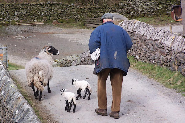 BLV77.jpg Tom Fishwick and lambs on Sadgill Bridge, Good Friday, 2006. (taken 15.4.2006) 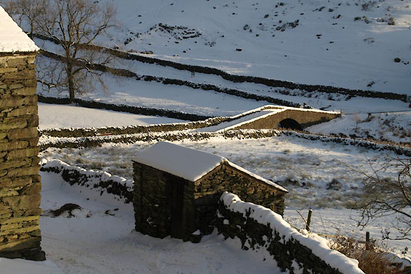 BTU88.jpg (taken 5.12.2010) 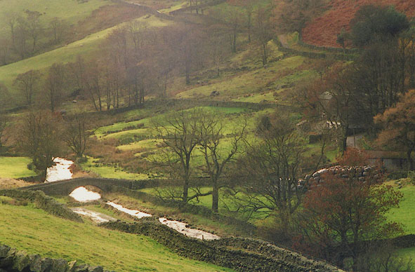 BHU14.jpg River Sprint and Sadgill Bridge. (taken 11.2003) 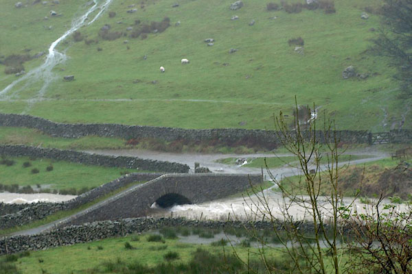 BRW97.jpg And a river in spate. (taken 19.11.2009) 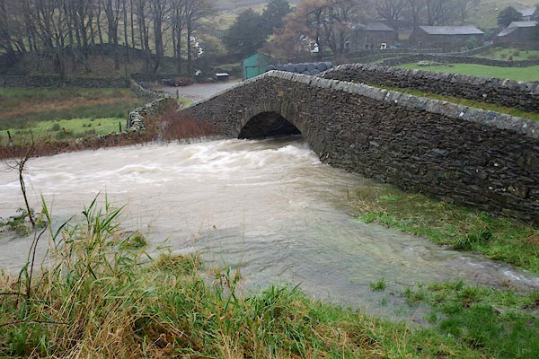 BRW98.jpg And a river in spate. (taken 19.11.2009) |
||
|
|
||
| hearsay:- |
A petition in 1717 wanted a bridge:- |
|
| "The inhabitants of Long Sleddale, Langdale, Grasmere Rydal and Loughrigg, Ambleside,
Troutbeck, Kentmere and several other townships in the Barony of Kendall, show that
the great road and public highway between Hawksyde, Ambleside, Shap, Penrith and Appleby,
very much used by travellers, drovers and others having occasion frequently to pass
and repass to and from the said markets with cattle and other goods, in which public
highway there is a water or rivulet called Sadgill which by the violent and sudden
rain there is often raised and overflows its banks so that no passenger may dare venture
to cross the same and many times travellers are forced to stay two or three days before
they dare venture to cross and are often in danger with their cattle of being lost
in crossing the said water to the great prejudice of trade, and pray that a bridge
may be erected over the same." |
||
| Curwen, J F: 1926: Records of Kendal:: vol.3: pp.150-151 |
||
|
|
||
 Lakes Guides menu.