 Old Cumbria Gazetteer
 |
 |
|
| Ruleholme Bridge, Irthington | ||
| Ruleholme Bridge | ||
| site name:- | Irthing, River | |
| locality:- | Ruleholme | |
| civil parish:- | Irthington (formerly Cumberland) | |
| county:- | Cumbria | |
| locality type:- | bridge | |
| coordinates:- | NY49316016 | |
| 1Km square:- | NY4960 | |
| 10Km square:- | NY46 | |
|
|
||
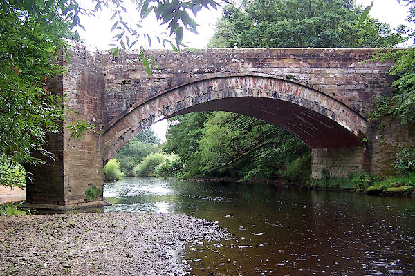 BMO26.jpg (taken 25.8.2006) 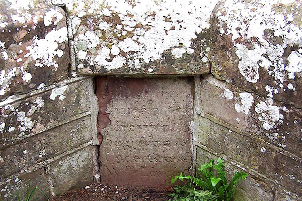 BMO27.jpg Inscribed stone:- "This Bridge [ ] / Built at the Charge of [ ] Begun in [ ]53 Undertakers Wm Lowden [ ]" (taken 25.8.2006) |
||
|
|
||
| evidence:- | old map:- OS County Series (Cmd 17 11) placename:- Ruleholme Bridge |
|
| source data:- | Maps, County Series maps of Great Britain, scales 6 and 25
inches to 1 mile, published by the Ordnance Survey, Southampton,
Hampshire, from about 1863 to 1948. |
|
|
|
||
| evidence:- | probably old map:- Bowen and Kitchin 1760 |
|
| source data:- | Map, hand coloured engraving, A New Map of the Counties of
Cumberland and Westmoreland Divided into their Respective Wards,
scale about 4 miles to 1 inch, by Emanuel Bowen and Thomas
Kitchin et al, published by T Bowles, Robert Sayer, and John
Bowles, London, 1760.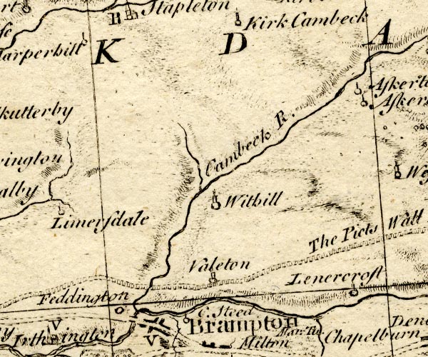 BO18NY56.jpg road crosses stream item:- Armitt Library : 2008.14.10 Image © see bottom of page |
|
|
|
||
| evidence:- | old map:- Bell 1892 placename:- Ruleholm Bridge |
|
| source data:- | Map, colour lithograph, Road Map of Cumberland, by George Joseph
Bell, scale about 2.5 miles to 1 inch, printed by Charles
Thurnam and Sons, Carlisle, Cumberland, 1892.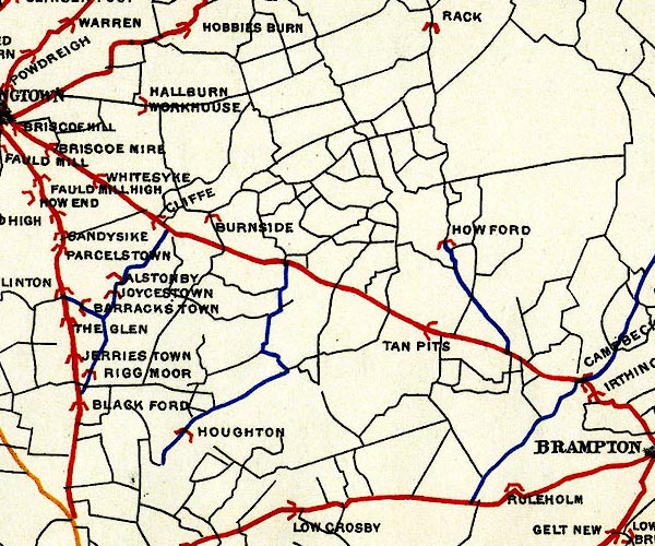 BEL9NY46.jpg "RULEHOLM" bridge symbol Road map of Cumberland showing County Bridges item:- Carlisle Library : Map 38 Image © Carlisle Library |
|
|
|
||
| evidence:- | database:- Listed Buildings 2010 placename:- Ruleholme Bridge |
|
| source data:- | courtesy of English Heritage "RULEHOLME BRIDGE / / / IRTHINGTON / CARLISLE / CUMBRIA / II / 77911 / NY4930560174" |
|
| source data:- | courtesy of English Heritage "Road bridge over the River Irthing, forming part of the Military Road from Newcastle to Carlisle. Inscribed on central internal splay parapet, This Bridge was built at the charge of the Government, Begun in 1753, Undertakers Wm. Lowden (rest of inscription covered by road surface). Dressed red sandstone. 3 arched bridge with splayed cut-waters, one in river bed the other on the river bank: rounded arches reinforced with C20 brick. Cut-water carried up to give splayed parapet. Bridge by-passed in 1970's." |
|
|
|
||
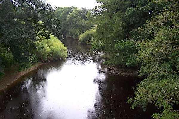 BMO28.jpg View of river. (taken 25.8.2006) |
||
|
|
||
 Lakes Guides menu.