 Old Cumbria Gazetteer
 |
 |
|
| Roanstrees, Bewcastle | ||
| Roanstrees | ||
| Roantrees | ||
| civil parish:- | Bewcastle (formerly Cumberland) | |
| county:- | Cumbria | |
| locality type:- | buildings | |
| coordinates:- | NY51847823 | |
| 1Km square:- | NY5178 | |
| 10Km square:- | NY57 | |
|
|
||
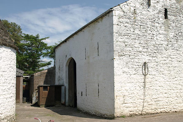 BSW19.jpg (taken 4.6.2010) 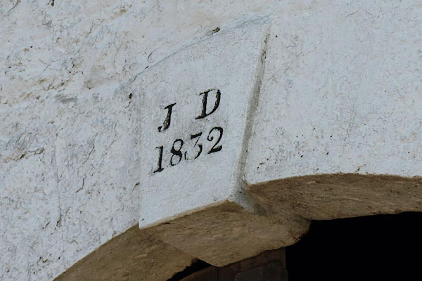 BSW20.jpg Date stone:- "J D / 1832" (taken 4.6.2010) |
||
|
|
||
| evidence:- | old map:- OS County Series (Cmd 3 12) placename:- Roanstrees |
|
| source data:- | Maps, County Series maps of Great Britain, scales 6 and 25
inches to 1 mile, published by the Ordnance Survey, Southampton,
Hampshire, from about 1863 to 1948. |
|
|
|
||
| evidence:- | old map:- Donald 1774 (Cmd) placename:- Roantrees |
|
| source data:- | Map, hand coloured engraving, 3x2 sheets, The County of Cumberland, scale about 1
inch to 1 mile, by Thomas Donald, engraved and published by Joseph Hodskinson, 29
Arundel Street, Strand, London, 1774.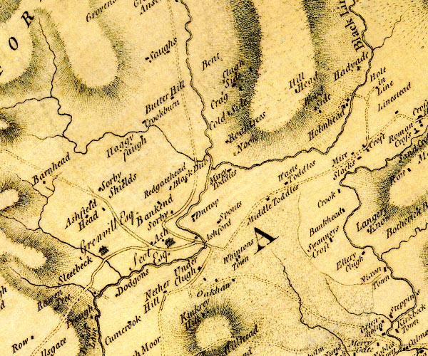 D4NY57NW.jpg "Roantrees" block or blocks, labelled in lowercase; a hamlet or just a house item:- Carlisle Library : Map 2 Image © Carlisle Library |
|
|
|
||
| evidence:- | database:- Listed Buildings 2010 |
|
| source data:- | courtesy of English Heritage "ROUND HOUSE IN CENTRE OF FARMYARD AT ROANSTREES / / / BEWCASTLE / CARLISLE / CUMBRIA / II / 78123 / NY5185078241" |
|
|
|
||
| evidence:- | database:- Listed Buildings 2010 item:- date stone (1832) |
|
| source data:- | courtesy of English Heritage "BARN TO WEST OF ROANSTRESS / / / BEWCASTLE / CARLISLE / CUMBRIA / II / 78124 / NY5186878218" |
|
|
|
||
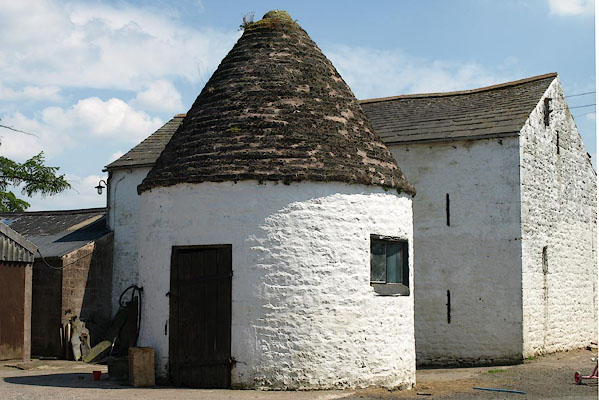 BSW21.jpg Store. (taken 4.6.2010) |
||
| This is said to have been built by a stone mason in answer to a challenge. The roof
is corbelled, no roof timbers. |
||
|
|
||
 Lakes Guides menu.