 Old Cumbria Gazetteer
 |
 |
|
| Red Tarn, Patterdale | ||
| runs into:- |  Red Tarn Beck Red Tarn Beck |
|
|
|
||
| Red Tarn | ||
| locality:- | Helvellyn | |
| civil parish:- | Patterdale (formerly Westmorland) | |
| county:- | Cumbria | |
| locality type:- | tarn | |
| coordinates:- | NY34811525 (etc) | |
| 1Km square:- | NY3415 | |
| 10Km square:- | NY31 | |
| altitude:- | 2356 feet | |
| altitude:- | 718m | |
|
|
||
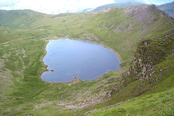 BRB66.jpg (taken 9.7.2009) 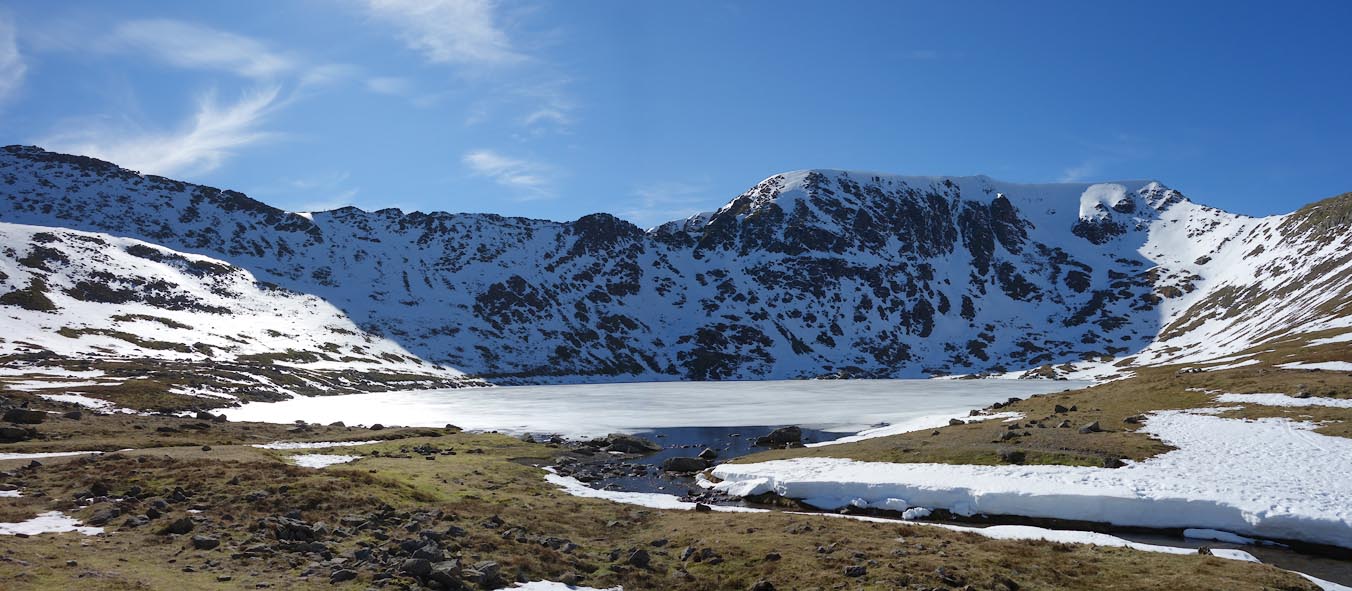 Click to enlarge CET41.jpg (taken 14.3.2016) |
||
|
|
||
| evidence:- | old map:- OS County Series (Wmd 12 13) placename:- Red Tarn |
|
| source data:- | Maps, County Series maps of Great Britain, scales 6 and 25
inches to 1 mile, published by the Ordnance Survey, Southampton,
Hampshire, from about 1863 to 1948. |
|
|
|
||
| evidence:- | old map:- Donald 1774 (Cmd) |
|
| source data:- | Map, hand coloured engraving, 3x2 sheets, The County of Cumberland, scale about 1
inch to 1 mile, by Thomas Donald, engraved and published by Joseph Hodskinson, 29
Arundel Street, Strand, London, 1774.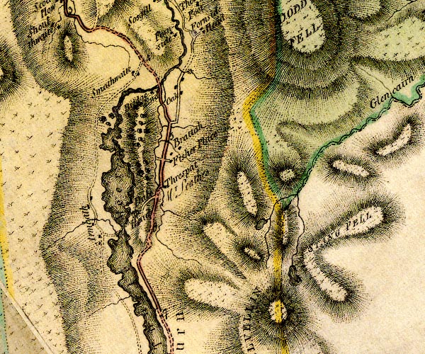 D4NY31NW.jpg lake N of Helvellyn item:- Carlisle Library : Map 2 Image © Carlisle Library |
|
|
|
||
| evidence:- | old text:- Wordsworth 1810 item:- eagle; angler |
|
| source data:- | Guide book, A Description of the Scenery of the Lakes, later A
Guide through the District of The Lakes, by William Wordsworth,
1810-35. goto source page xx "... a silent Tarn in the recesses of Helvellyn. This desolate spot was formerly haunted by eagles, that built in the precipice which forms its western barrier. These birds used to wheel and hover round the head of the solitary angler. ..." |
|
|
|
||
| evidence:- | old map:- Otley 1818 |
|
| source data:- | Map, uncoloured engraving, The District of the Lakes,
Cumberland, Westmorland, and Lancashire, scale about 4 miles to
1 inch, by Jonathan Otley, 1818, engraved by J and G Menzies,
Edinburgh, Scotland, published by Jonathan Otley, Keswick,
Cumberland, et al, 1833.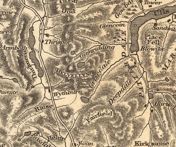 OT02NY31.jpg item:- JandMN : 48.1 Image © see bottom of page |
|
|
|
||
| evidence:- | descriptive text:- Otley 1823 (5th edn 1834) |
|
| source data:- | Guide book, A Concise Description of the English Lakes, the
mountains in their vicinity, and the roads by which they may be
visited, with remarks on the mineralogy and geology of the
district, by Jonathan Otley, published by the author, Keswick,
Cumberland now Cumbria, by J Richardson, London, and by Arthur
Foster, Kirkby Lonsdale, Cumbria, 1823; published 1823-49,
latterly as the Descriptive Guide to the English Lakes. goto source Page 34:- "... Red Tarn, also of considerable extent, containing about twenty acres, is upon the" goto sourcePage 35:- "highest level of any of the mountain tarns; being upwards of two thousand three hundred feet above the level of the sea, and about seven hundred feet below the summit of Helvellyn; from whence into it you might almost cast a stone. ..." |
|
|
|
||
| evidence:- | old map:- Garnett 1850s-60s H placename:- Red Tarn |
|
| source data:- | Map of the English Lakes, in Cumberland, Westmorland and
Lancashire, scale about 3.5 miles to 1 inch, published by John
Garnett, Windermere, Westmorland, 1850s-60s. GAR2NY31.jpg "Red Tarn" outline with shore form lines, lake or tarn item:- JandMN : 82.1 Image © see bottom of page |
|
|
|
||
| evidence:- | old text:- Martineau 1855 item:- depth, Red Tarn |
|
| source data:- | Guide book, A Complete Guide to the English Lakes, by Harriet
Martineau, published by John Garnett, Windermere, Westmorland,
and by Whittaker and Co, London, 1855; published 1855-76. goto source Page 180:- "A TABLE OF THE LENGTH, BREADTH, AND DEPTH OF THE LAKES." "No. : Names of Lakes. : Counties : Length in Miles. : Extreme breadth in Miles : Extreme depth in Feet : Height above the Sea" "6 : Red Tarn, Helvellyn : Westmorland : - : - : - : 2400" |
|
|
|
||
| evidence:- | old photograph:- Bell 1880s-1940s |
|
| source data:- | Photograph, black and white, Red Tarn, Helvellyn, Patterdale, Westmorland, by Herbert
Bell, photographer, Ambleside, Westmorland, 1890s.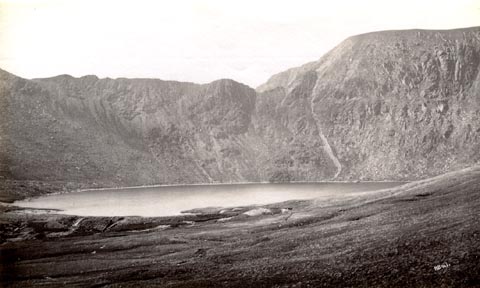 click to enlarge click to enlargeHB0600.jpg internegative at lower right:- "H. Bell" item:- Armitt Library : ALPS260 Image © see bottom of page |
|
|
|
||
| evidence:- | old photograph:- Bell 1880s-1940s item:- costume |
|
| source data:- | Photograph, black and white, Red Tarn, Helvellyn, Patterdale, Westmorland, by Herbert
Bell, photographer, Ambleside, Westmorland, 1890s.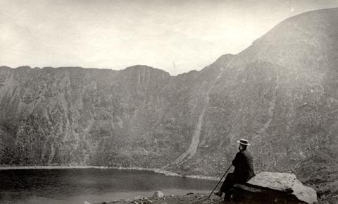 click to enlarge click to enlargeHB0601.jpg internegative at lower right:- "H. Bell" item:- Armitt Library : ALPS261 Image © see bottom of page |
|
|
|
||
| evidence:- | old print:- Philip/Wilson 1890s |
|
| source data:- | Print, engraving, Striding Edge and Red Tarn, Helvellyn,
published by George Philip and Son, London, Philip, Son and
Nephew, Liverpool, Lancashire, and Titus Wilson, Kendal,
Westmorland, about 1895.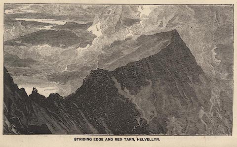 click to enlarge click to enlargePW1E25.jpg "STRIDING EDGE AND RED TARN, HELVELLYN." item:- JandMN : 58.26 Image © see bottom of page |
|
|
|
||
| evidence:- | old print:- Brabant 1902 placename:- Red Tarn |
|
| source data:- | Print, uncoloured lithograph, Striding Edge and Red Tarn, Patterdale, Westmorland,
by Edmund H New, published by Methuen and Co, 36 Essex Street, Strand, London, 1902.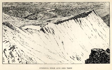 click to enlarge click to enlargeBBT109.jpg Tipped in opposite p.190 of The English Lakes, by F G Brabant. printed at bottom left:- "E / H / N" printed at bottom:- "STRIDING EDGE AND RED TARN" item:- JandMN : 502.15 Image © see bottom of page |
|
|
|
||
| evidence:- | text:- Mason 1907 (edn 1930) |
|
| source data:- | Text book, The Ambleside Geography Books bk.III, The Counties of
England, by Charlotte M Mason, published by Kegan Paul, Trench,
Trubner and Co, Broadway House, 68-74 Carter Lane, and the
Parents' Educational Union Office, 26 Victoria Street, London,
edn 1930. MSN1P020.txt Page 20:- "..." "The best way to see the mountain [Helvellyn] in its grandeur is to follow the track that leads up by the Red Tarn. A tarn is a small mere, or lake, high up among the mountains. This Red Tarn lies in a dip about 600 feet from the summit. It is shut in between two sloping walls of rock, the Striding Edge, and the Swirral Edge, ..." |
|
|
|
||
| evidence:- | old photograph:- Marr 1916 placename:- Red Tarn |
|
| source data:- | Photograph, halftone print, Red Tarn, Helvellyn, Cumberland, 1916.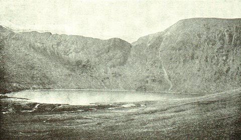 click to enlarge click to enlargeMA1224.jpg item:- JandMN : 173.32 Image © see bottom of page |
|
|
|
||
| evidence:- | old print:- Robertson 1911 placename:- Red Tarn |
|
| source data:- | Print, lithograph? Red Tarn, Helvellyn, from a watercolour by Arthur Tucker, published
by Chatto and Windus, London, 1911.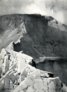 click to enlarge click to enlargeRSN136.jpg Tipped in opposite p.226 of Wordsworthshire by Eric Robertson. Striding Edge in the foreground. printed at bottom:- "RED TARN, HELVELLYN" signed at painting lower left:- "Arthur Tucker" item:- JandMN : 197.40 Image © see bottom of page |
|
|
|
||
| evidence:- | old photograph:- Bogg 1898 placename:- Red Tarn |
|
| source data:- | Photograph, halftone print, Red Tarn, Helvellyn, St John's Castlerigg and Wythburn,
Cumbria, by W G Foster, published by Edmund Bogg, 3 Woodhouse Lane, and James Miles,
Guildford Street, Leeds, Yorkshire, 1898.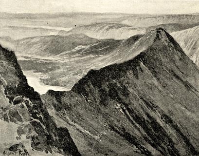 click to enlarge click to enlargeBGG160.jpg Included on p.172 of Lakeland and Ribblesdale, by Edmund Bogg. item:- JandMN : 231.60 Image © see bottom of page |
|
|
|
||
| evidence:- | outline view:- Jenkinson 1875 placename:- Red Tarn |
|
| source data:- | Print, lithograph, outline view, Panoramic Sketches from Helvellyn, Westmorland, by
Edwin A Pettitt, London, published by Edward Stanford, 55 Charing Cross, London, 1875. click to enlarge click to enlargeJk01E1.jpg "... Red Tarn ..." item:- JandMN : 28.5 Image © see bottom of page |
|
|
|
||
| evidence:- | old print:- Fielding 1822 (plate 23) placename:- Red Tarn |
|
| source data:- | Print, uncoloured engraving, Red Tarn, Patterdale, Westmorland, by Theodore H A Fielding,
published by Thomas McLean, 26 Haymarket, London, et al, 1822.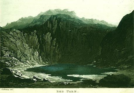 click to enlarge click to enlargePR0123.jpg Plate 23 in the set of prints, Cumberland, Westmoreland, and Lancashire Illustrated. printed at bottom, left, centre:- "T. Fielding delt. / RED TARN." item:- Dove Cottage : 2008.107.123 Image © see bottom of page |
|
|
|
||
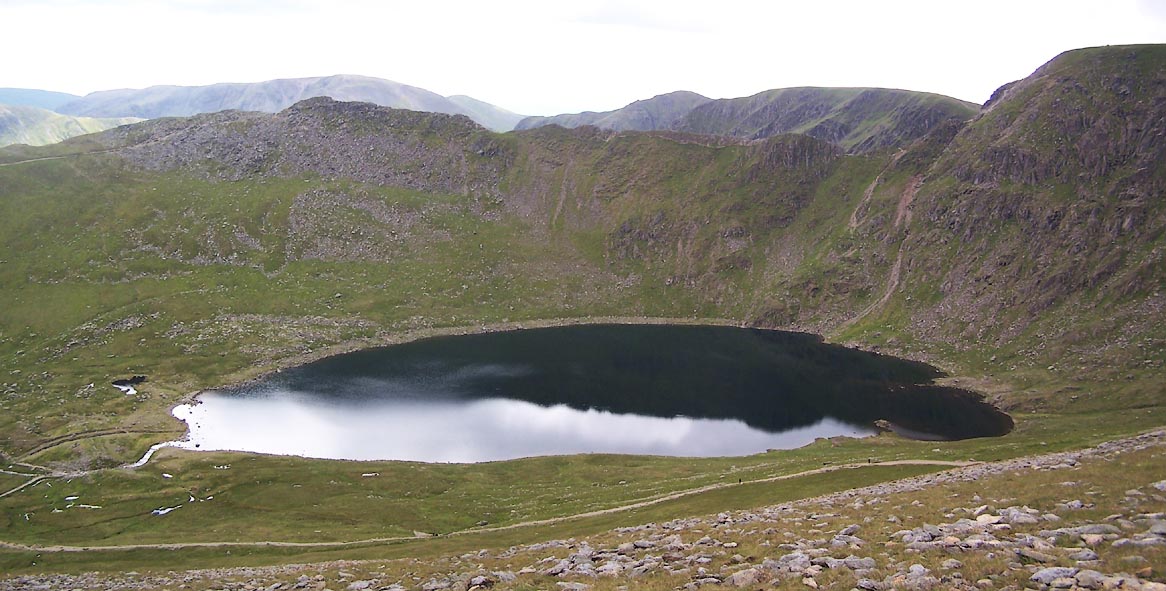 Click to enlarge BUU94.jpg Striding Edge behind. (taken 20.6.2011) 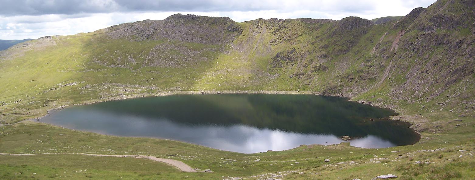 Click to enlarge BUU95.jpg Striding Edge behind. (taken 20.6.2011) 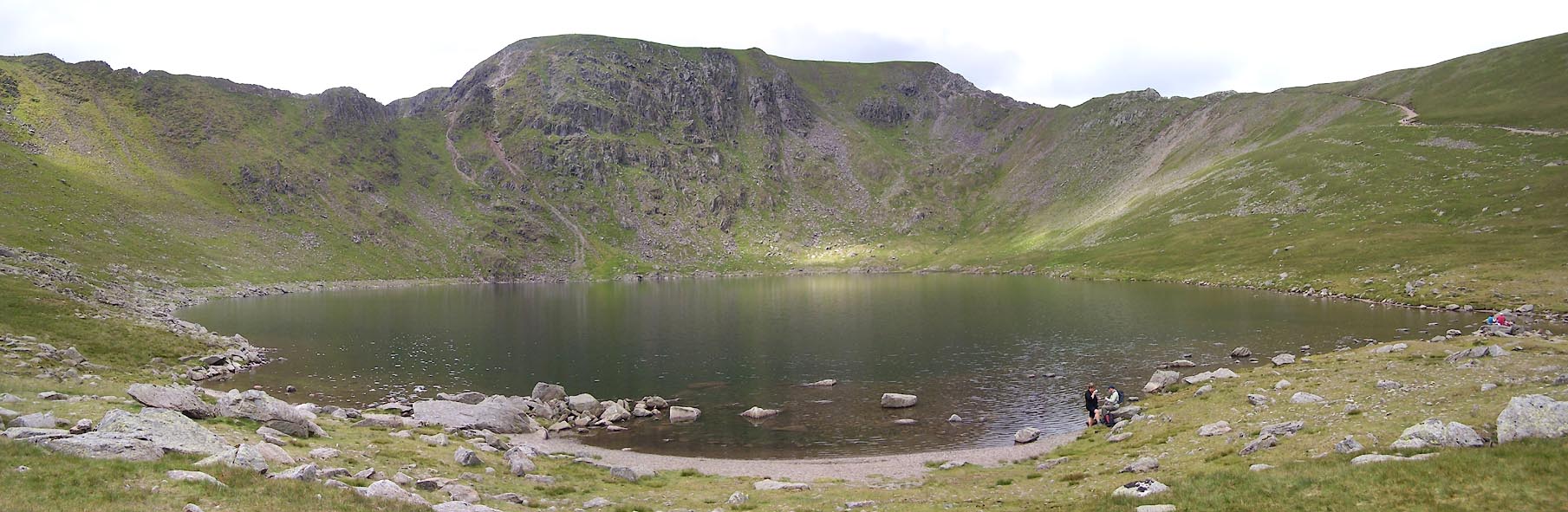 Click to enlarge BUU96.jpg Helvellyn behind. (taken 20.6.2011) 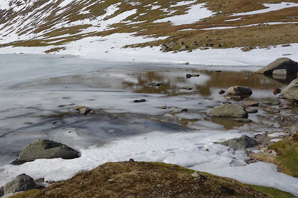 CET42.jpg (taken 14.3.2016) 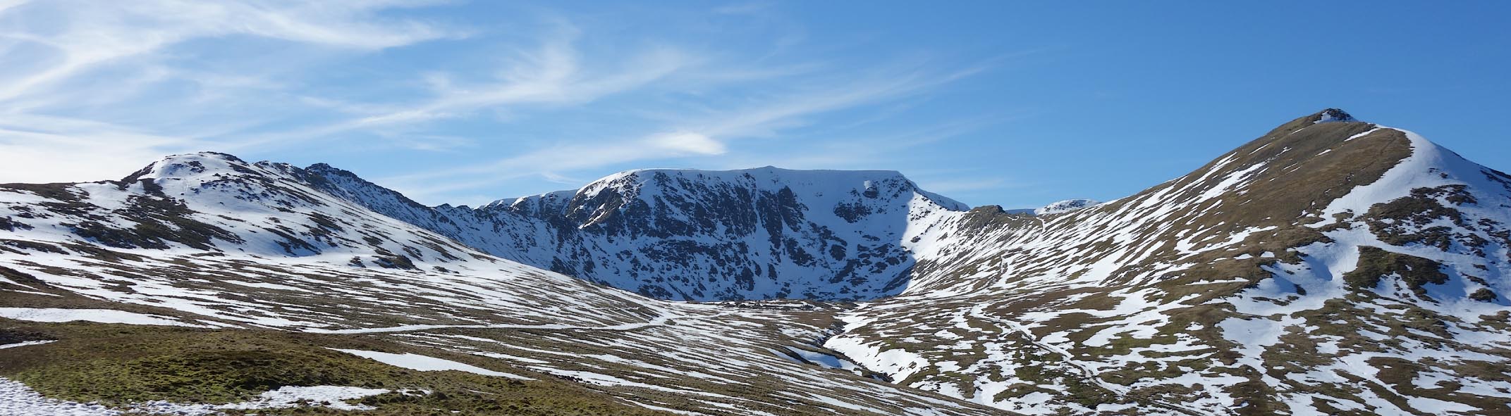 Click to enlarge CET44.jpg The whole cirque: Bleaberry Crag, Helvellyn, Catsty Cam. (taken 14.3.2016) |
||
|
|
||
| MN photo:- |
Artificial outlet. |
|
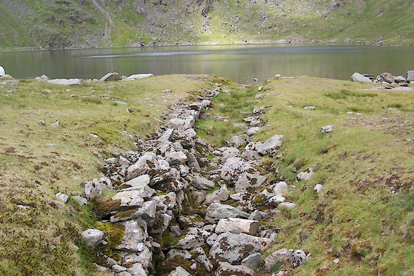 BUU97.jpg (taken 20.6.2011)  BUU98.jpg (taken 20.6.2011) |
||
|
|
||
| notes:- |
They say there are brown trout and skelly in thus tarn; and Willilam Wordsworth fished
here. |
|
|
|
||
Lakes Guides menu.